White and Thompson Glacier repeat photos 1977-2008-2022Since observations began around 1960, White Glacier has been slowly but steadily receding. Meanwhile, Thompson Glacier advanced for decades, compressing proglacial sediments into a prominent push moraine. In recent years, however, the advance has ceased, and the glacier surface has started to subside in the tongue area. In July 2022, repeat photographs were taken at locations documented in 1977 and 2008. Due to logistical challenges, some of the photos were taken under varying lighting conditions (time of day, weather). The collection includes aerial photographs, which were repeated from similar perspectives. |
 1977: White Glacier from White Glacier Hill, looking north. The glacier surface is only slightly lower than the lateral moraines formed during a previous advance, possibly towards the end of the Little Ice Age. (JA). |  2008: As the photo was taken with the sun in nearly the opposite direction, the glacier surface appears less crevassed than in 1977. The surface lowering is evident from the lateral moraines (JA). |  2022: The glacier surface has continued to subside. Due to the late snowmelt in the summer 2022, remnants of old snow are still present in some crevasses (JA). | 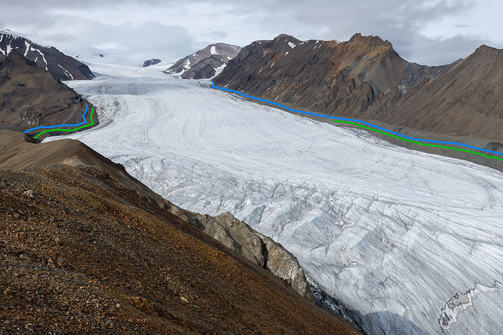 2022 photograph with the 1977 outline in blue and the 2008 outline in green (JA). |
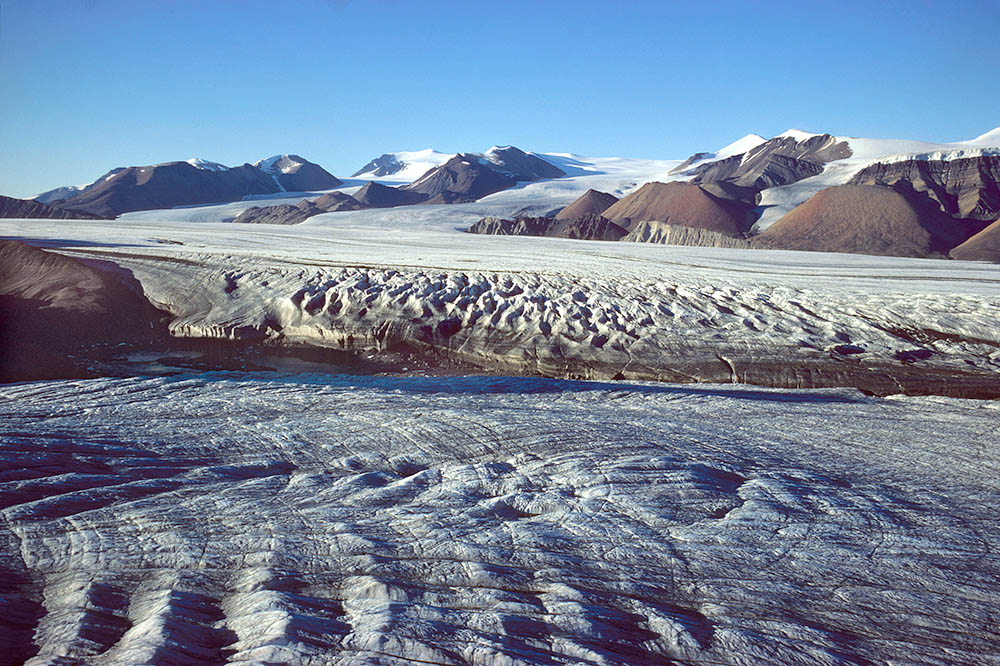 1978: View from White Glacier Hill over White Glacier towards Thompson Glacier. Between Lake has already drained. In the background, from left to right: Astro Glacier, Wreck Glacier and an unnamed glacier near Hidden Icefield (JA). | 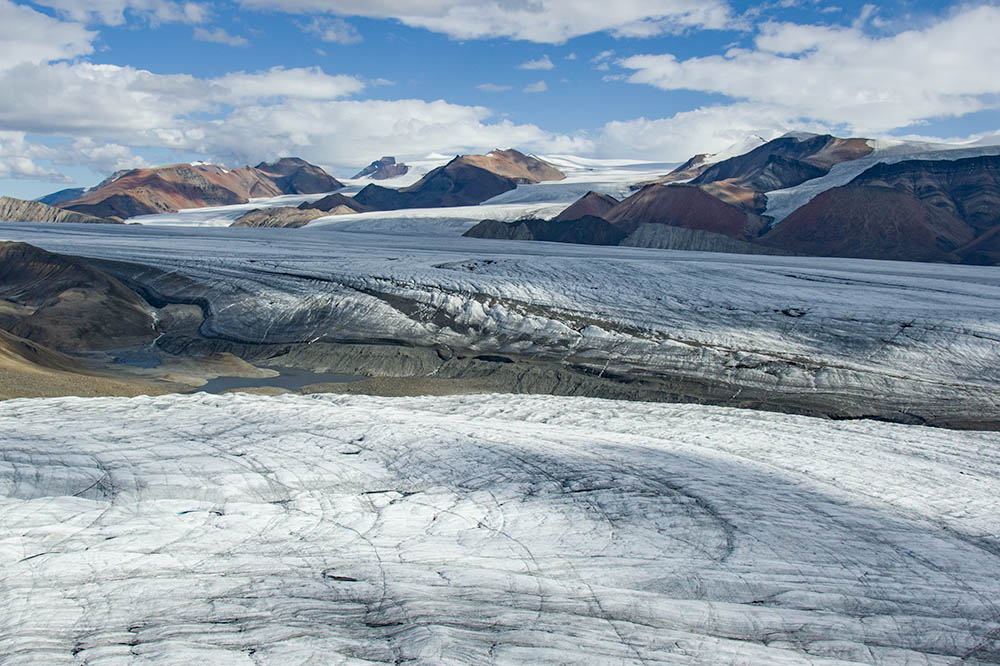 2008: Same view with the sun in the opposite direction. Only small remnants of Between Lake remain. No more lake outbursts occur (JA). | 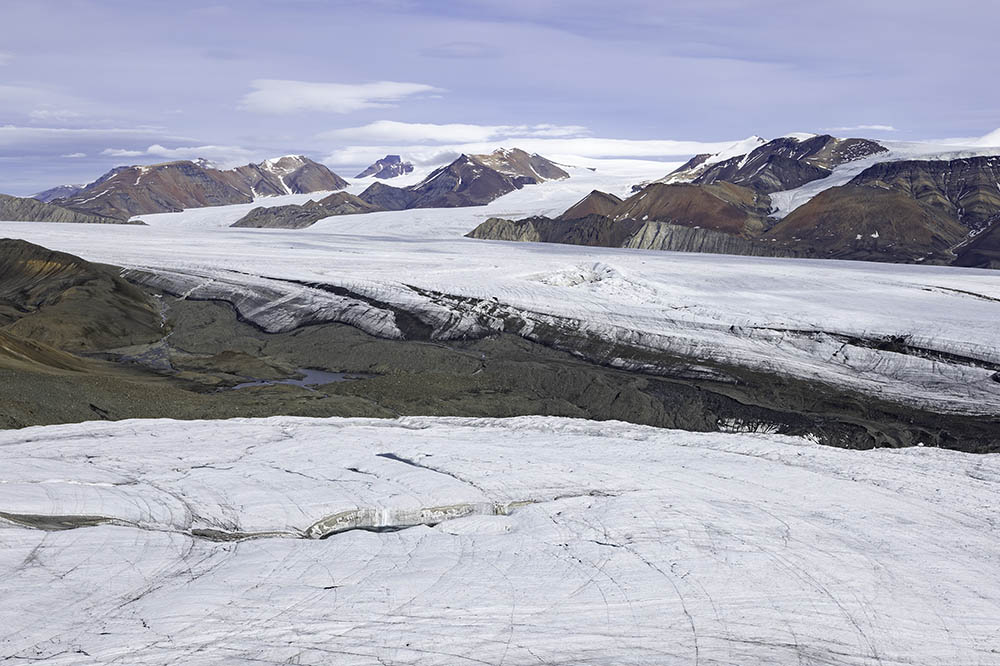 2022: Same view as in the two previous images. The flattened and sunken surface of the Thompson Glacier is particularly striking (JA). |  2022 photo with outlines from 1977 in blue and 2008 in green (JA). |
 1977: Enlarged view of the unnamed glacier east of the terminus of Thompson Glacier (bottom of the image), taken from White Glacier Hill. On the true left, right side of the tongue in the image, a lateral moraine is partially visible (JA). |  2008: Same view with the sun at a higher position. The recession of the glacier tongue is particularly evident in the lower part. Note also the exposed mountain slope above the centre of the image and signs of glacier thinning at the ice cliff in the upper right (JA). | 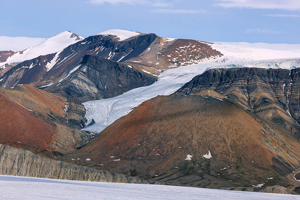 2022: Accelerated recession of the unnamed glacier; photo from White Glacier Hill as in the two previous images. The glacier thinning is especially noticeable at the ice cliff in the upper right (JA). |  2022 image with the outlines from 1977 in blue and 2008 in green. The earlier surfaces of Thompson Glacier are similarly outlined (JA). |
 Front and terminal moraine complex of White Glacier (foreground) and Thompson Glacier (background). Photo taken near the cairn-marked survey points at the southern end of the ridge leading up to White Glacier Hill. Grey areas extend the image width to match subsequent photos (JA). | 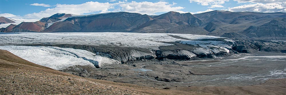 2008: Similarly scaled but slightly wider photograph taken from approximately the same survey points (not an exact match with 1977). The terminus of the White Glacier has receded far to the left and is intersected by a deep meltwater channel. The once steep face of Thompson Glacier has now become significantly flatter (JA). |  2022: Photo from the same location as in 2008. White Glacier has significantly receded. Thompson Glacier no longer advances and shows an even more flattened terminus. Unlike in 2008, an extensive area of Aufeis has formed over winter at the edge of the push moraine (JA). | 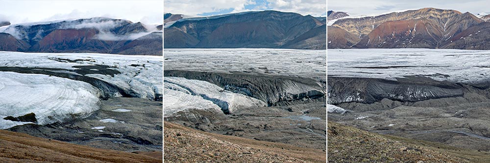 1977-2008-2022: Tragic disappearance of White Glacier's tongue (crops from the previous three images; JA). |
 2008: Panoramic view of White Glacier from White Glacier Hill. The camera position is a few metres east of the summit to allow the terminus of Thompson Glacier to be visible (JA). |  2022: Panoramic view of White Glacier from the same location (JA). |  2008: Aerial photo showing the terminus of White Glacier (left) and Thompson Glacier, with a prominent push moraine (JA). | 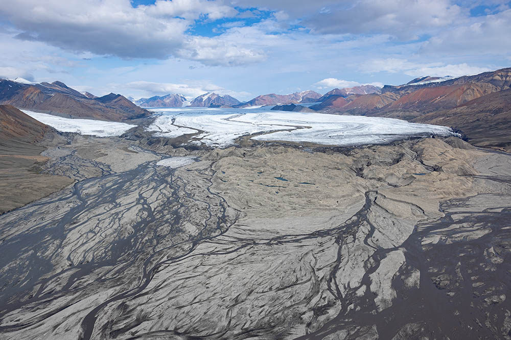 2022: Aerial photo from a slightly different perspective than the previous image (JA). |
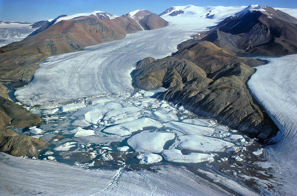 1977: Aerial photo of the ice-dammed Astro Lake, where large icebergs from Astro Glacier (in the background) are calving. Transit Glacier can be seen in the far left background, Wreck Glacier on the far right, and Thompson Glacier, which dams the lake, at the bottom. Note the shoreline of Astro Lake to the right of centre (JA). |  2008: Photo taken from a similar, though slightly lower position than the previous one. Some of the heavily debris-covered icebergs at the bottom right are likely to be from Thompson Glacier. Shorelines highlight the lower lake level compared to 1977 (JA). |  2022: Photo from a similar perspective as the previous two images. Far fewer icebergs are present in Astro Lake compared to 1977 and 2008, and lake ice has only started to melt around the edges due to the late onset of melting (MH). |  2022: Another photo from a comparable perspective, taken during the same flight. Summer ice melt has caused water to flood the margin of the glacier ice at the confluence of Thompson (bottom) and Wreck Glacier (right; JA). |
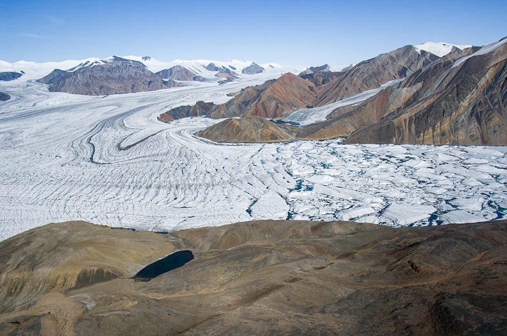 2008 aerial photo: Lateral inflow of Thompson Glacier into Phantom Lake. The small Finger Glacier, flowing down from Phantom Peak, is visible to the upper right of centre. Note also the strogly folded moraine in Thompson Glacier (JA). |  2022 aerial photo, taken from a similar perspective as the previous one; note the lake in the dark foreground when comparing with the previous image (MH). |  2008 aerial photo of Phantom Lake, Phantom Glacier, and Transit Glacier on the left, and a small unnamed glacier on the right (JA). |  2022 aerial photo taken from nearly identical perspective. The recession of the small unnamed glacier on the right is evident (JA). |
 2008 aerial photo: Phantom Glacier with its tongue partially floating in Phantom Lake, Phantom Peak (top left) and Transit Glacier (right). Note the lateral moraines where Phantom Glacier enters the lake (JA). | 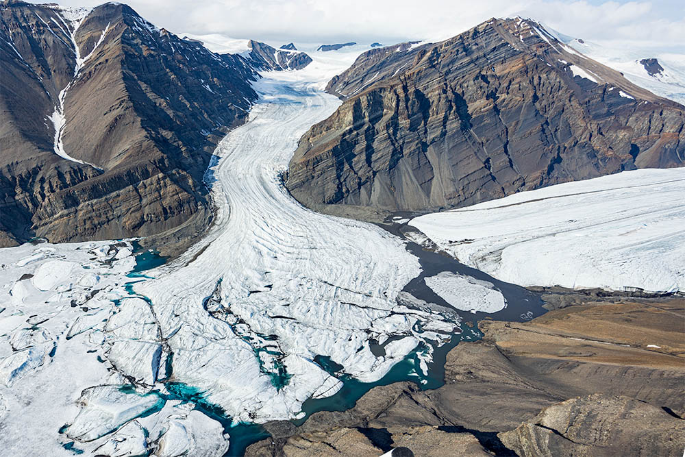 2022 aerial photo taken from a similar perspective as the previous one. The front of Phantom Glacier has largely receded from that of Transit Glacier and the lake shore in the foreground (JA). | 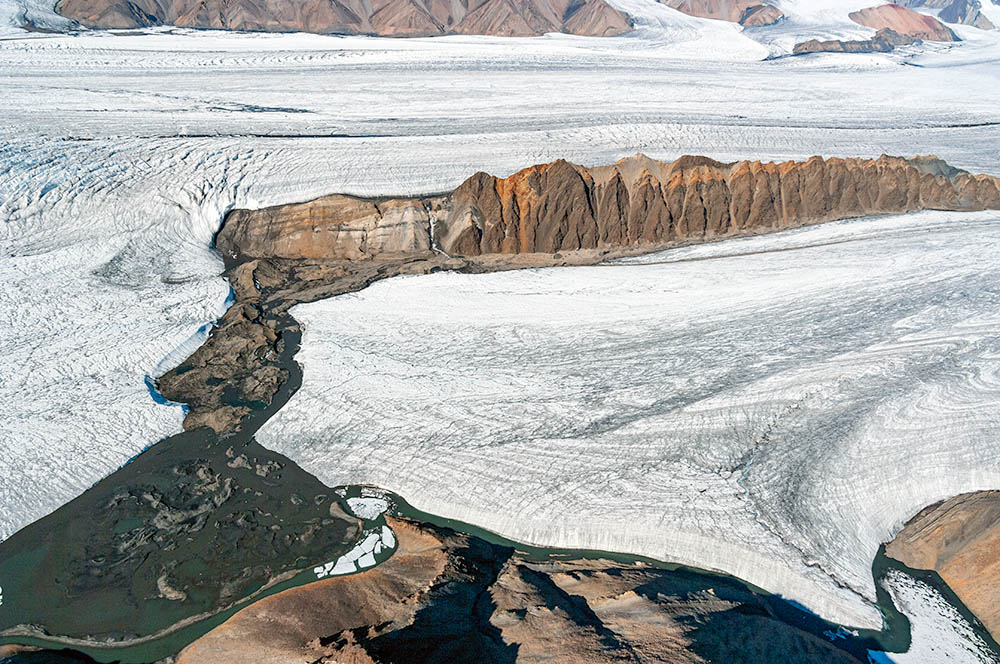 2008 aerial photo of the terminus of Parallel Glacier (bottom), Separation Ridge (middle top), parts of Thompson Glacier (background) and complex glaciofluvial sediments in the bottom left (JA). |  2022 aerial photo taken from a position slightly further left than the previous photo. The dark area of glaciofluvial sediments on the bottom left has expanded significantly due to recession of Parallel Glacier (JA). |
 1977: Terrestrial overview from the survey point on Gypsum Hill, facing the fronts of White Glacier and Thompson Glacier (JA). | 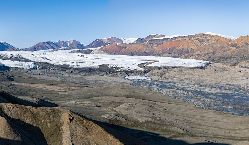 2022: Despite different lighting conditions, the recession of White Glacier and the flattening of the front of Thompson Glacier are clearly visible (JA). |  2008: Telephoto image from Gypsum Hill towards the front of White Glacier (foreground), Thompson Glacier (middle), and Phantom Peak (top left; JA). |  2022: The recession of White Glacier is apparent, with evidence of ice loss in the summit area of Phantom Peak (JA). |
 2008: Telephoto view from Gypsum Hill over the contact area of White Glacier (left) and Thompson Glacier with Bellevue Ridge in the background (JA). |  2022: White Glacier has receded significantly. The terminus of Thompson Glacier is now more debris-covered (bottom right), and the lowered surface of Astro Glacier (in front of Bellevue Ridge) is clearly visible (JA). |  2008: Western part of the front of Thompson Glacier, telephoto image from Gypsum Hill (JA). |  2022: The front of Thompson Glacier has flattened further and is increasingly covered in debris. Note the sinking of the glacier edge in the background (JA). |
| Photos Jürg Alean (JA) and Michael Hambrey (MH), 1977, 2008 and 2022 |