Astro Glacier, Astro Lake and Piper GlacierAstro and Piper Glacier (formerly called Wreck Glacier) are valley glaciers of moderate size which flow from east to west towards Thompson Glacier. Piper Glacier reaches Thompson and is, therefore, its tributary, whereas Astro Glacier terminates in a spectacular glacial lake dammed by Thompson. |
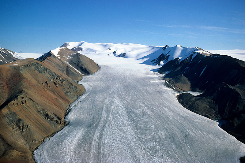 Astro Glacier descends from an unnamed peak, roughly 1700m high (here informally called "Peak 1700", climbed in 1977 by J. Alean and H.J. Meier). Along its sides are ice-dammed lakes of various sizes. A small part of Piper Glacier can be seen on the upper right. Aerial photo August 8th, 1977. | 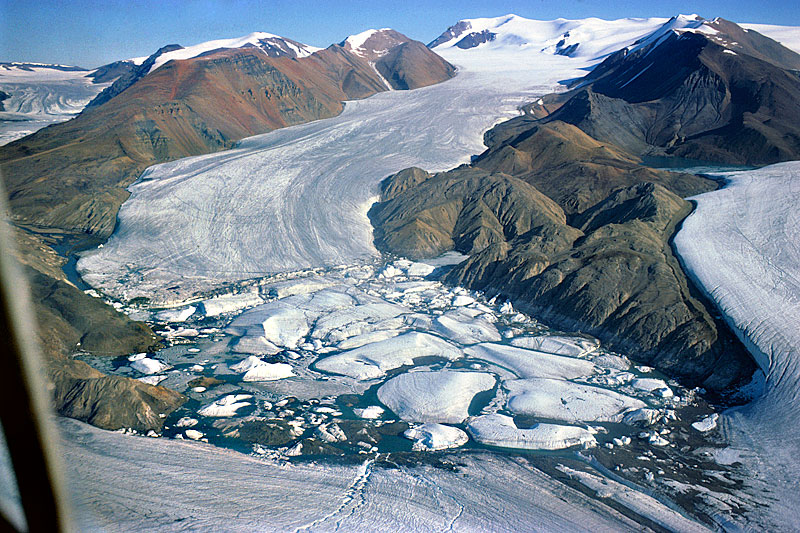 Astro Glacier terminates and calves into Astro Lake, dammed at the confluence of Thompson Glacier (bottom) and Piper Glacier (right). Aerial photo August 8th, 1977; compare with next photo from 2008. | 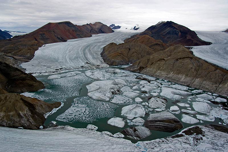 Astro Lake from a similar perspective as the previous photo, here on July 13th, 2008. Careful examination of the coastline and strandlines shows that the lake surface has dropped considerably due to a thinning of Thompson Glacier. However, the calving front of Astro Glacier remains at a very similar position as in 1977. | 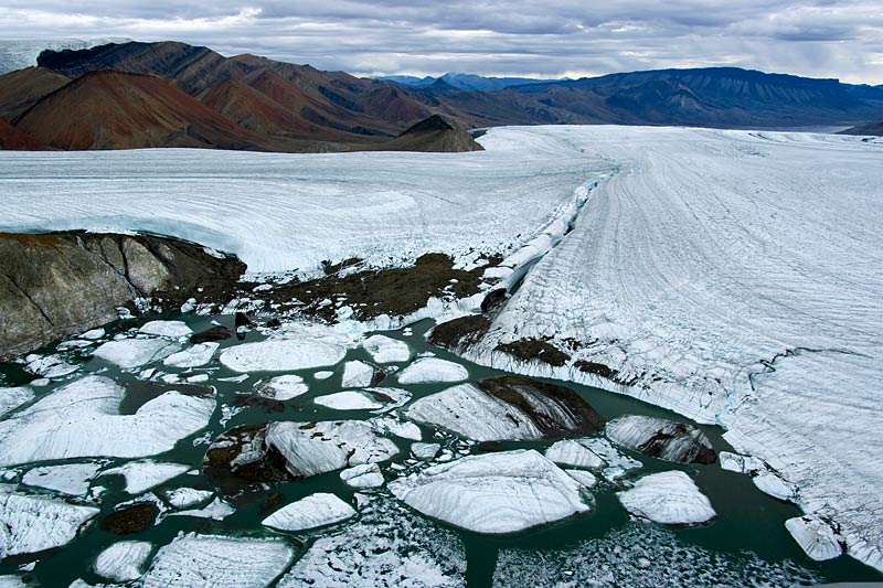 Astro Glacier drains through a huge channel along the line of contact of Piper (top left) and Thompson Glacier (right). The channel is so deep that in some places it closes and forms a tunnel due to plastic deformation of the glacier ice. This view is downglacier towards Expedition River and Bastion Ridge (top right; July 13th, 2008). |
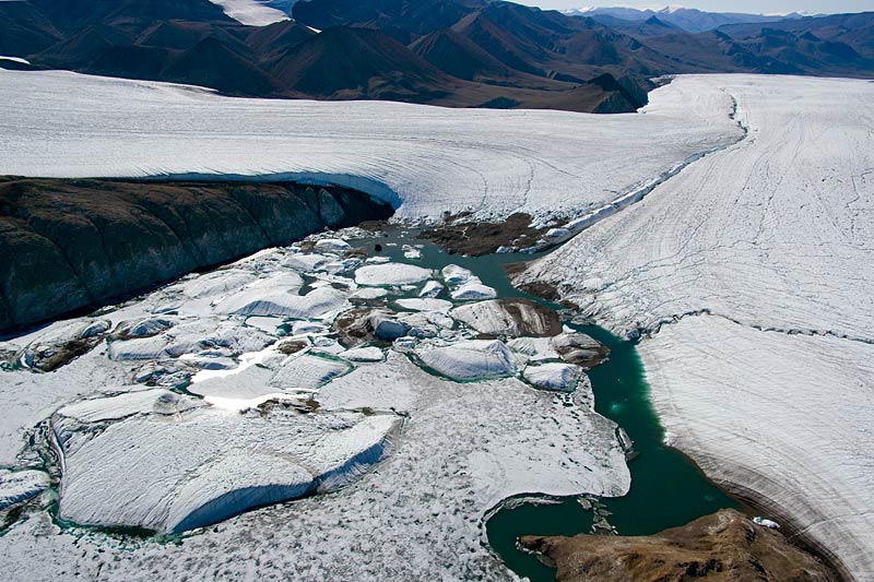 A similar view, in different weather conditions, of Astro Lake on July 2nd, 2008. Note the remarkable green colour of the lake's water. | 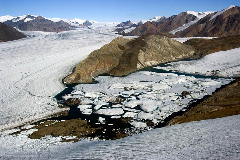 This view of Astro Lake is towards Thompson Glacier's accumulation area; Phantom Peak is on the top right. On the lower left, moraine material can be seen which, in addition to the ice of Thompson ond Piper Glacier, helps to dam the lake. | 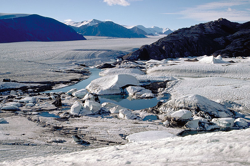 Terrestrial view, from 1977, of Astro Lake taken in almost exactly the same direction as the previews aerial photo. Some of the icebergs are several hundred metres in diameter! | 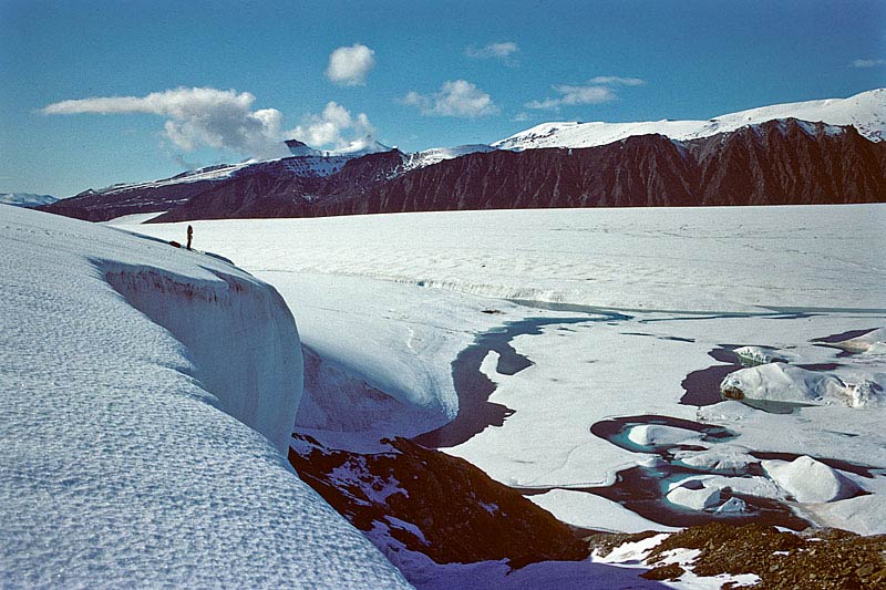 On the cliff of Piper Glacier; Konrad Steffen observing Astro Lake, which is still mostly covered by lake ice from the previous winter (1976 photo). Wolf Mountain and Black Crown Peak can be seen below the clouds on the upper left. |
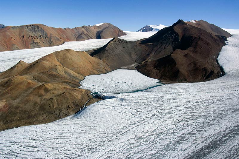 Piper Glacier (bottom, July 2nd, 2008) dams a remarkably big lake along its true right margin (centre of the photo). The lake has a diameter of approximately 1.5 kilometres and, due to its altitude of 491 m.a.s.l. and corresponding relatively low air temperatures, is still mostly covered by lake ice. | 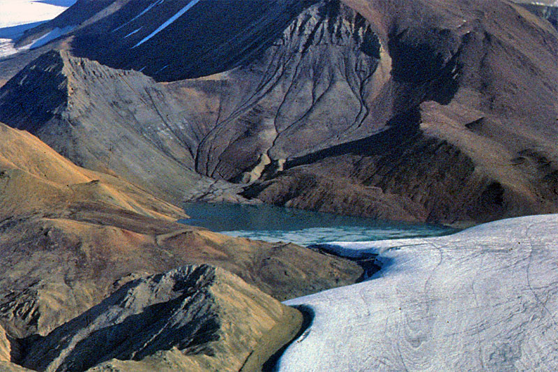 Similar view of the ice-dammed lake at 491 m.a.s.l. on the side of Piper Glacier on August 8th, 1977, when most lake ice has melted. Careful comparison of the previous and this photo shows some surface lowering of Piper Glacier during the intervening 31 years. | 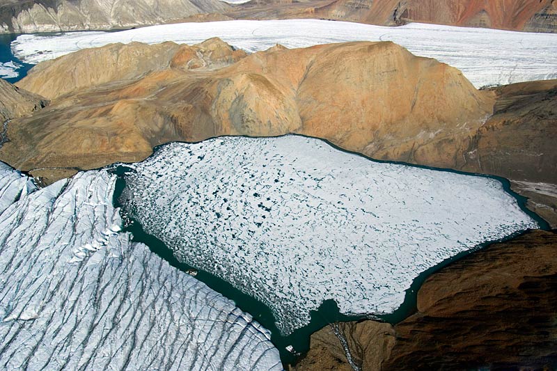 Piper Glacier (lower left) damming the 491m-lake; Astro Glacier in the background (July 2nd, 2008). The outflow channel crossing some land on the left is new since 1977, and is due to a slight recession of Piper Glacier. | 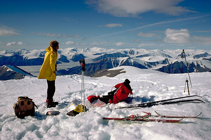 On "Peak 1700" at the head of Piper Glacier's accumulation area. This loaction was reached on July 19th, 1977, after a two day treck from basecamp, over Thompson and Piper Glacier. The skis are being used to melt snow for drinking. |
 Panorama photo (very wide, may require scrolling to the right) taken from "Peak 1700" July 19th, 1977. The accumulation area of Astro Glacier is in the foreground; the view is from Expedition Fjord (far left) to the Mueller Ice Cap (right). A rare aeroplane contrail is in the sky. |  Panorama photo of the piedmont glaciers on the eastern side of the water devide running through "Peak 1700" (July 19th, 1977. The bright band behind the rainbow is Nansen Sound, which separates Axel Heiberg and Ellesmere Islands. | 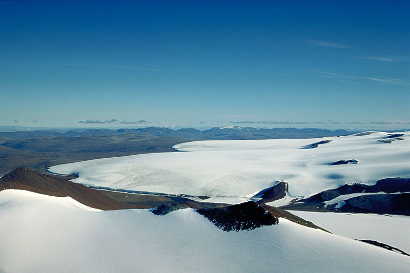 Broad Piedmont Glacier lobes west of "Peak 1700" (July 19th, 1977). | 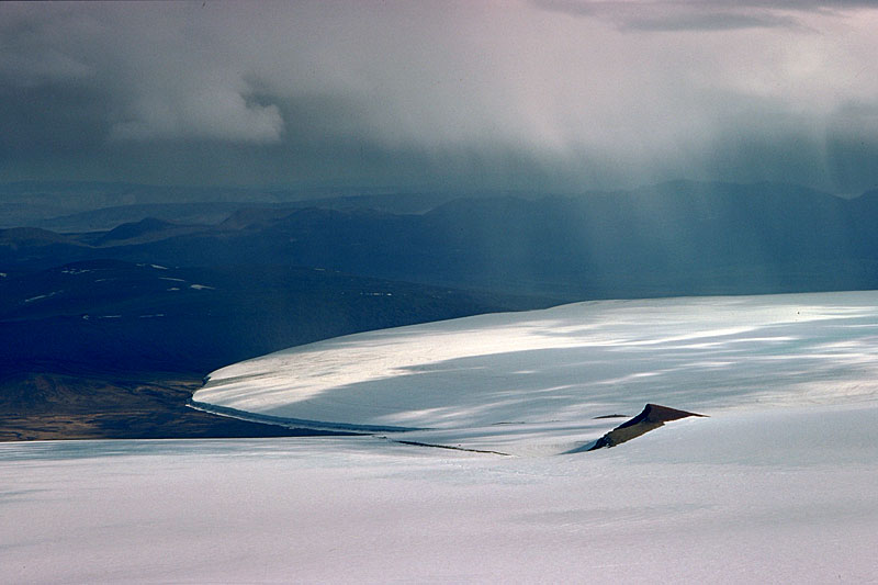 Telephoto view of Piedmont Glaciers west of "Peak 1700" (July 19th, 1977). Note the cliff along the glacier margin and a band of ice debris in front of it. |
| Photos Jürg Alean |