Franz Josef GlacierThe dimensions of Franz Josef Glacier are 37 km2 in area with an estimated mean depth approaching 100 metres, very similar to Fox Glacier. Its recent behaviour is also remarkably similar to the Fox Glacier, and positive mass balances (from increased snowfall) since the mid-1980s have resulted in a few hundred metres of advance, except for brief recession at the turn of the century. Franz Josef Glacier responds rapidly to mass balance changes because of its wide accumulation area and steep narrow tongue, again similar attributes to those of Fox Glacier. |
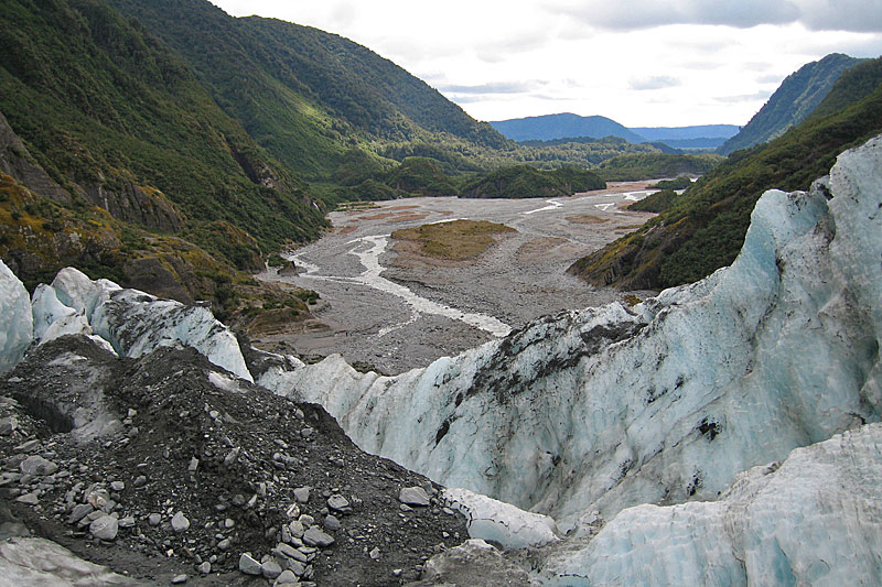 View from a crevasse with supraglacial debris at the snout of Franz Josef Glacier over the braided outwash plain in 2007. In the previous year, the main river channel abutted the right-hand side of the valley, illustrating the dynamic nature of this glacial steam. | 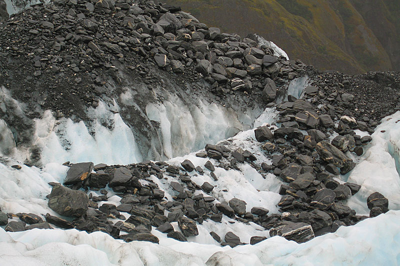 In April 2007, a large pile of stones with subrounded shapes lay amongst the crevasses (normal debris on the glacier is angular). It originated from a subglacial outburst flood which broke through the icefall in 2003. By 2008, most of it had already reached the snout, 1 km from the source. | 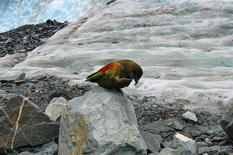 Typical supraglacial debris on Franz Josef Glacier, illustrating its angular character. The kea, the comical New Zealand parrot, provides a convenient scale. | 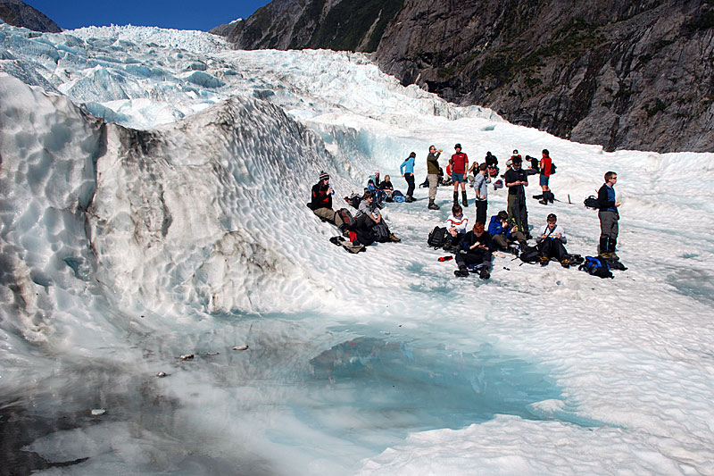 Supraglacial pond on a rare crevasse-free surface of Franz Josef Glacier, with Aberystwyth University students, staff and the local village guides pausing for lunch, April 2008. |
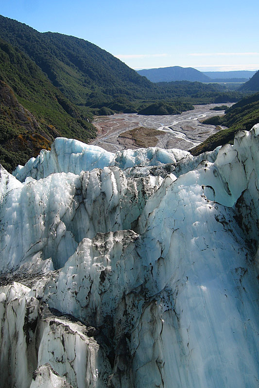 Longitudinal foliation exposed in crevasse walls in lower Franz Josef Glacier, with the proglacial in the background, April 2006. Note the position of the river compared with an earlier photograph | 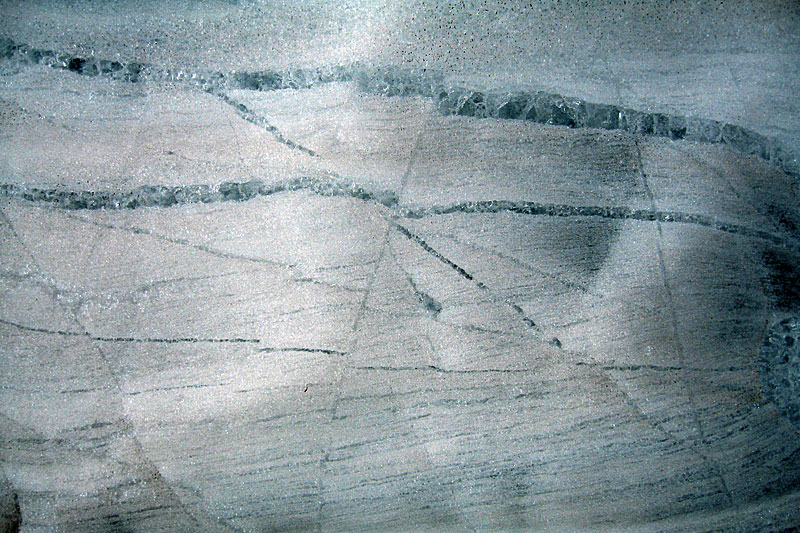 Clear ice veins cutting foliated ice. These veins are interpreted as crevasse traces, and are the remnant of earlier fractures. Note the small-scale faulting, indicated by the displacements along some of the veins. The width of this view is approximately one metre. | 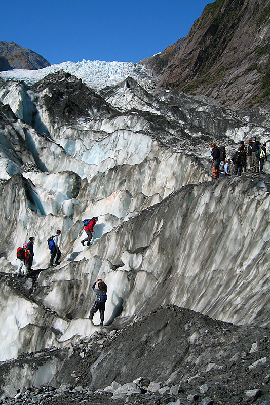 A series of ablation area crevasses with partial debris cover. Typically, these crevasses are several metres deep, and mean that traversing the glacier, as these Aberystwyth students are doing in 2006, is a tortuous exercise. | 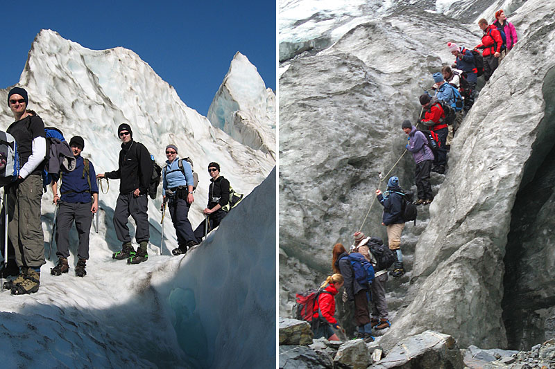 The guided route takes the visitor past ‘ice ships’ (ridges between crevasses, 2006; left). After a day on the Glacier, the party descends the terminal face, using large steps cut in the ice by the guides; handrails of rope provide additional security (2007; right). |
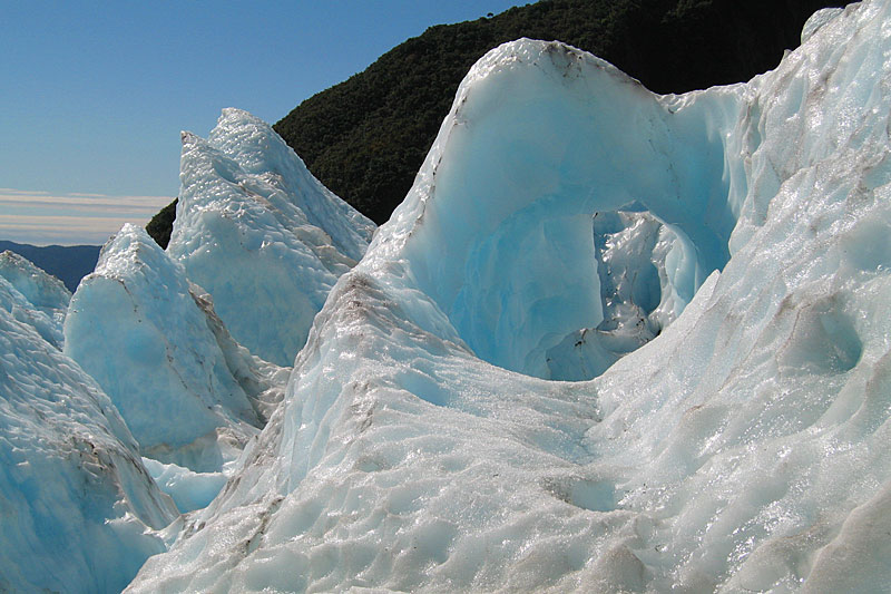 More ‘ice ships’ on Franz Josef Glacier, illustrating the scalloped ice surface resulting from solar radiation, and the remnant of a meltwater channel, 2006. | 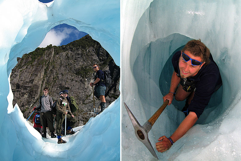 Aberystwyth students peer into an ice tunnel, carved out by meltwater, on Franz Josef Glacier, 2006. Emerging from a several metre long meltwater tunnel on Franz Josef Glacier in 2006. These tunnels are known as ‘worm-holes’ to the local guides. | 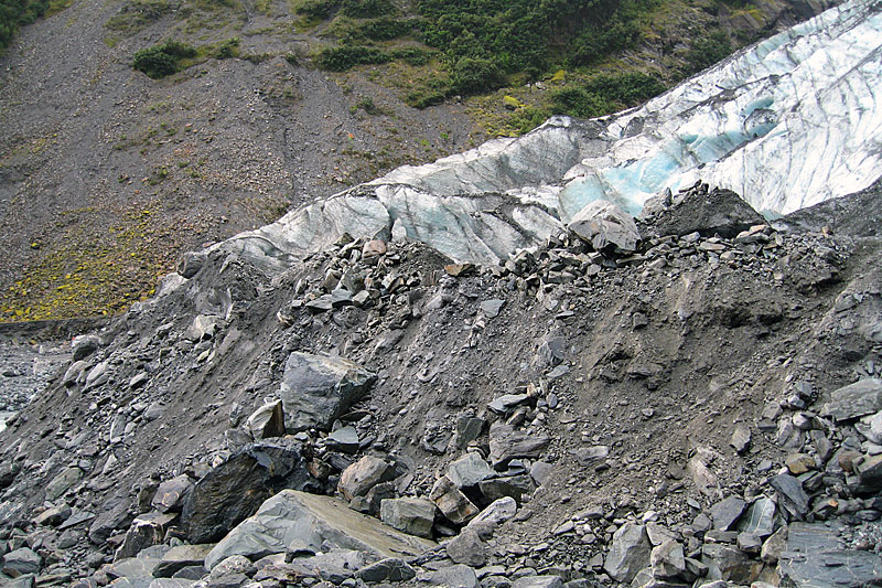 The push moraine of Franz Josef Glacier in 2007, when the glacier was advancing. The material is sandy gravel, with boulders several metres in length. | 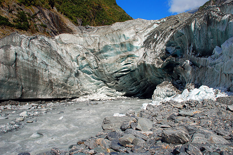 General view of the portal of Franz Josef Glacier in April 2008, showing collapsed ice from the cave roof (a hazard often ignored by tourists) and the outlet stream which carries not only suspended sediment and gravel, but also blocks of ice. |
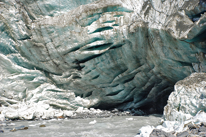 Detail of the Franz Josef Glacier portal, illustrating a series if near-horizontal crevasses and foliation in the cave roof in April 2008. | 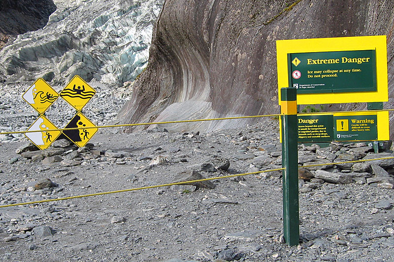 Department of Conservation sign warning of various hazards near the snout of Franz Josef Glacier: rock-fall, ice-fall and associated waves and flash flooding. Despite these warnings, some tourists still enter the ice cave at the glacier portal, and some have been seriously injured, putting rescuers’ lives at risk. | 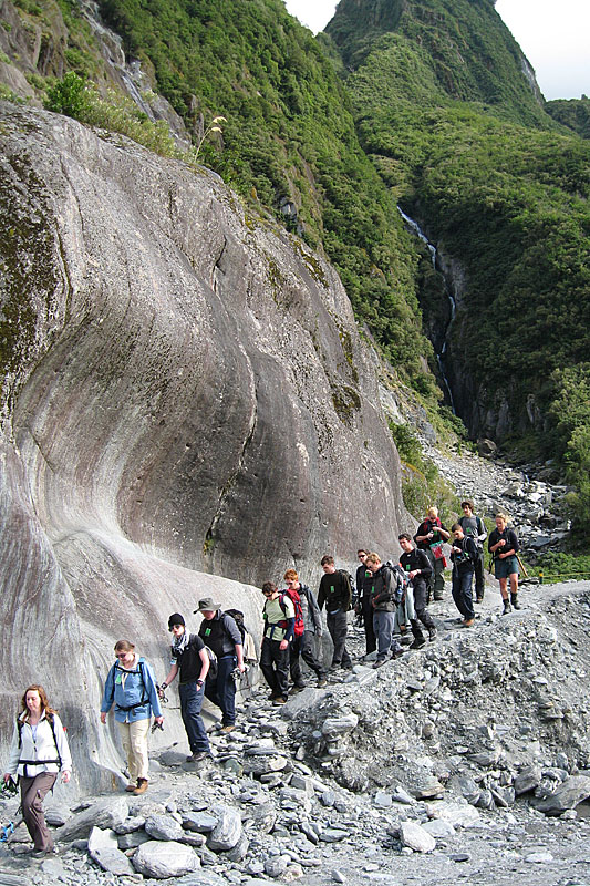 Ice-worn bedrock alongside the route to the glacier in 2007. In 2008, it had been removed by the migrating river channel, and a high-level detour over the rock buttress was necessary. In the background, the gully marks a fault splaying off the main Alpine Fault, which is a focus for major earthquakes. | 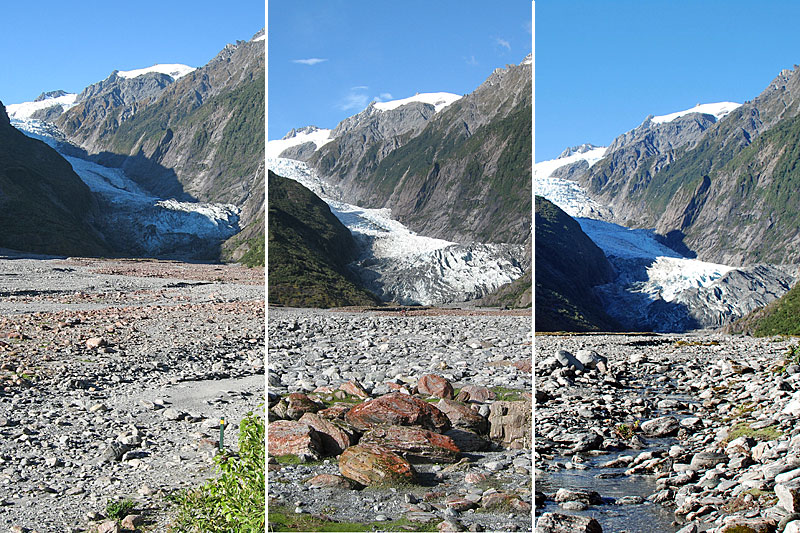 General views of Franz Josef Glacier from the braid-plain at the edge of the forest in successive years: 2006, 2007 and 2008 when this glacier was last advancing. The reddish colour on the boulders in the middle photo is from algae, which is the precursor to vegetation that develops rapidly if the ground is undisturbed. |
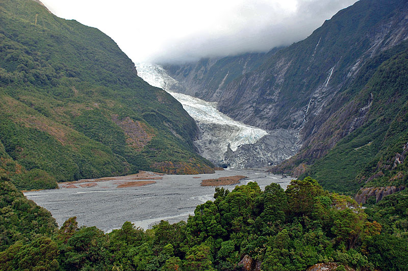 Franz Josef Glacier from Sentinel Hill in April 2008. A prominent trimline where the vegetation changes from dense to relatively sparse is evident on the left-hand mountainside; this dates from the Little Ice Age of around 1750. | 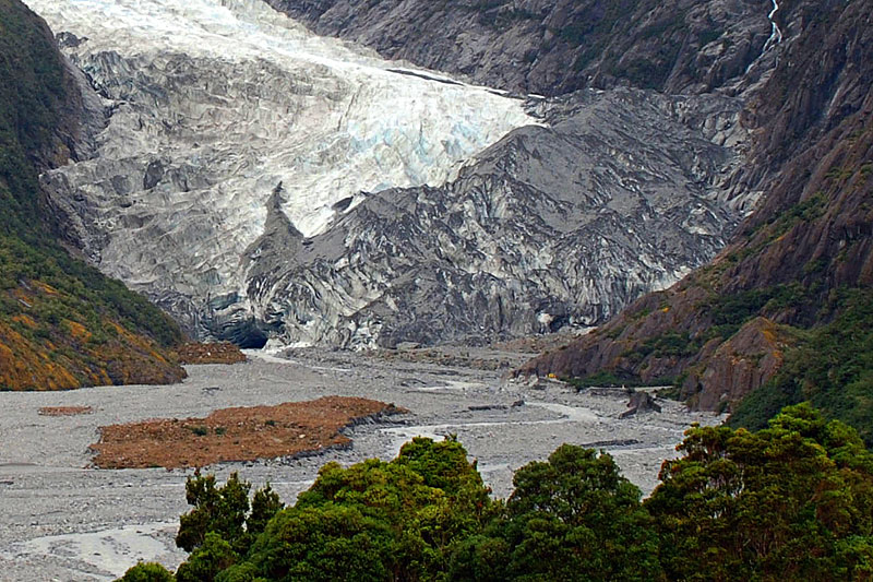 Enlarged section of the previous photo. The proglacial area used to be occupied by a lake from 1930 to 1949, but has since become infilled with glaciofluvial sediment. | 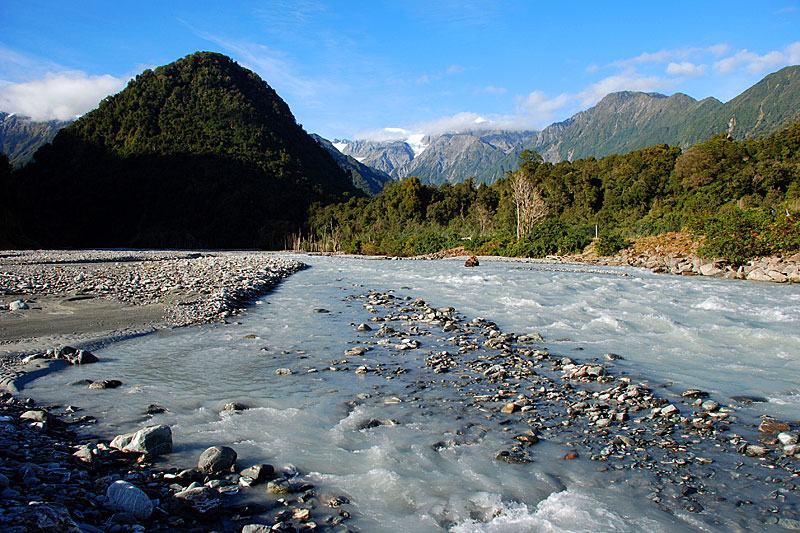 The braided Waiho River just above the road bridge of Highway 6. The sediment derives from the Southern Alps in the background, particularly the Franz Josef Glacier in the right hand valley, and the Callery River valley on the left. | 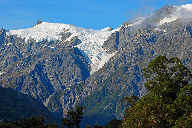 Clear morning telephoto view of Blumenthal Glacier (left) and Croz Glacier (right), whose waters flow down cliffs into Franz Josef Glacier. The rain forest vegetation provides a dramatic contrast with the glacierised peaks above. |
| Photos Michael Hambrey |