Ruapehu: earlier glacial activity (Pleistocene Epoch)At lower levels there is abundant evidence of much more extensive glaciation that took place during the Pleistocene Epoch. Lateral moraines from more extensive glaciers extend down the mountain as long tentacles into the beech forest. They are believed to date from the Last Glacial Maximum of around 14,000 years ago. Volcanic events have overprinted this evidence in a number of places: the near-perfect cone of 2500-year old Ngauruhoe partly obliterates the Mangatepopo Valley, whilst extensive tephra deposits drape the older moraines almost everywhere. The glacial valleys themselves are part-filled with lava flows and lahar deposits. |
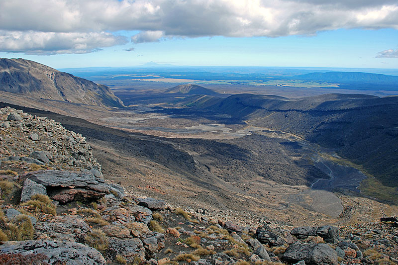 The Mangatepopo Valley is a volcanically modified glacial trough. Wide-angle view looking down the valley from the Mangatepopo Saddle at 1650 m. The glacial trough is bounded by moraines from the Last Glacial Maximum and ice-worn rock slopes, but the valley floor has been filled by andesitic lava flows from the 2500-year old volcano of Ngauruhoe, whose slopes are on the left. On the distant horizon is the volcanic cone of Taranaki. | 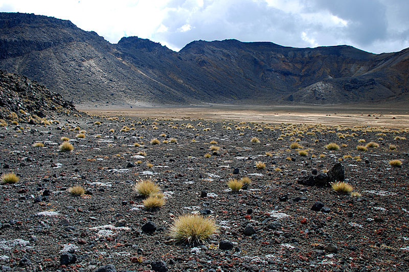 The source of the Mangatepopo Glacier was Mount Tongariro (1967 m), the peak in the background. Rather than occurring in a classic glacial cirque, the accumulation area lay within the heavily eroded South Crater, viewed here. The floor of south crater is part-filled with tephra and lava flows, and supports only sparse tussock grass. | 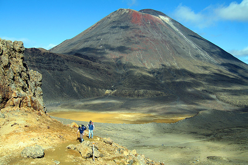 The impressive andesitic cone of Ngauruhoe (2287 m), seen from the east rim of Tongariro’s South Crater. The glacial valley is almost overprinted here by the new cone, but the original glacial valley wall can be seen on the left. The Mangatepopo Glacier originally flowed out of this crater towards the right. | 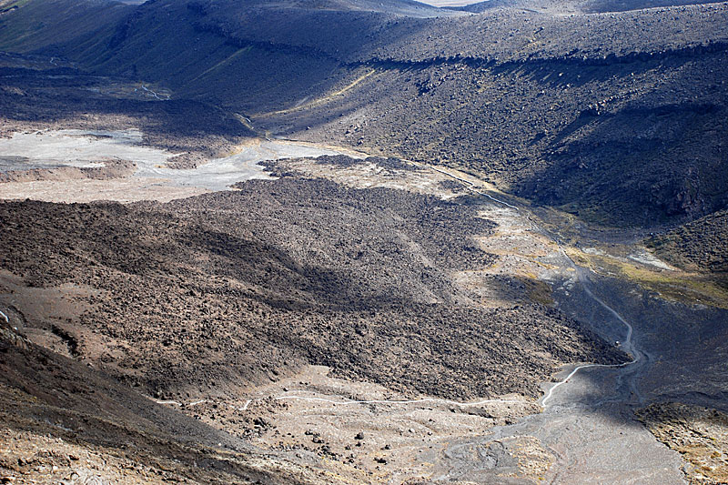 Looking down onto a prehistoric, but post-glacial, lava flow from Ngauruhoe on the floor of the lower Mangatepopo Valley. This telephoto view was taken from the new (2008) path to Mangatepopo Saddle, which now avoids the strenuous loose rocky scramble up the ‘Devil’s Staircase to the right. Late Glacial Maximum moraines capping eroded proglacial lavas from Tongariro are in the background (top). |
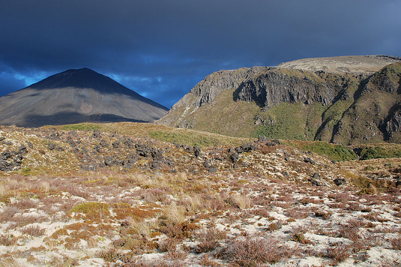 Contrasting ‘old’ and ‘new’ topography in Mangatepopo Valley. The young landscape is reflected in the cone of Ngauruhoe (2287 m) that has been built up over 2500 years. To the right are the andesitic, columnar-jointed cliffs of Pukekaikiore (1737 m) which was active as part of the Tongariro volcano between 190,000 and 120,000 years ago. These cliffs form the remaining remnant of the left-hand side of the glacial trough. The foreground mounds are prehistoric lava flows. | 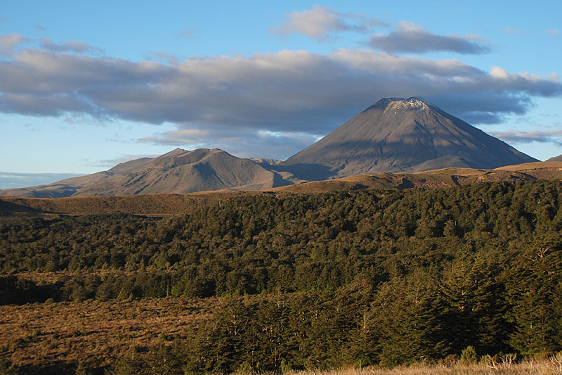 Evening sunlight picks out the detailed form of volcanoes and glacial valleys as seen the Taranaki Falls Track, just east of Whakapaka Village. In the background is the old heavily eroded cone of Mount Tongariro and the new cone of Ngauruhoe. The Mangatepopo Valley, with its half-sunlit lateral moraine, is visible between the two peaks. Running from right to left in the middle distance is a larger moraine created by a glacier that flowed down the northern slope of Ruapehu. | 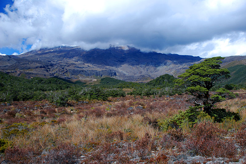 The broad open Whakapapaiti Valley is one of the finest glacial troughs in the area, graced by natural beech forest. It is reached via a track of the same name. At the head, in the clouds, is Ruapehu which was the source of the glacier that carved out this valley. | 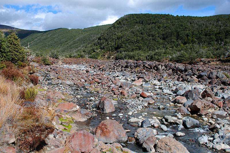 The forested left-lateral moraine in this view, dating from the Late Glacial Maximum, is one of two prominent ridges that bound of the Whakapapaiti Valley. The stream carries large volumes of coarse debris, derived from both the moraines and lahar deposits. |
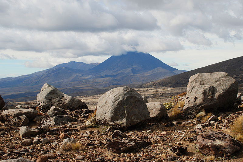 Erratics on the crest of the Late Glacial Maximum right-lateral moraine of Whakapapaiti Valley, looking towards Mount Tongariro (left) and Ngauruhoe (in cloud). | 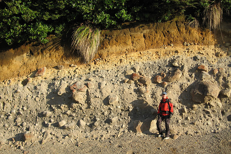 Road section through glacial debris forming a Late Glacial Maximum lateral moraine adjacent to the Bruce Road, just above Whakapaka Village. The poorly sorted nature of the debris is evident, with subrounded boulders indicating contact with the glacier bed. The fawn and brown finer grained horizon on top represents postglacial falls of tephra. | 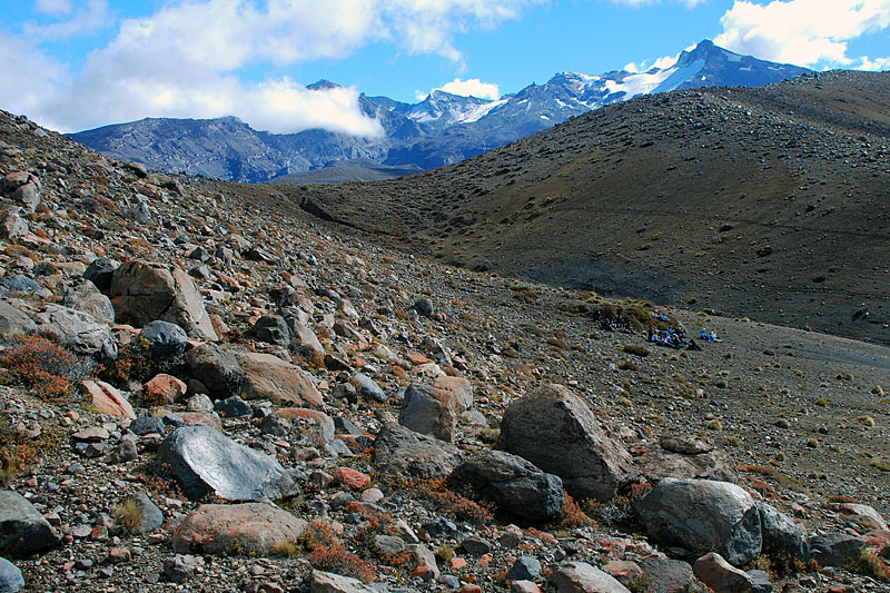 One of several Late Glacial Maximum lateral moraines on the eastern slope of Ruapehu. Sparse vegetation reveals a wide variety of volcanic rock types of different shapes and sizes. The summit of the volcano, with its small remnant glaciers, is visible in the background. | 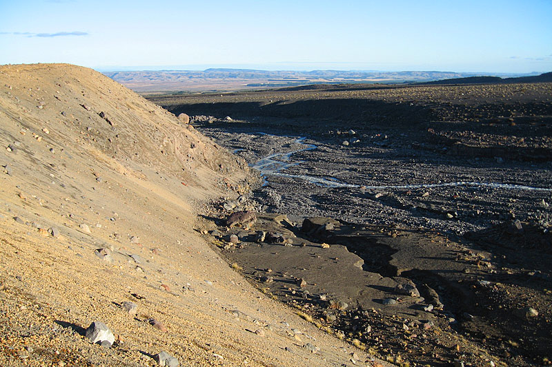 The end of the left-lateral moraine of the Whangaehu Valley. This was the route of the devastating 1953 lahar, originating in the Ruapehu Crater Lake, which led to New Zealand’s worst railway disaster with the loss of 151 lives. |
| Photos Michael Hambrey |