Glaciers on Ruapehu volcanoRuapehu (2797 m) is an active andesitic stratovolcano that is the highest mountain on
North Island. There are eight small glaciers on the upper outer flanks of the volcano
and in the summit craters, although they are all in rapid recession and some are on the
verge of extinction. The thickest ice known reaches 160 m - in the ice-filled crater
named Summit Plateau (further details are at the bottom of the page). |
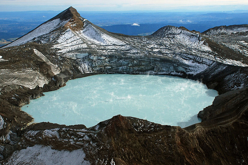 Aerial view of Crater Lake, its light blue waters steaming away at 35°C, with the
peak of Paretetaitonga (2751 m) prominent above the crater rim. | 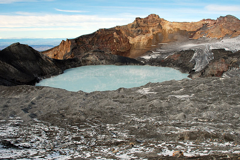 Wide-angle ground view of Crater Lake with the hummocky surface of the glacier,
covered with September 2007 tephra, in the foreground. | 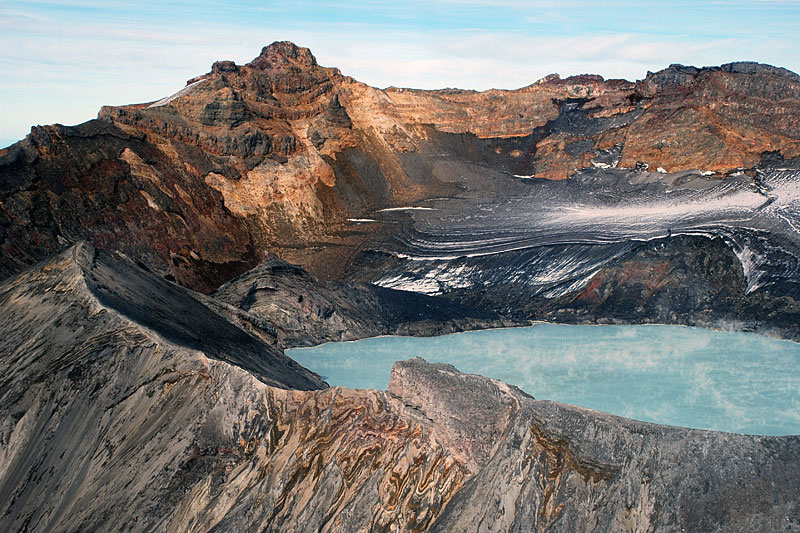 Crater Lake rim comprising andestic lavas and tephras with Ruapehu’s summit,
Tahurangi (2797 m) and remnant stratified glacier in the background. | 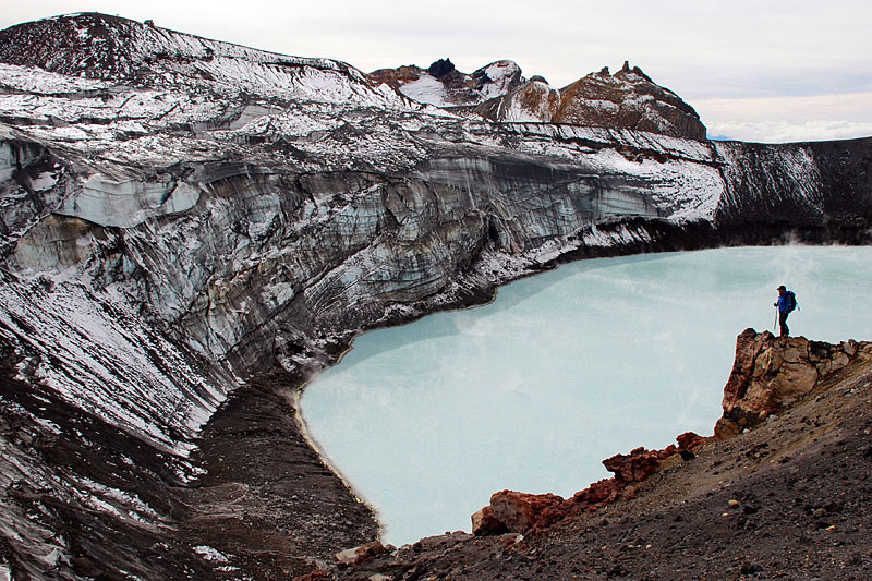 Crater Lake Glacier cliff. Following the March 2007 lake breach the lake level has
dropped and the glacier no longer calves readily into the lake. |
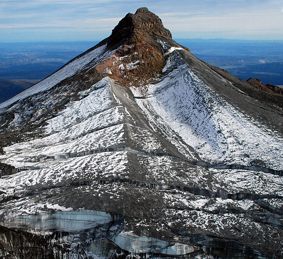 The peak of Paretetaitonga in this aerial view reveals how accumulation of snow is
controlled by wind-drift from the prevailing southwesterlies. Large transverse crevasses split the face of the glacier. | 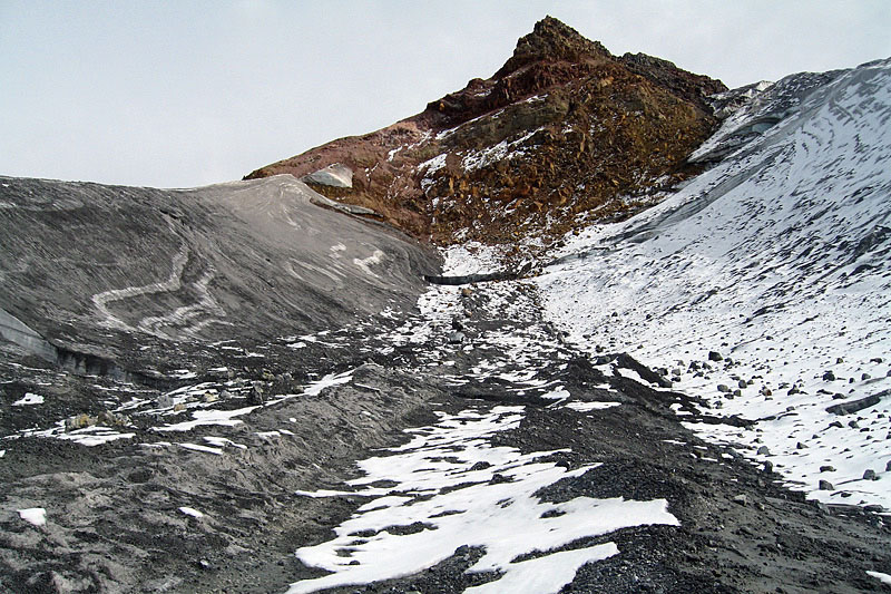 Ground view of Paretetaitonga and the drift-controlled accumulation ridges and
supraglacial tephra. | 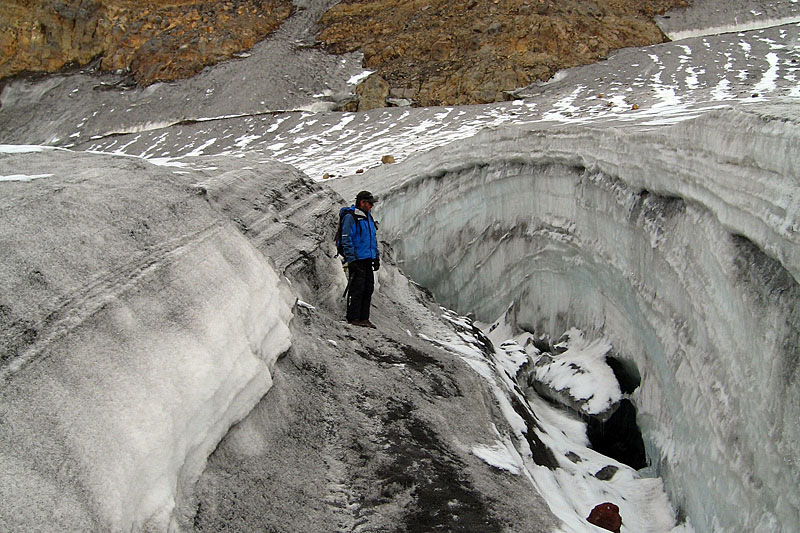 Dome-like stratification of snow/firn of the accumulation area of the Crater Lake
Glacier, illustrating the uneven nature of snow accumulation in this area. | 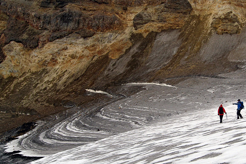 Stratified glacier ice below Tahurangi, suffering from rapid ablation and indicating
little net accumulation here in recent years. The prominent black horizon at lower left is from the 1995-96 eruptions. |
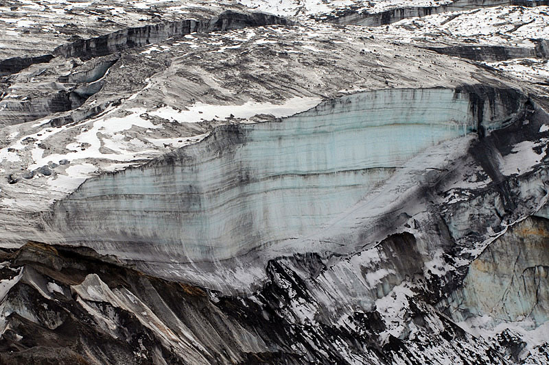 Telephoto view of ice cliff, 60m high, above the Crater Lake. The
1995-96 tephra layer is prominent at the base. | 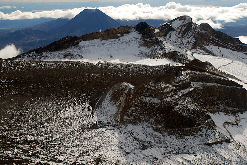 Summit Plateau is an area of stagnant glacier ice up to 160m thick, almost totally
covered by ash from the 1995-96 eruptions. Te Heuheu is on the right with the Mangatoetoenui Glacier top right. | 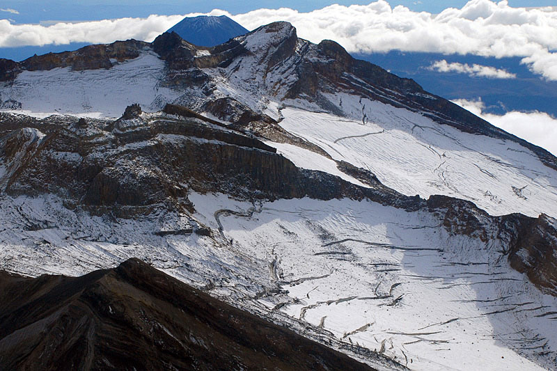 Aerial view of Te Heuheu Peak that forms the rim of a now inactive crater filled with tephra-covered glacier ice; this formerly flowed out to join Whangaehu Glacier in the right foreground, but recent measurements indicate little discharge from the crater. The Mangatoetoenui Glacier is at the top right. | 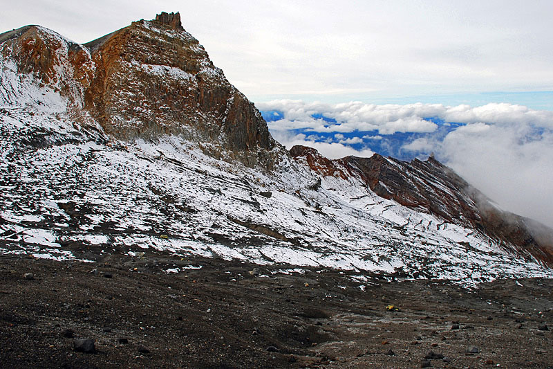 Peak of Cathedral Rocks, illustrating the inclined lavas and tephras that have been
eroded by Whangaehu Glacier in the foreground. Note the extensive tephra cover from the 1995-96 eruptions in the
foreground. |
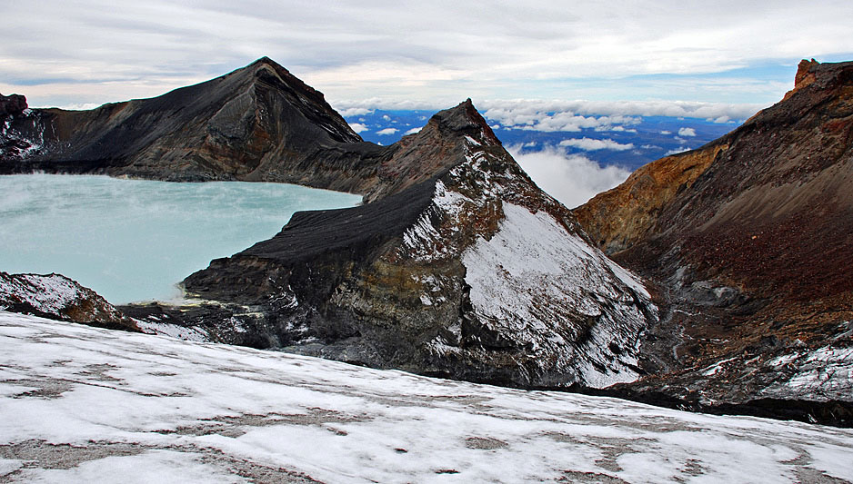 The breach (left) in Crater Lake that resulted in the March 2007 lahar. Seepage
through the dam, made of ash from the 1995-96 eruptions, led to failure after a period of heavy rain, resulting in a
flood through the glacier-filled gorge to the right. | 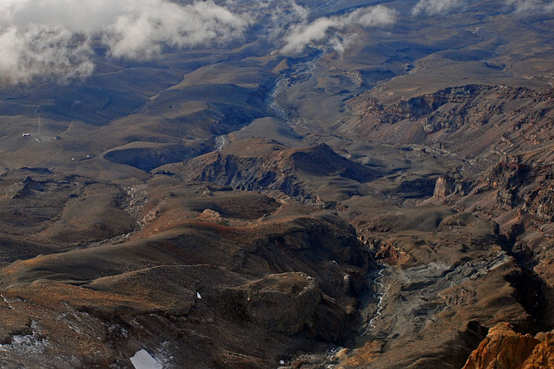 Aerial view of the March 2007 upper lahar route through the Whangaehu Gorge and out onto
the plain across which the Desert Road, North Island’s main arterial road, passes. The smooth rounded ridges are
mostly of Pleistocene moraines. | 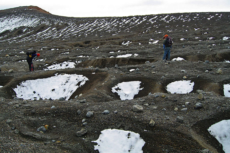 Summit Plateau with ice dolines, which form as a result of sub-tephra melting They were covered up during the 1995-96 eruptions, and later re-opened. | 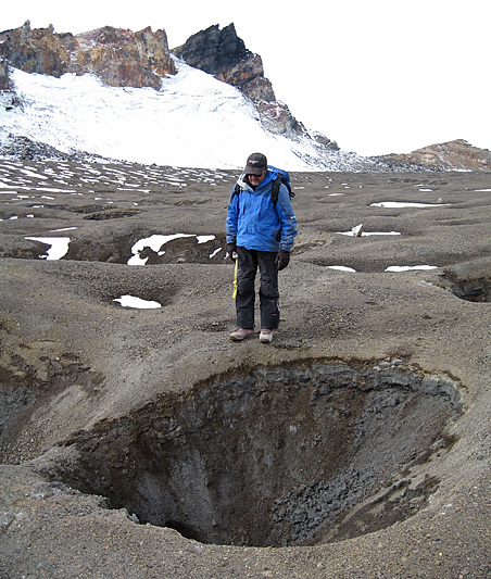 Harry Keyes standing beside an ice doline on Summit Plateau. The thick layer of
tephra smears glacier ice that is visible in the lower part of the hole. |
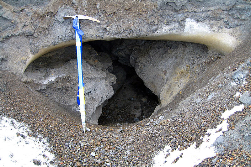 An englacial tunnel on Summit Plateau, formed by meltwater and locally nicknamed a
‘Harry hole’ after Harry Keys who has explored some of them. This tunnel underlies the thick cover of 1995-96 tephra. | 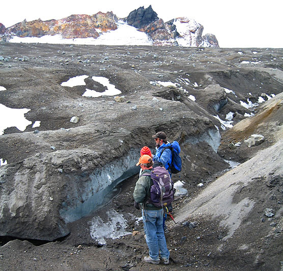 A supraglacial stream on Summit Plateau. Runoff is probably via Whangaehu Glacier.
Clean glacier ice is visible beneath about half a metre of 1995-96 tephra. | 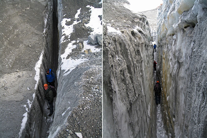 Scientists inside a crevasse on Crater Lake Glacier. | 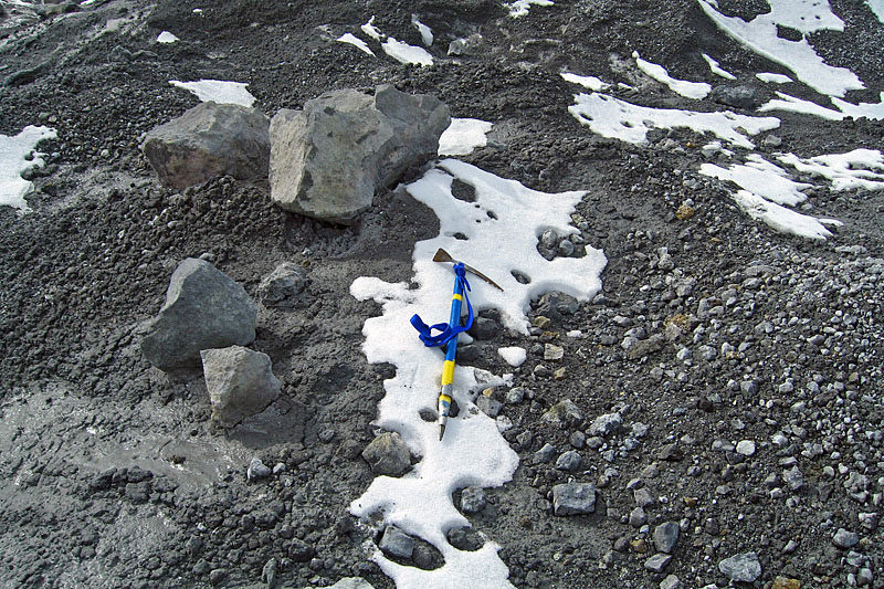 Tephra on Crater Lake Glacier of variable grain size from sand to boulder from the
September 2007 eruption. The larger fragments are derived from the bed of the lake and were thrown out during the eruption. |
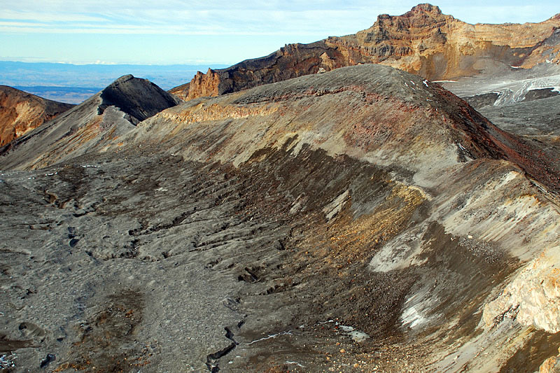 The Dome (2572 m) displays a recent trimline marking the glacier level, separating
the tephra-covered Summit Plateau glacier on the left (dark grey) from nonglaciated terrain (light-coloured). | 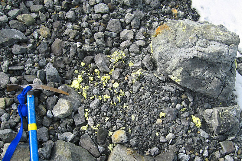 Pebble- to boulder-sized tephra from the 2007 eruption on the surface of the Crater
Lake glacier. The yellow mineral on some stones is sulphur and, along with larger fragments, is derived from the lake bed. | 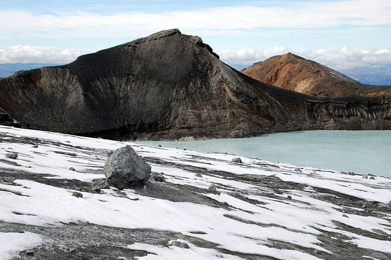 Isolated boulders on the Crater Lake Glacier that originated from the floor of the lake during the 2007 eruption. The material is semi-lithified muddy sand. | 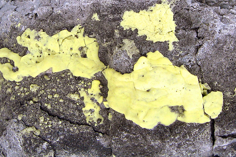 Coating of sulphur on a boulder derived from the lake floor and vent sediment during the 2007 eruption. These fragments are characteristic of the recent eruption only. |
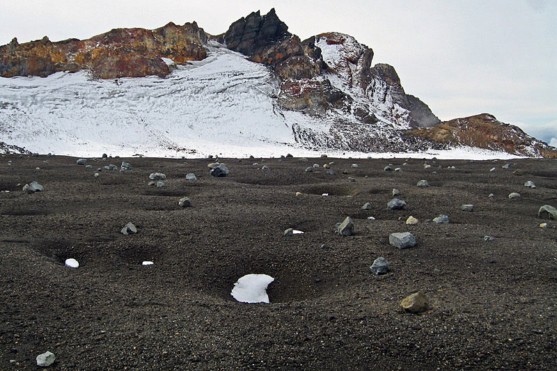 Isolated boulders on the Crater Lake Glacier that originated from the floor of the
lake during the 2007 eruption. The material is semi-lithified muddy sand. | 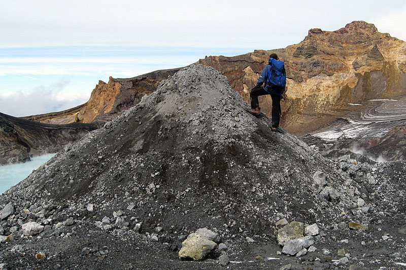 A thick layer of lake-derived tephra fringes Crater Lake since the 2007 eruption.
Uneven thickness has resulted in differential ablation of the ice beneath, giving rise to dirt cones. | 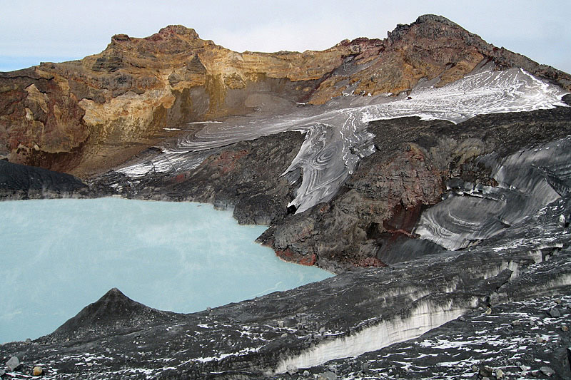 The north-facing glaciers below Ruapehu’s summit, Tahurangi (2797 m), showing
black tephra from the 1995-96 eruptions and light grey tephra (foreground) from the 2007 eruption. The dirt cone at
lower left was formed from the younger material. | 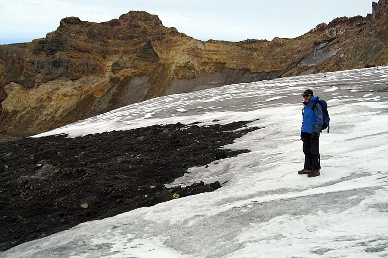 The Crater Lake glacier with the prominent 1995-96 tephra horizon emerging from
the stratified glacier ice. This, and other marker horizons have the potential for deriving accumulation rates
from these glaciers if they were cored. |
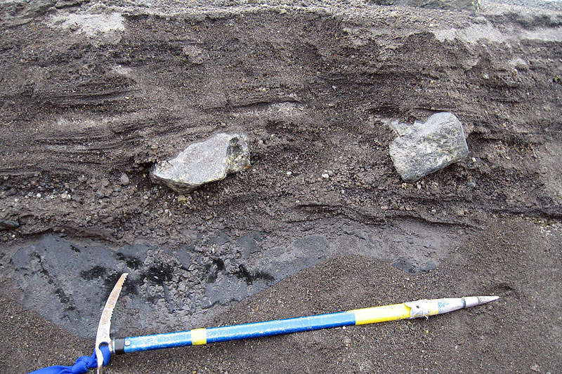 Approximately half a metre of stratified 1995-96 tephra with two bombs lying on top of
Summit Plateau glacier. The shiny grey material just above the ice axe is glacier ice. | 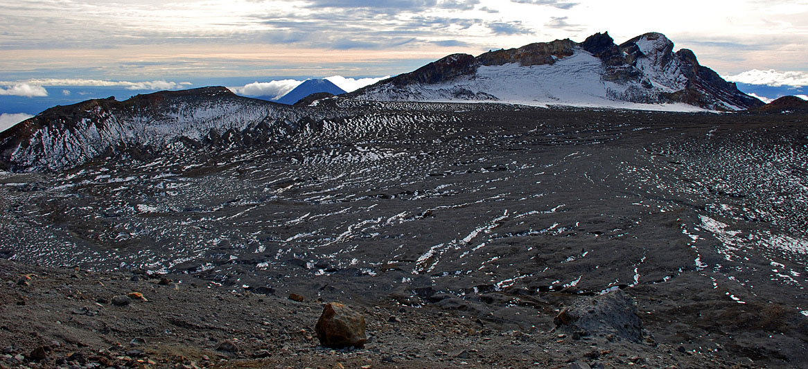 Summit Plateau from the Dome, looking towards Te Heuheu Peak, illustrating how the
tephra-covered glacier fills the old crater. The irregular lines across the glacier are meltwater channels, but
little water was flowing during this visit. | 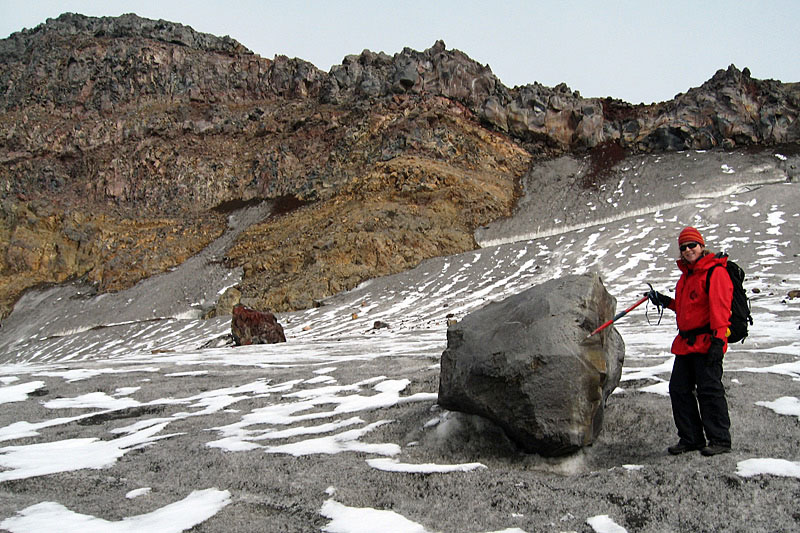 A supraglacial boulder of andestitic lava on the Crater Lake Glacier, derived from
rockfall originating in the cliffs in the background. Karen Williams, author of ‘Volcanoes of the South Wind’ is standing
beside the boulder. | 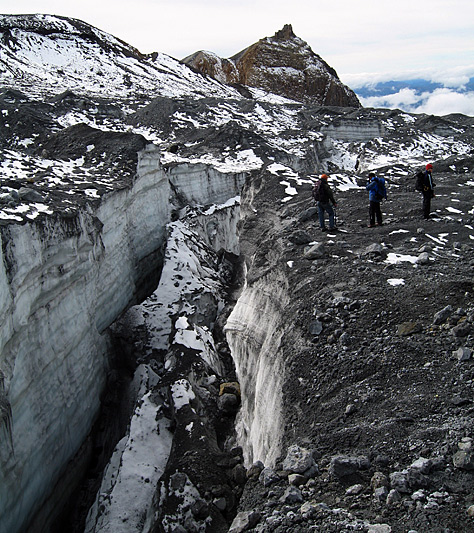 Where crevasses form, as here on Crater Lake Glacier, large quantities of tephra are
ingested by the glacier. This debris is from the 2007 eruption. |
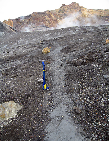 A sedimentary dyke of fine-grained 2007 tephra (surrounded by 1995-96 tephra)
runs away from the camera on upper Whangaehu Glacier. In the absence of crevasses in this area, the origin of this
feature is unknown. | 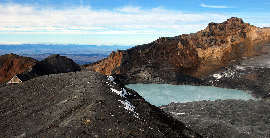 The Dome Shelter (left) is a vital monitoring station for volcanic activity in this area.
Even a small eruption can have important consequences for humans, especially during the skiing season. The shelter is
occasionally damaged by eruptions. | 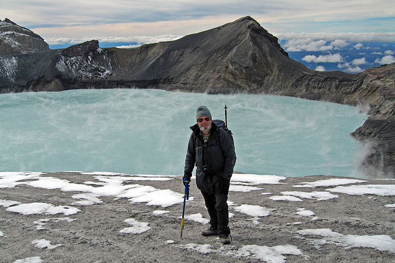 Michael Hambrey (the photographer) in front of steaming Crater Lake. | 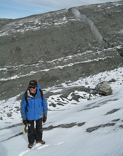 Dr Harry Keys is a leading expert in the recognition and mitigation of volcanic
hazards. He is seen here on the glacier flanking the rim of Ruapehu’s active Crater Lake. |
| The interaction of volcanic processes and the glaciers gives rise to a wide range of unique phenomena, some of which are illustrated in this collection of photographs. Of particular interest are the contrasting products of the 1995-96 and September 2007 eruptions, which have left extensive tephra deposits on the surface of the glaciers. Apart from the volcanic eruptions themselves, the principal hazard is from lahars generated by expulsion of lake water plus rapid melting of snow and ice. The breakout from Crater Lake in March 2007 was of particular concern, and through close monitoring, scientists were able to predict the event accurately, and temporarily suspend transport links on the lower slopes of the mountain. The concern arose because of an unpredicted lahar on Christmas Eve, 1953, which demolished a railway bridge shortly before the Wellington to Auckland Express arrived. Most of the train plunged into the raging torrent, resulting in the loss of 151 lives.
All photos were
taken in April 2008, mostly during a guided trip by Dr Harry Keys, who is Advisor to
the Department of Conservation on volcanic hazards.
|