Vadret da Morteratsch and Vadret Pers 2021Repeat and aerial photos illustrate the accelerated recession of Vadret da Morteratsch and Vadret Pers. The two valley glaciers are no longer joined. |
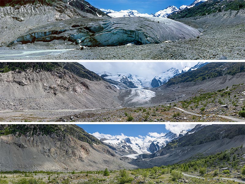 Repeat photo from identical position in font of the glacier terminus in 1985 (top), 2007 (centre) and 2021 (bottom). | 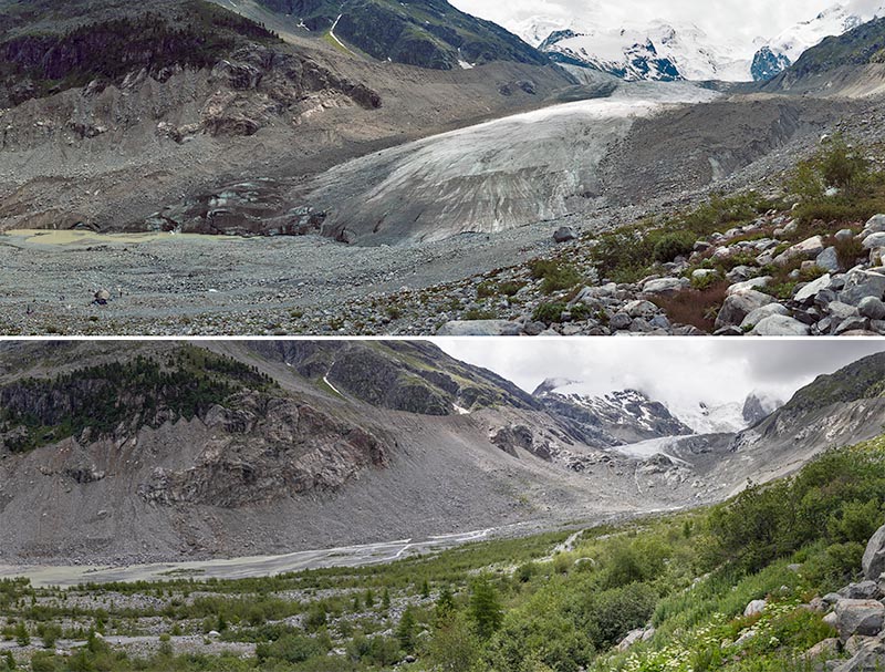 Repeat photo from identical position near the glacier terminus in 1997 (top) and 2021 (bottom). | 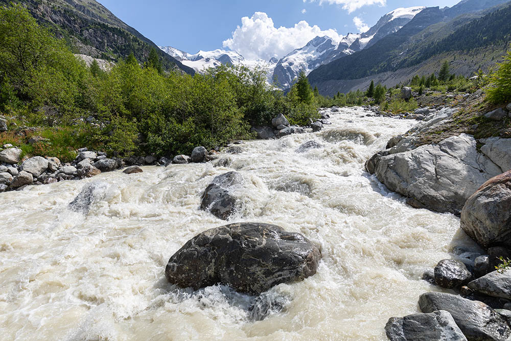 Massive runoff on a warm day in July 2021. | 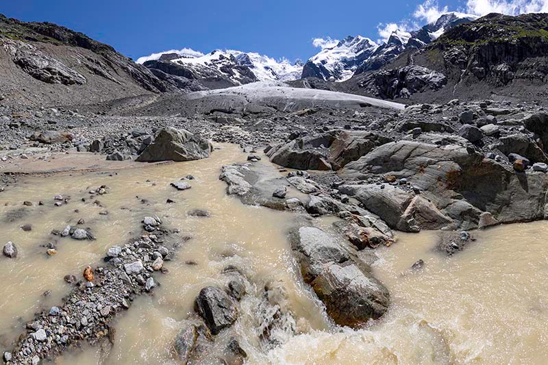 Meltwater stream near the present glacier front (Juli 2021). |
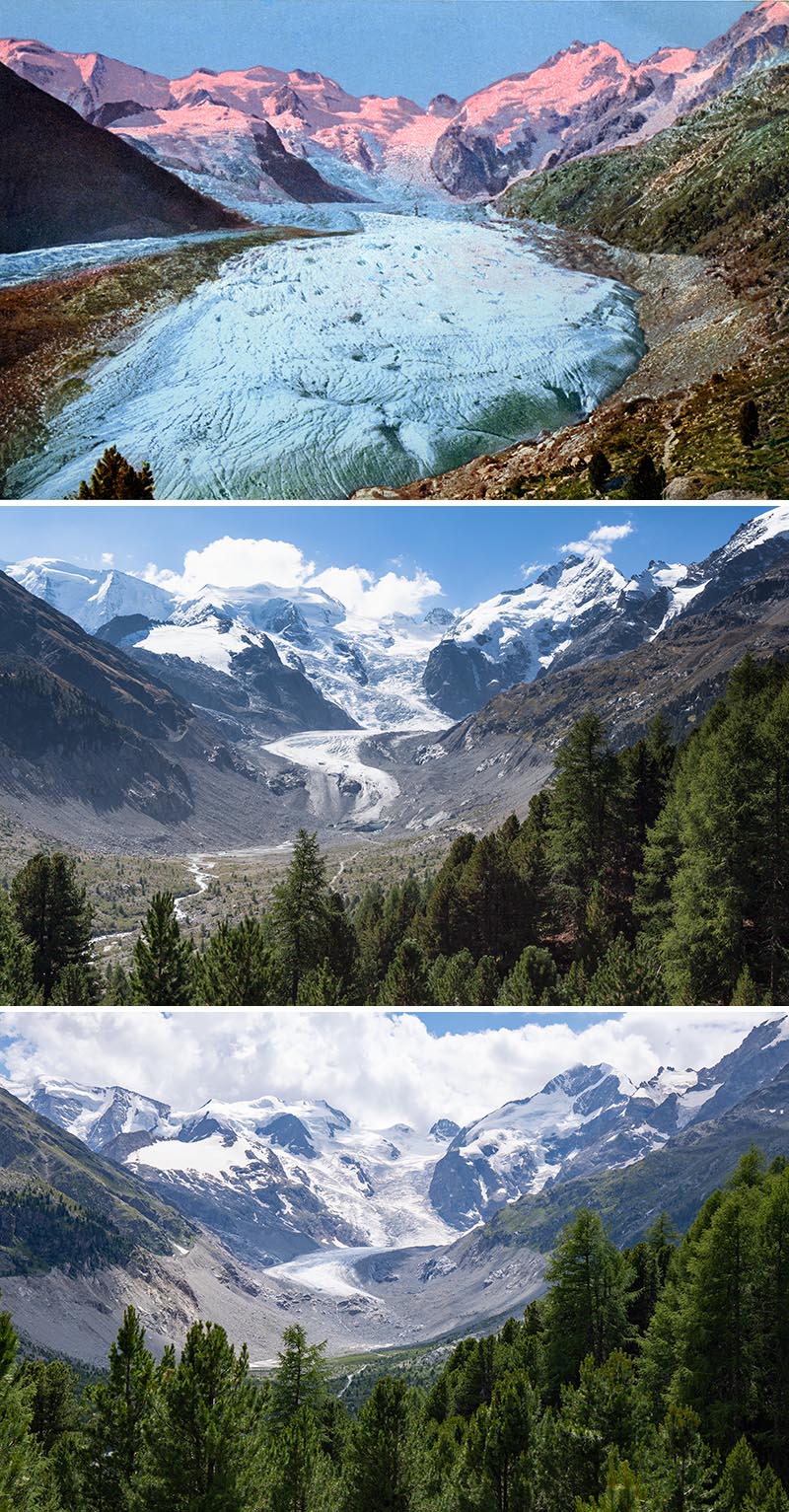 Repeat photo from a location known as Chünetta around 1900 (top), in 2012 (centre) and in 2021 (bottom). | 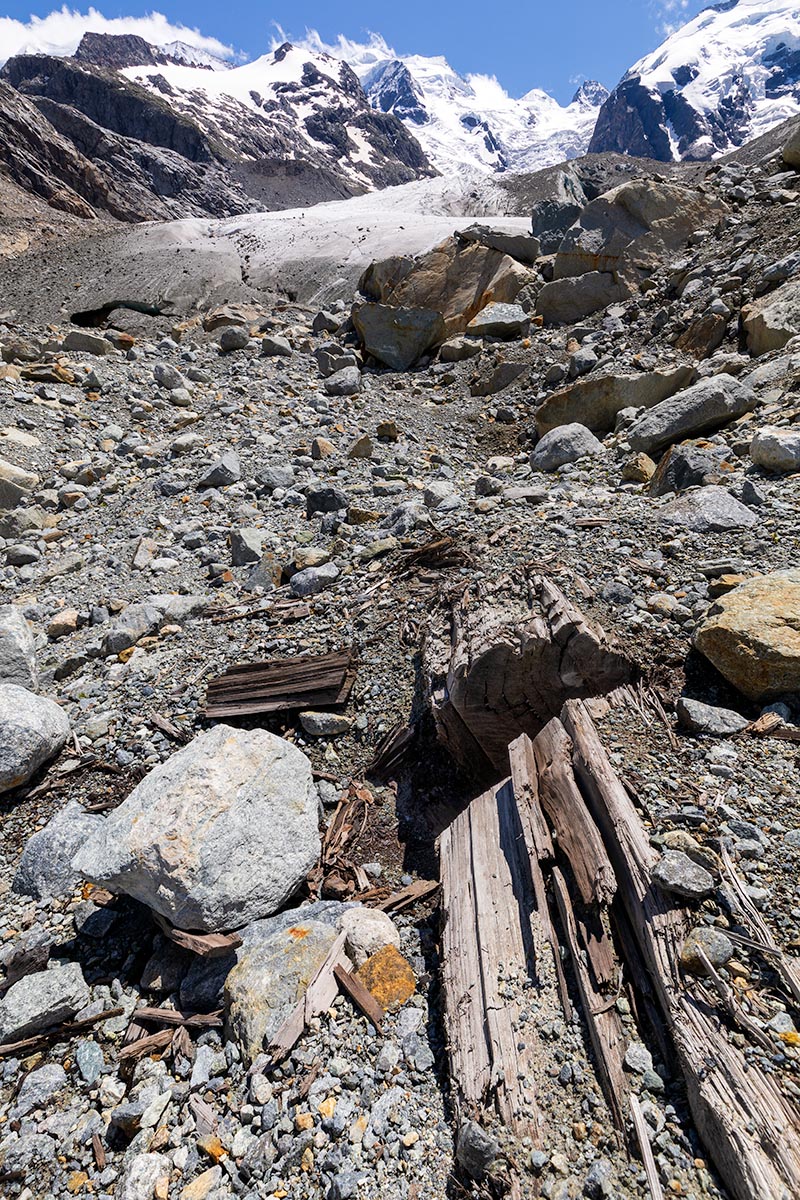 Fossil larch trunk which recently emerged from under the ice. A section of wood has been removed for dendrochronological analysis (July 2021). | 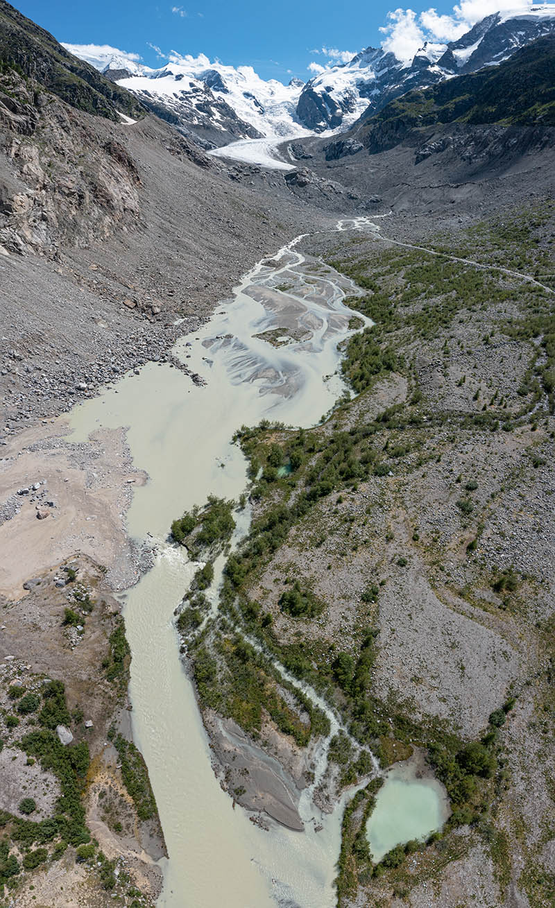 Proglacial area on July 9th, 2021 with braided meltwater stream and kettle hole (bottom). | 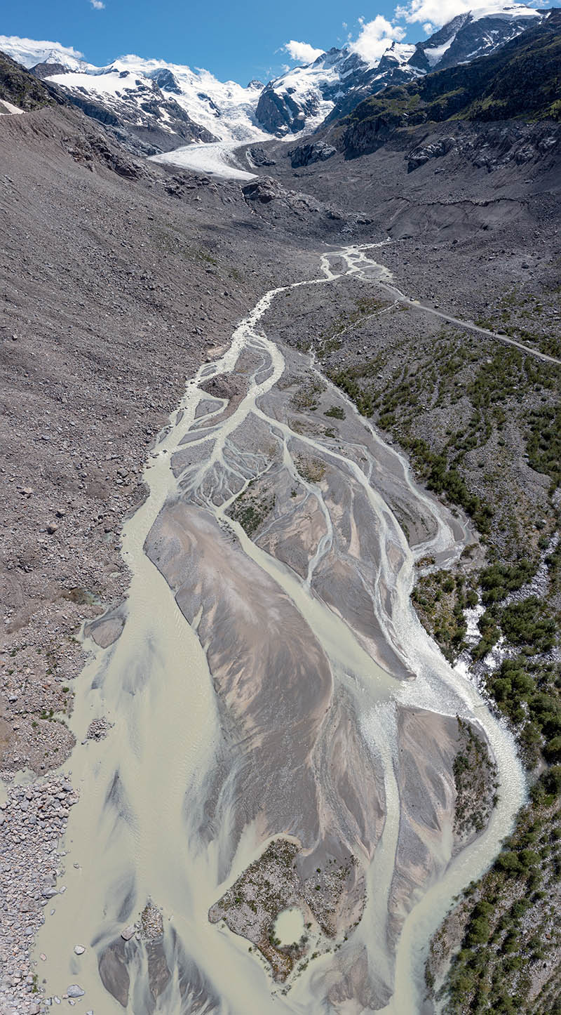 Proglacial area on July 9th, 2021 with braided meltwater stream, kettle hole (bottom), illustrating the mobile nature of channels and river bars. The tonal variations in the bars reflect changes in the size of particles, ranging from sand to pebbles and cobbles. |
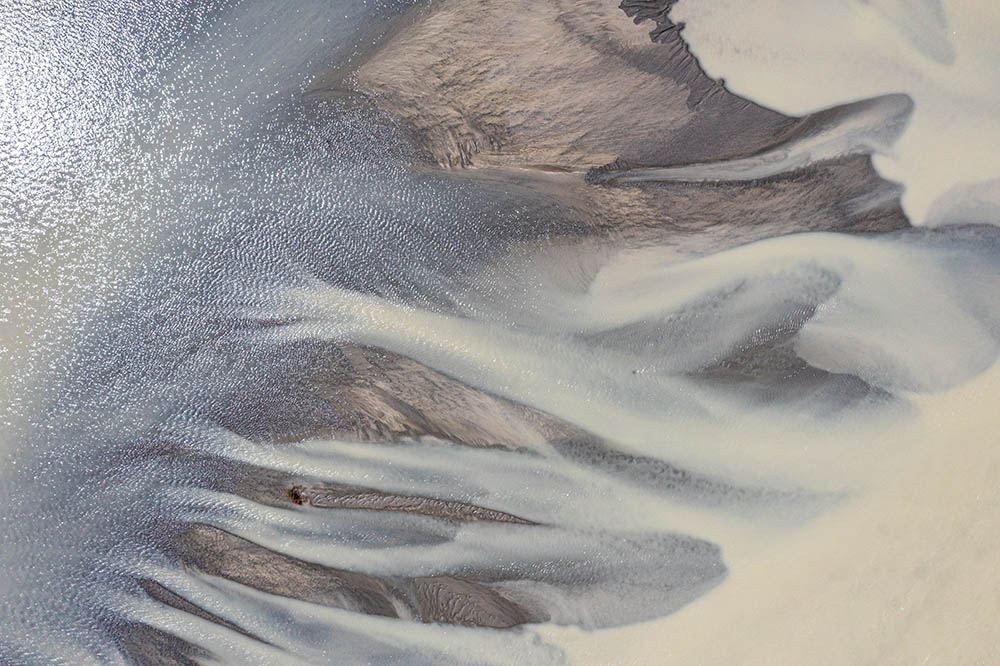 Detail in the braided river (vertical aerial view). | 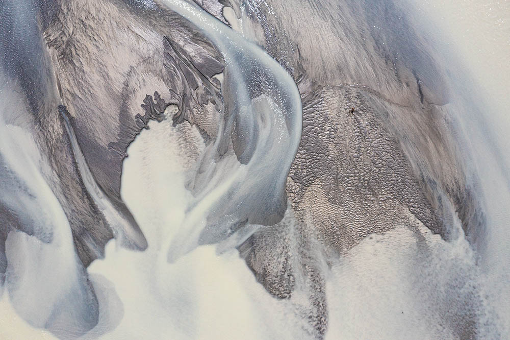 Prominent channels, with a variety of sedimentary structures on bars, including ripples on the right (vertical aerial view). | 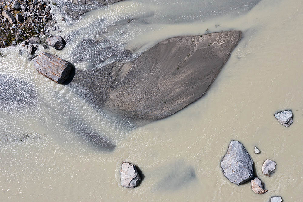 Streamline-shaped channel bar, with sediment streaks showing water flow paths during high discharge. A few blocks which have tumbled down from the lateral moraine are also visible (vertical aerial view). | 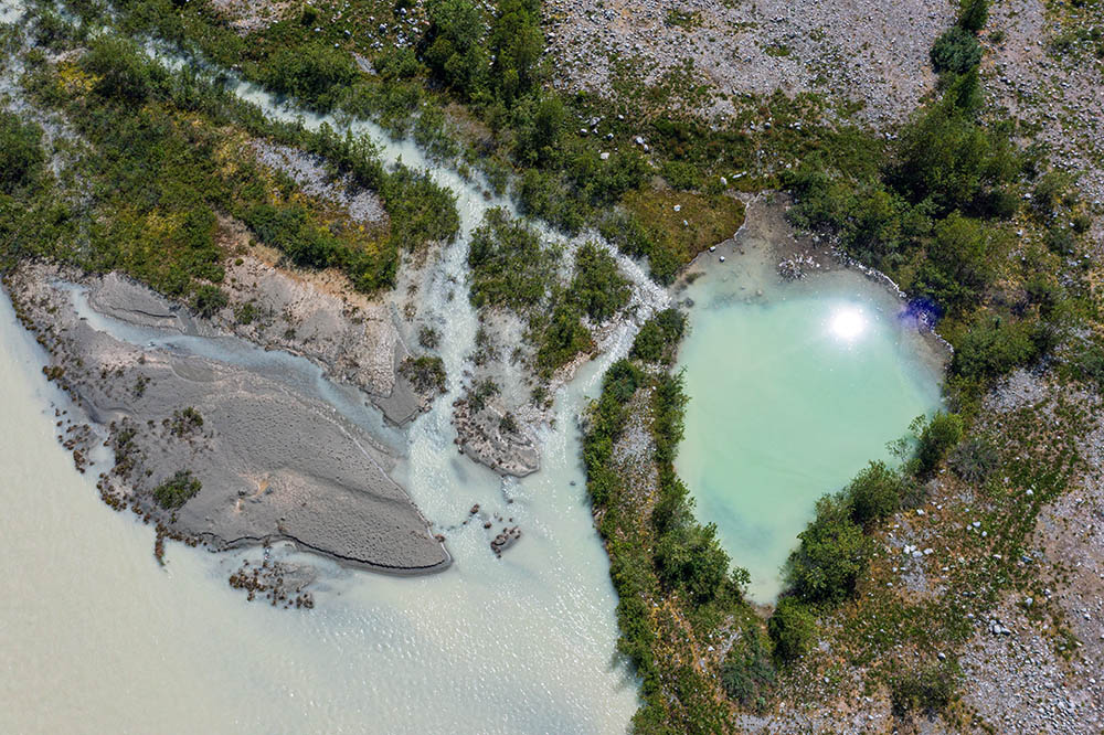 Kettle hole surrounded by pioneer vegetation (vertical aerial view). |
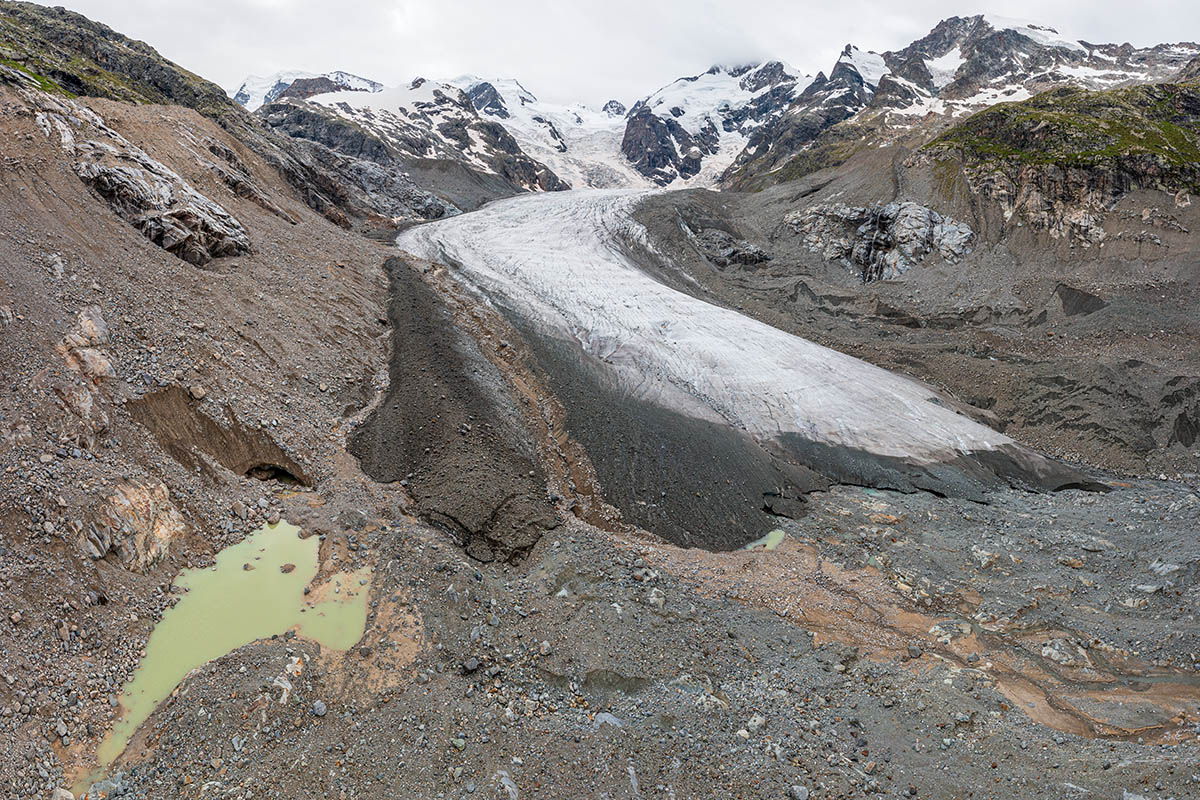 Glacier tongue with small proglacial lake. Note the brown track of a mudflow on the glacier surface and in the glacier forefield (drone panorama July 5th, 2021). | 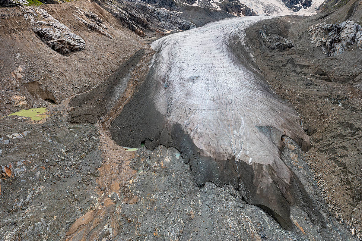 Drone panorama taken from a position along the longitudinal axis of the glacier tongue (July 5th, 2021). The dark brown glacier margin comprises ice that carries debris derived from the glacier bed, and uplifted along thrust faults. | 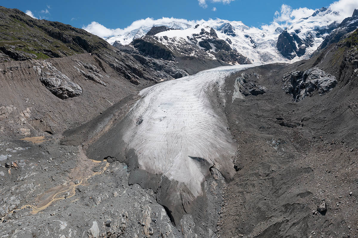 Tongue of Vadret da Morteratsch; Piz Palü, Bellavista and Piz Bernina are in the background (drone panorama July 5th, 2021). | 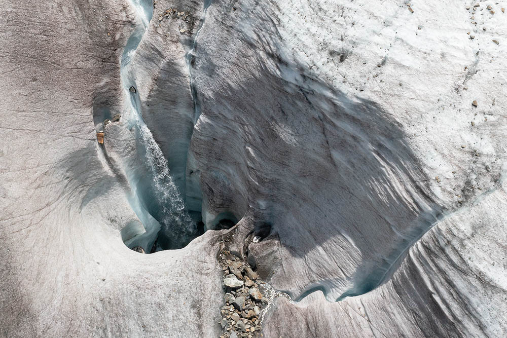 Supraglacial meltwater streams disappearing into a moulin in the lowest part of the glacier tongue (drone photo). |
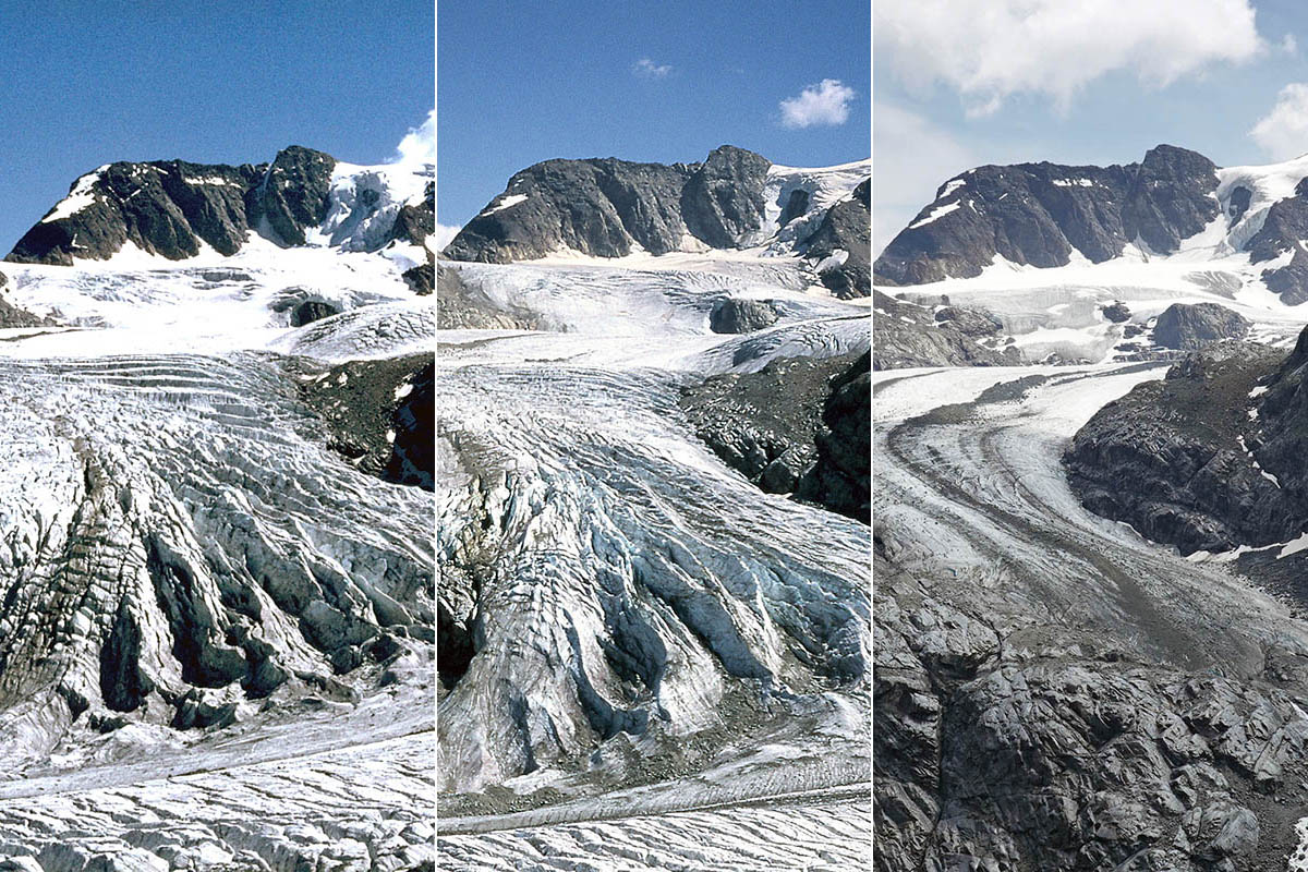 Repeat photo of the icefall in the lower part of Vadret Pers: 1973 (left, photo Joachim Wolff), 2003 (centre) and 2021 (right, photo Angelika Jung-Hüttl). | 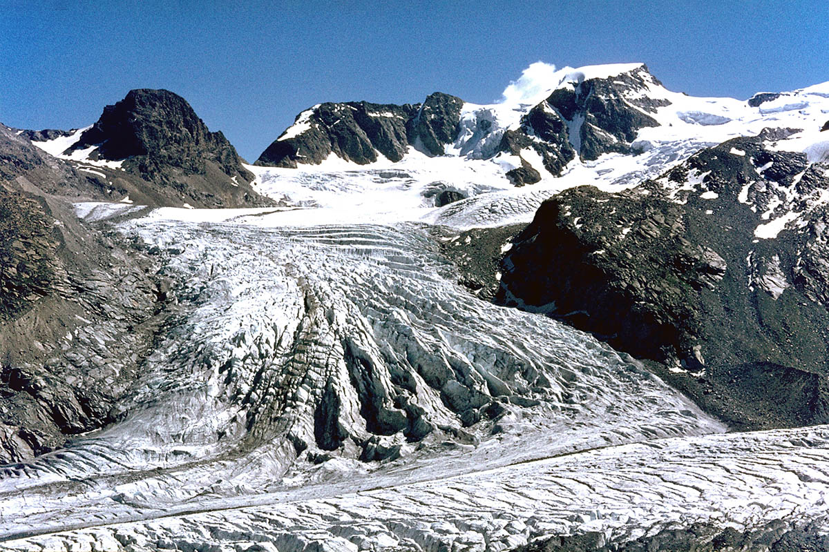 Vadret Pers as seen from Boval hut (Swiss Alpine Club), 1973 (photo Joachim Wolff). Pers Glacier is a tributary of Vadret da Morteratsch, bottom, flowing from right to left. | 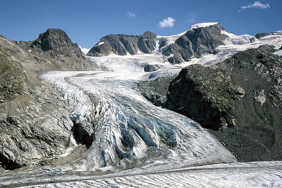 Vadret Pers from the same position in 2003. Recession is already evident, as is surface lowerng of Vadret da Morteratsch (bottom). | 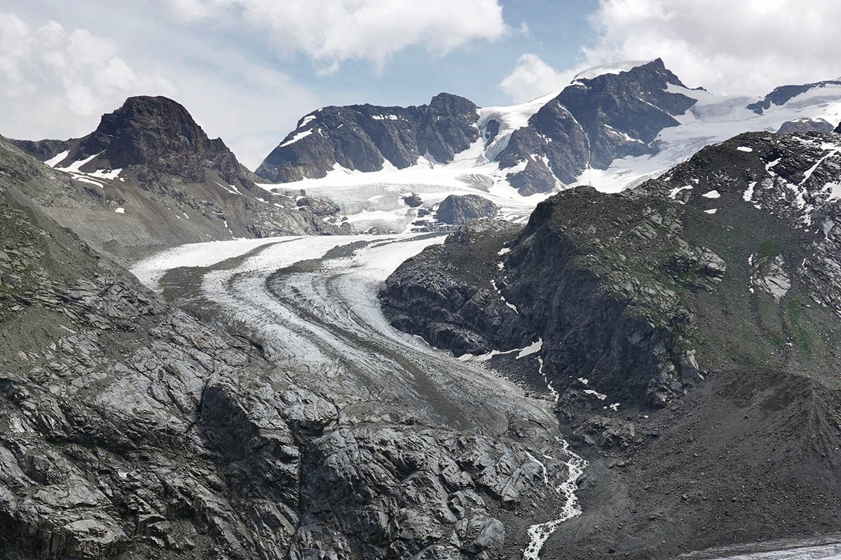 Vadret Pers from the same position in 2021 (photo Angelika Jung-Hüttl). Vadret Pers no longer reaches Vadret da Morteratsch (bottom right corner). |
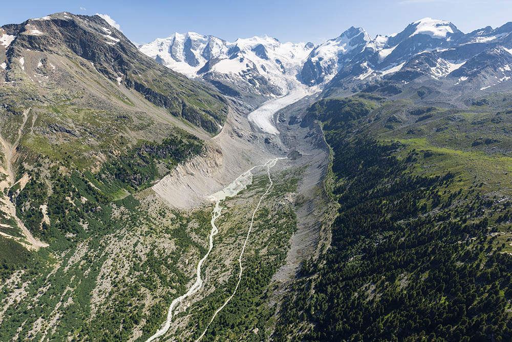 Forefield of Vadret da Morteratsch. Around 1950 the glacier front was at the lower margin of the photo (aerial photo July 23rd, 2021). | 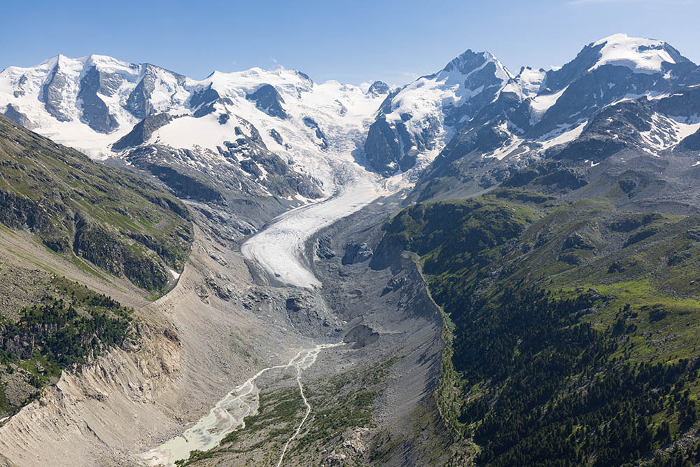 Forefield of Vadret da Morteratsch. Around 1970 the glacier front was at the lower margin of the photo (aerial photo July 23rd, 2021). | 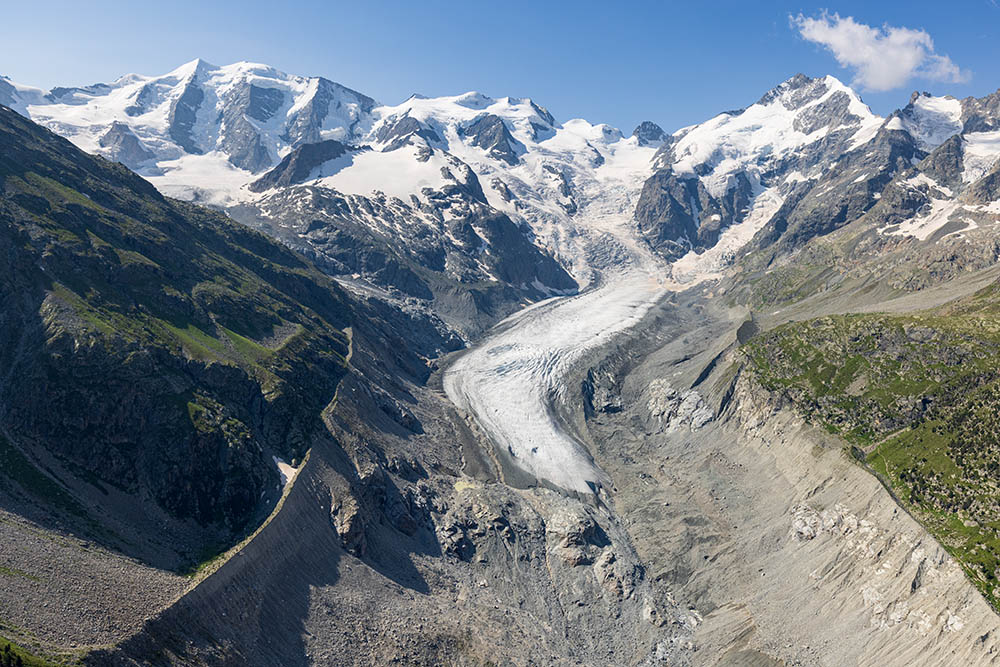 Vadret da Morteratsch from the North. The hiking path leading towards the glacier now ends below the riegel visible in the lower part of the photo (aerial photo July 23rd, 20211). | 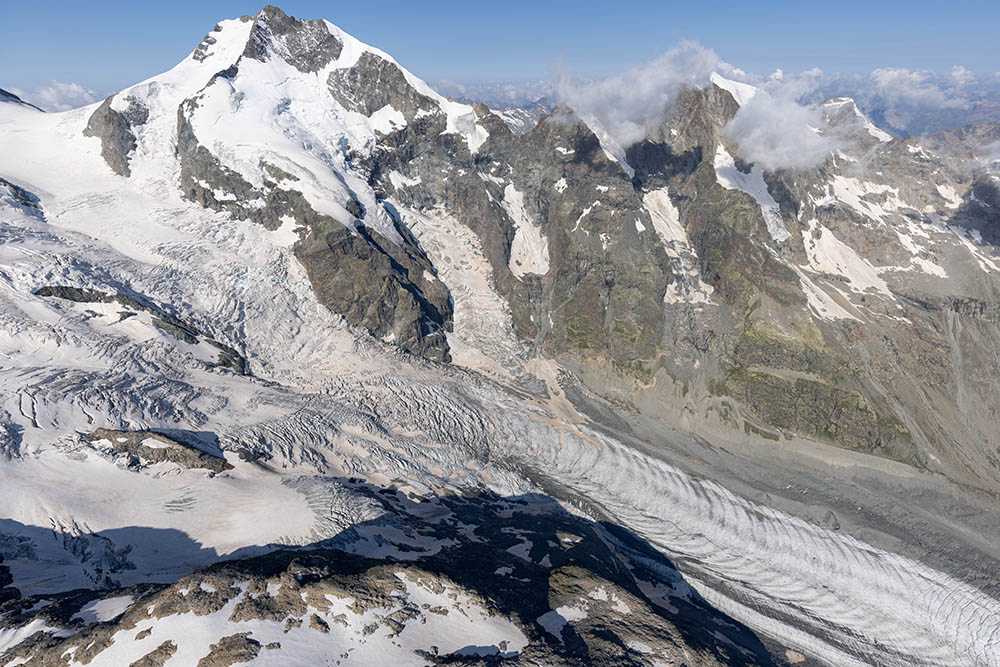 Middle part of Vadret da Morteratsch with prominent ogives; Piz Bernina (left) and Piz Morteratsch (right bckground; aerial photo July 23rd, 2021). |
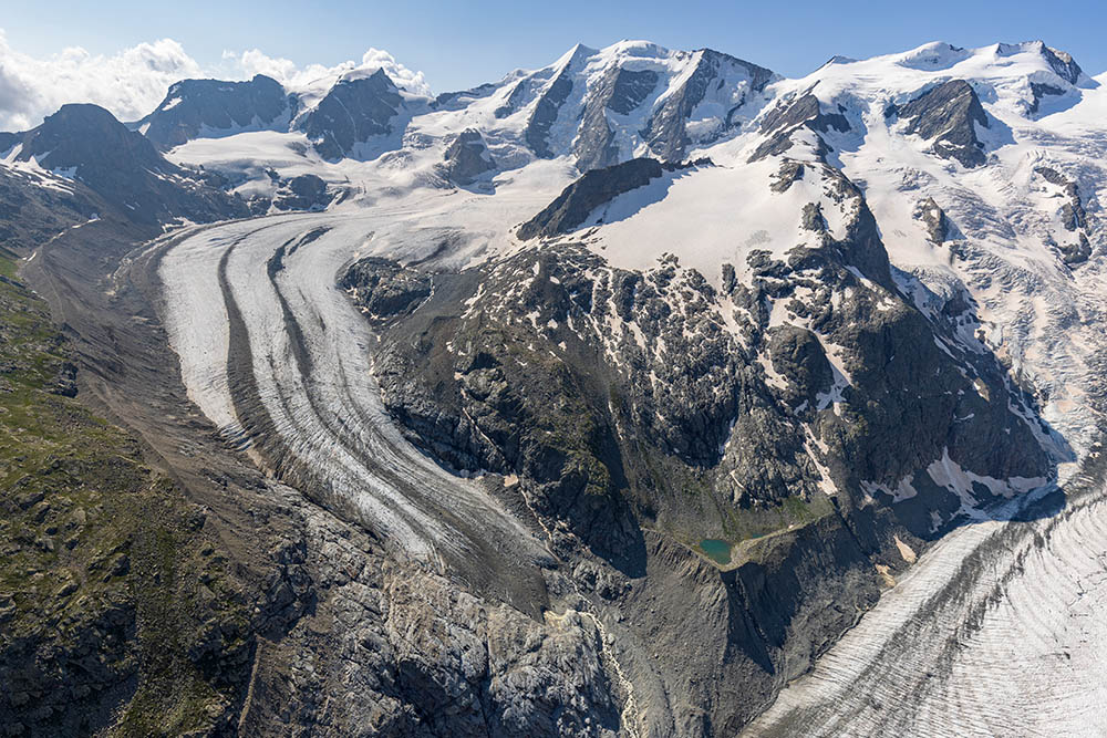 Vadret Pers (left) has receded so much in recent years that it is no longer in contact with Vadret da Morteratsch (lower right); Piz Palü is in the background (aerial photo July 23rd, 2021). | 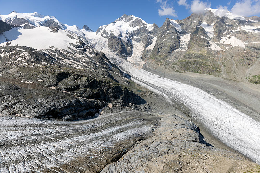 Tongue of Vadret Pers (lower left) and Vadret da Morteratsch; in the background are Bellavista (left), Piz Bernina (centre) und Piz Morteratsch (right; aerial photo July 23rd, 2021). | 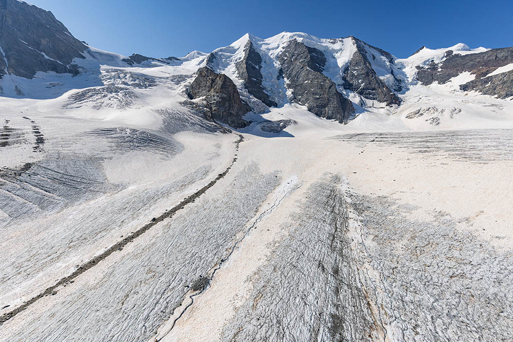 Firn basin of Vadret Pers below the north face of Piz Palü (aerial photo July 23rd, 2021). | 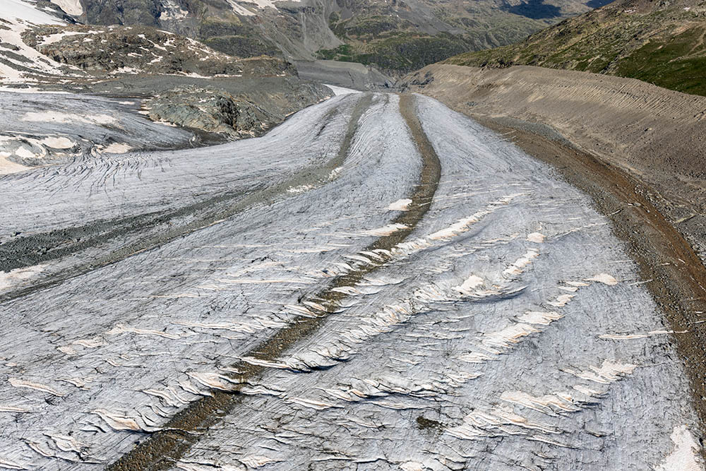 Lower part of Vadret Pers with several prominent medial moraines and longitudinal foliation, intersected by diagonally trending sets of en echelon crevasses. A high lateral moraine, belonging to the Little Ice Age, is on the right (aerial photo July 23rd, 2021). |
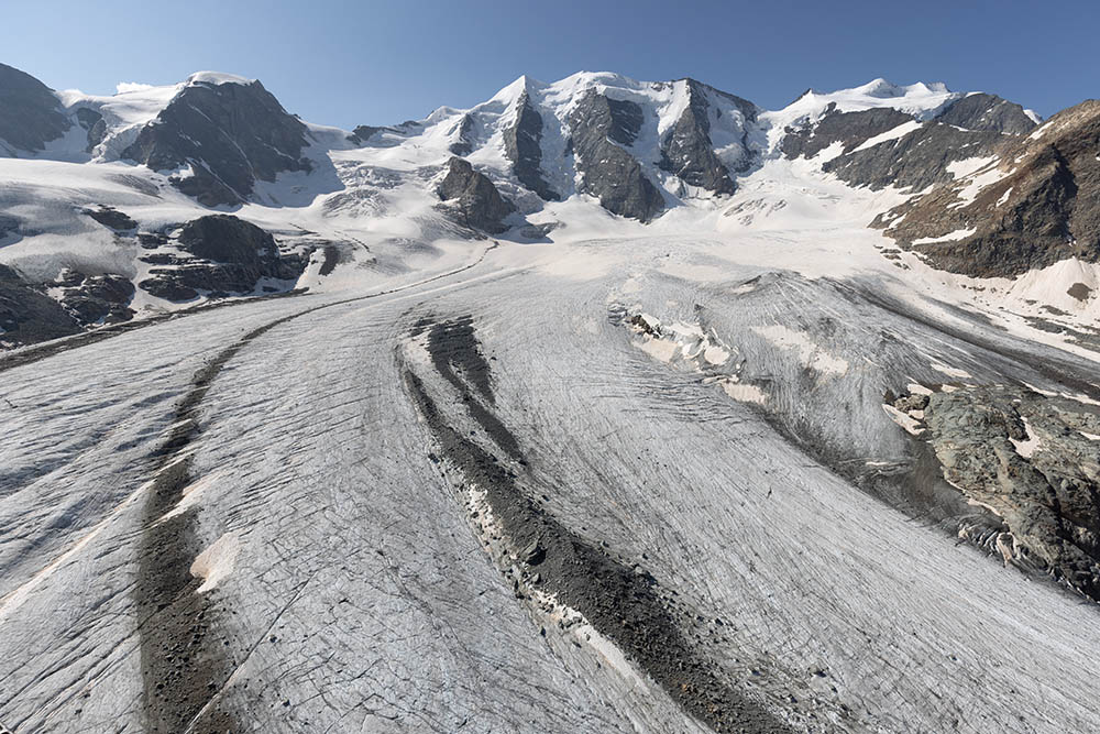 The discontinuous nature of a medial moraine on Vadret Pers probably is a consequence of sporadic landslides falling from Piz Palü (aerial photo July 23rd, 2021). | 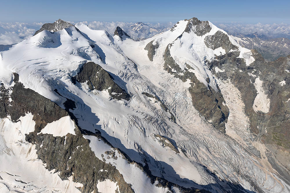 Firn basin of Vadret da Morteratsch (aerial photo July 23rd, 2021). | 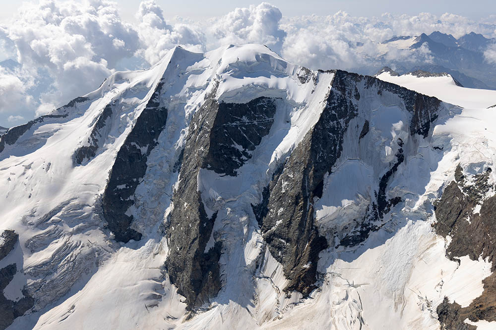 North face of Piz Palü with several hanging glaciers (aerial photo July 23rd, 2021). | 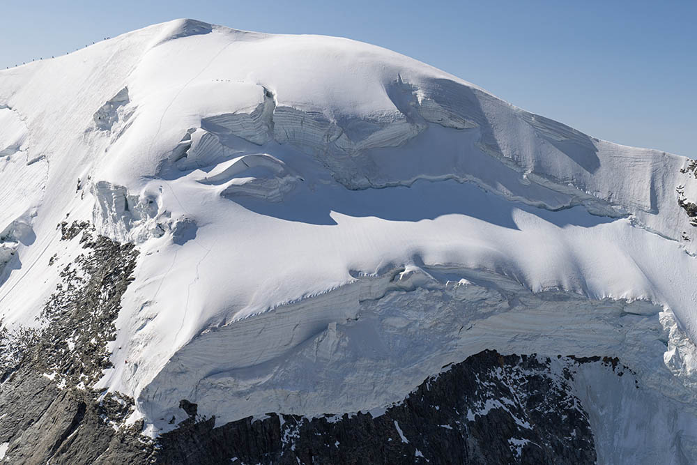 Hanging glaciers near the main summit of Piz Palü show prominent firn stratigraphy. Note climbers on the firn ridge leading to the summit (aerial photo July 23rd, 2021). |
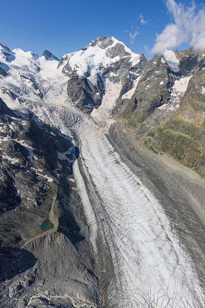 Firn basin and middle part of Vadret da Morteratsch from the north. At lower left is the meltwater stream from Vadret Pers. Ogives, originating in the icefall, are prominent in this photo (aerial photo July 23rd, 2021). | | | |
| Photos, unless otherwise noted, are all by Jürg Alean. |