Ice and waterOn many glaciers, ice and water are intimately associated. Surface streams during the melt season eventually penetrate to the bed of the glacier or reach the sides, sometimes via tunnels. Lakes commonly form on the glaciers surface or at the margins. |
 Surface (‘supraglacial’) meltstream on the surface of Austre Lovénbreen, a small valley glacier in NW Spitsbergen. In summer, streams on Arctic glaciers become more incised and can be difficult to cross. Streams often retain the same channel year-after-year. MH | 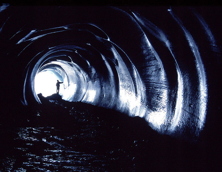 Lakes at the margins of glaciers are ephemeral features and can drain suddenly. This and the next photograph is of Pastaruri, an icefield in the Cordillera Blanca, Peru, showing the site of a drained lake. The smooth semi-circular tunnel was the route taken beneath the ice when the lake drained suddenly. MH | 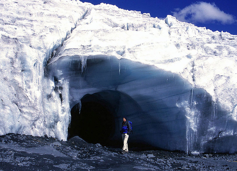 The same tunnel at Pastaruri, seen from the outside. MH | 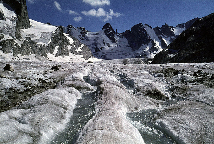 On alpine glaciers, such as Vadrec del Forno, streams commonly exploit structures in the ice. In the longitudinal foliation shown here, dark ice layers absorb more solar radiation than light layers, so forming grooves that then provide ready-made channels for meltwater. MH |
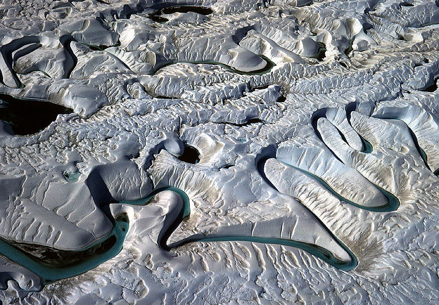 Stream channels that become reoccupied each year on polythermal glaciers evolve slowly through time independently of ice structures. On Vibeke Gletscher in East Greenland, an exceptionally fine set of meanders has formed, and are here viewed from a helicopter. MH | 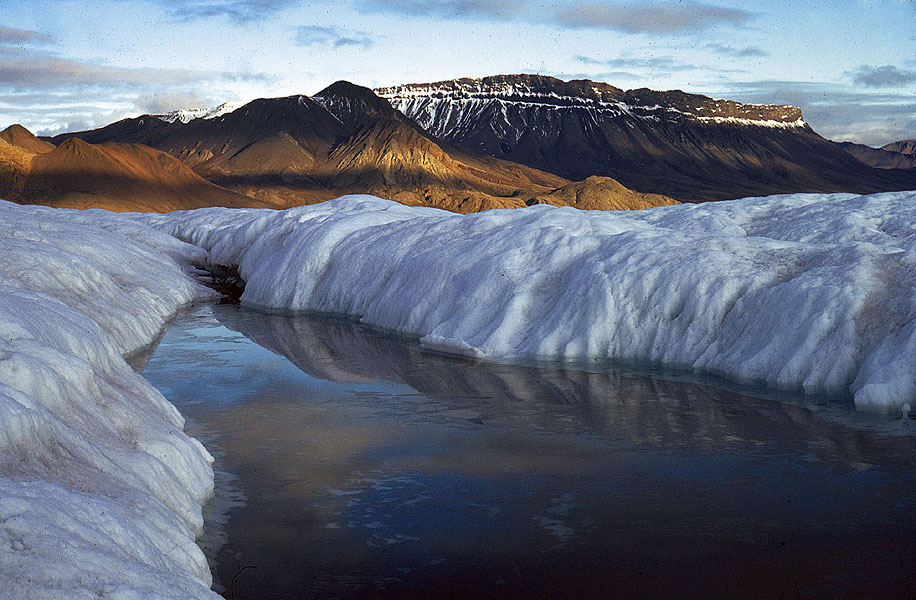 If the surface glacier ice is cold, i.e. below the melting point, water is unable to drain away freely, so ponding takes place, as here on Thompson Glacier, Axel Heiberg Island, Canadian Arctic. MH | 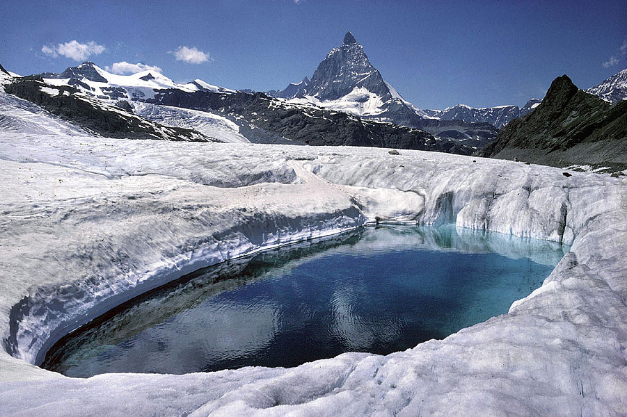 One of the rare polythermal glaciers in the Alps is Gornergletscher. Those parts of the glacier that originate above 4000 m are cold. The pond is one of several that are found in the cold ice that has reached the glacier tongue. The Matterhorn is in the background. JA | 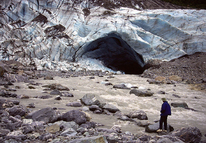 In temperate glaciers, streams commonly emerge from the snout at a single outlet known as a glacier portal. The water is commonly laden with suspended sediment and the roof of the portal prone to collapse, sending ‘ice boulders’ down-river. This view is of the snout of Fox Glacier, New Zealand. MH |
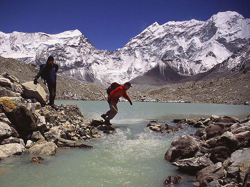 Ice-cored moraines at the terminus of a glacier are associated with the development of numerous ponds and lakes. Here at Imja Glacier, Khumbu Himal, Nepal, runoff from the glacier passes through one such lake. All the loose debris in this picture is underlain by dead glacier ice, so the topography is constantly changing as it slowly melts. MH | 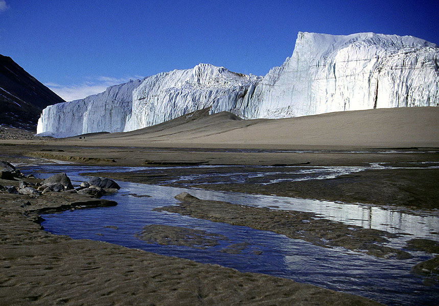 Streams emanating from cold glaciers do so only from the glacier surface. The water is generally clean. This view shows the start of Onyx River, that drains into an inland lake. Supraglacial meltstreams run off the surface of Wright Lower Glacier, Dry Valleys, Antarctica, in the background, and cut through a pile of wind- blown and fluvial sands, before spreading out in braided fashion. MH | 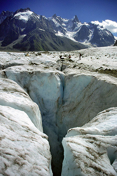 Supraglacial streams tend to exploit structural weaknesses in the ice and work their way towards the bed. The streams often plummet to the depths of a glacier via vertical shafts called moulins. This view shows the well-known site known as Les Moulins on the Mer de Glace, France that typifies this feature. MH | 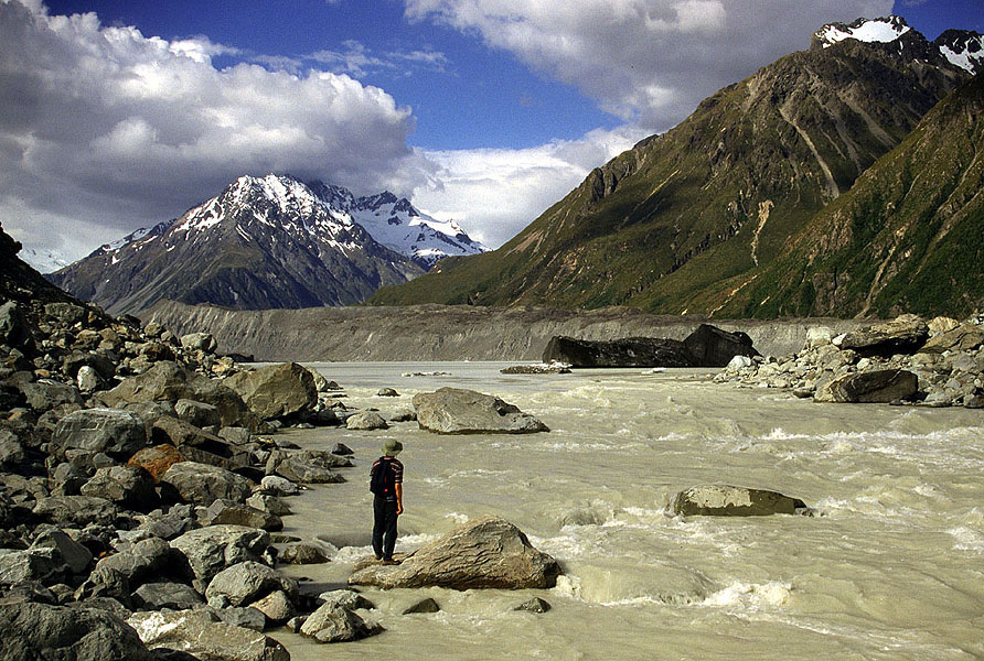 Sediment-laden meltwater is a feature common to most glaciers. The fine components are of clay and silt size, and remain in suspension for considerable distances down-stream. Here dirty water emerges from the lake in front of Tasman Glacier, New Zealand through a breach in the terminal moraine. The dark object partially blocking the lake outlet is a dirty iceberg. MH |
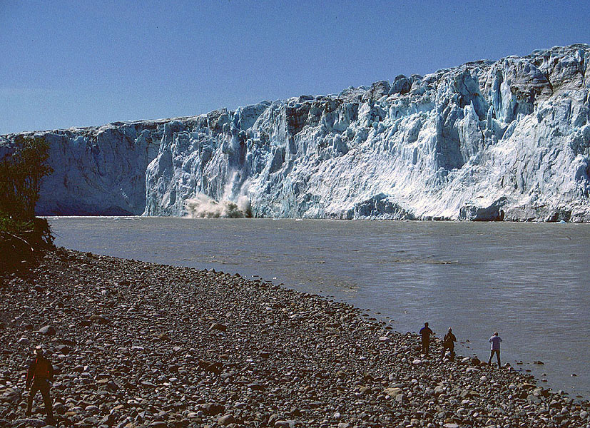 Some glaciers have rivers that flow along their flanks or across the terminal face, and are also prone to cliff collapse. Here, the terminal cliff of Childs Glacier, is being undercut by the fast-flowing Copper River in SE Alaska MH. | 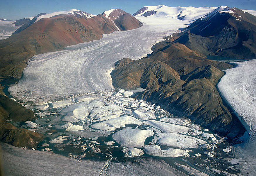 Glaciers commonly trap water along their flanks, forming ice-dammed lakes. Here, Astro Lake on Axel Heiberg Island in the Canadian High-Arctic, is dammed by Thompson Glacier, which flows from left to right at the bottom of the picture. JA | 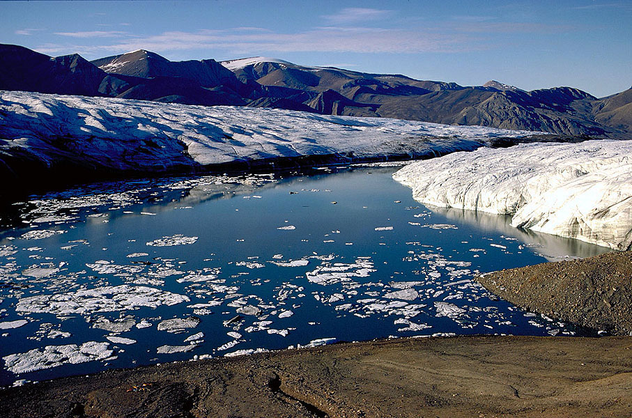 This and the next view is of Between Lake, an ephemeral lake formed where the Thompson and White glaciers on Axel Heiberg Island meet. This picture shows the lake almost full, just before draining. JA |  Between Lake, seen after it has drained catastrophically. This filling and emptying takes place once every year, the outlet closing up over the winter as a result of ice-creep. MH |
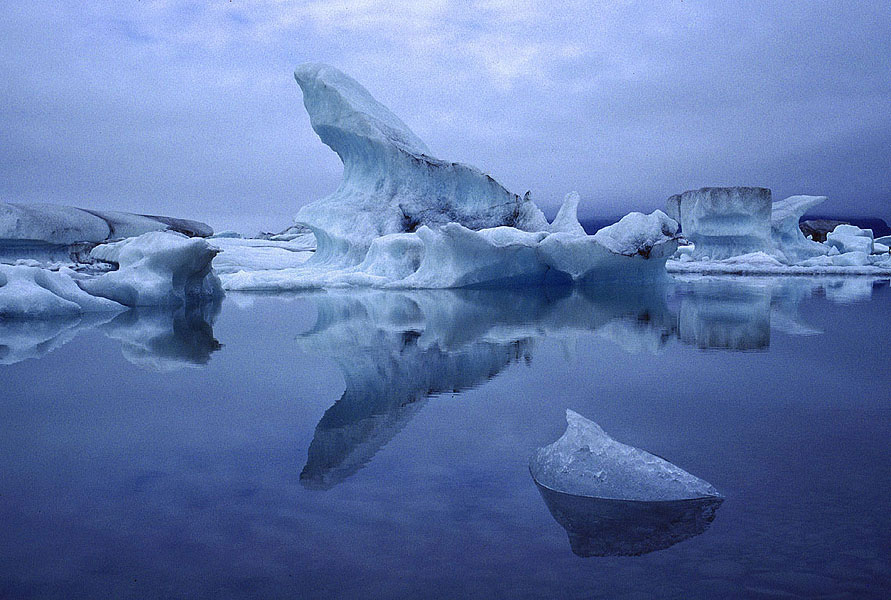 Because glaciers often excavate deeply below the general lie of the land, when they recede they are replaced by large proglacial lakes, such as Jökulsarlon in front of Breidamurkerjökull in southern Iceland. JA | 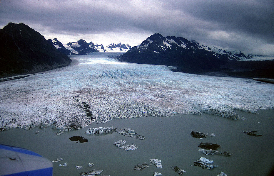 In areas of flat topography, ‘proglacial lakes’ commonly form around the snout of a glacier. Small icebergs may calve into such lakes as here at Sheridan Glacier, near Cordova, Alaska. MH | | |
| Photos: Michael Hambrey (MH), Jürg Alean (JA) |