Evolution of the Arctic IslandsThe islands of the Arctic have a long geological history, with some of the world’s oldest rocks occurring in Greenland, dating back nearly 4000 million years. The geological evolution of the regions is recorded in a range of igneous, metamorphic and sedimentary rocks. The images displayed here illustrate the major stages of the region’s history: (1) the geological foundations; (2) early sedimentation, life and climate; (3) the mountain-building phase; (4) development of younger sedimentary basins; (5) opening of the North Atlantic ocean; (6) emerging present-day geography and temperate climates; and (7) the Ice Age in the Arctic. |
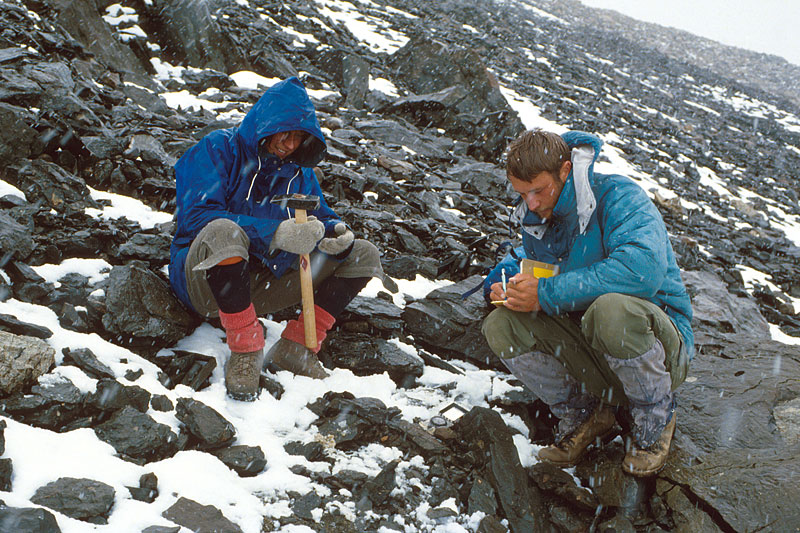 Snow falls as geologists collect specimens for analysis back in the laboratory on a remote ‘island of rock’, surrounded by ice, known as Tillit Nunatak at the edge of the Ice Sheet in East Greenland. | 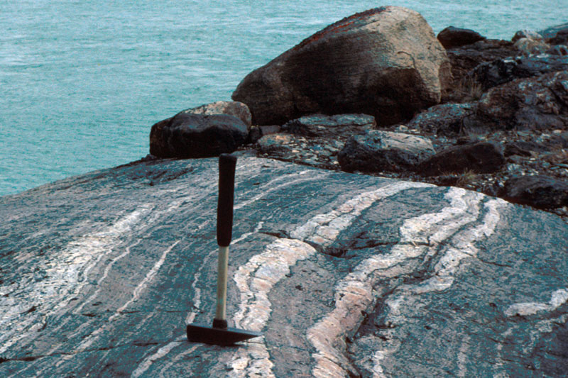 The ice-scoured surface in the foreground comprises ancient crystalline gneisses (rocks metamorphosed by strong heat and high pressure) of the Laurentian shield in Gåseland, inner Vestfjorden (Scoresby Sund), East Greenland. | 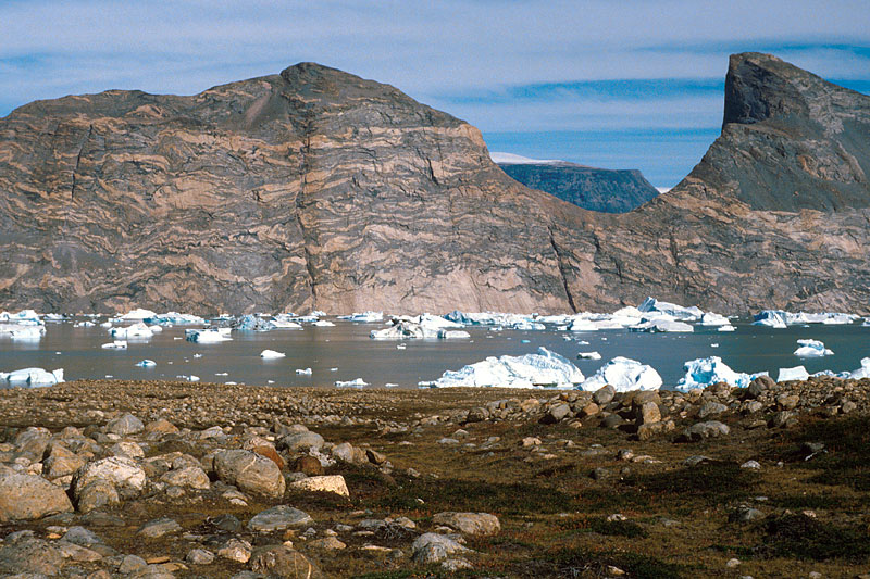 The inner fjords of East Greenland reveal ice-carved rock faces with structure of ancient crystalline rocks. This exposure of Precambrian rock in Nordvestfjord, East Greenland, shows large bodies of pink igneous and partially melted material folded in with strongly metamorphosed grey rock. | 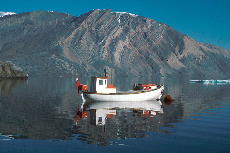 Ella Ø, East Greenland. Tilted sequence of Precambrian sedimentary rocks, originally deposited on the floor of a shallow sea. These rocks were uplifted into their present position around 400 million years ago, but only exposed by erosion in the last 50 million years. |
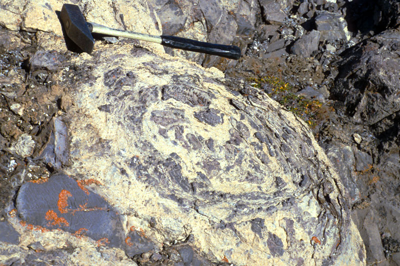 Amongst the strongest evidence of shallow marine environments during late Proterozoic time is the presence of algal mounds called stromatolites. These examples have weathered out beautifully from dolomites exposed on Ella Ø, East Greenland, and reach diameters of several metres. | 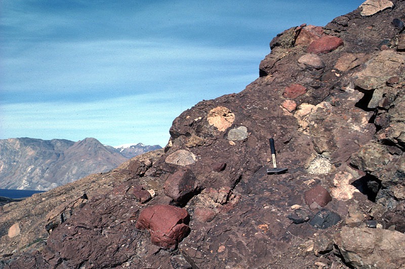 Many parts of the Arctic yield evidence for a late Precambrian glaciation, about 650 million years ago. These tillites, typically comprise a mixture of all grades of material from clay to boulder size. This example on Ella Ø includes colourful boulders derived from the crystalline shield. | 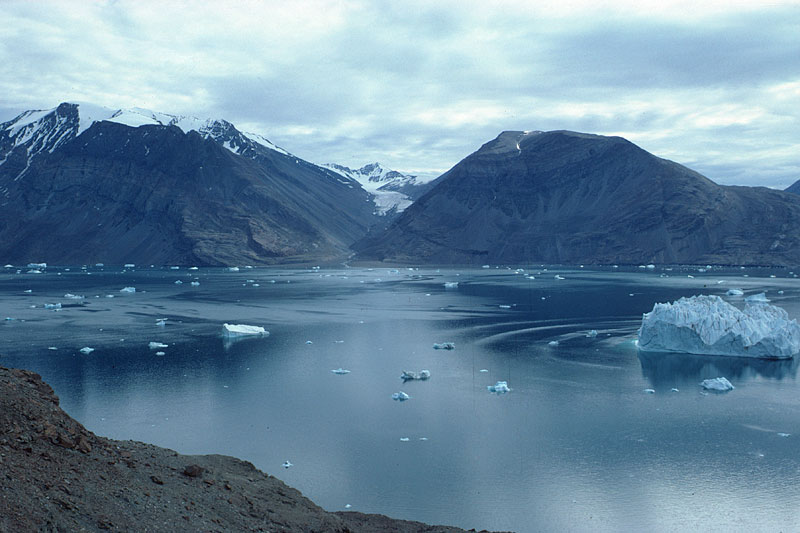 During the Caledonian mountain-building event, around 420 million years ago, the early sedimentary rocks were folded deep in the crust, where they can bend more easily. Here a downfold called a syncline is exposed along the 1200 m high flanks of Antarctic Sund in East Greenland, as icebergs wallow in the fjord waters beneath. | 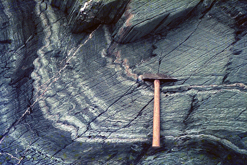 At deeper levels, Caledonian mountain-building not only folded the rocks but also metamorphosed them. This close up view of small folds around a larger fold in the Hornsund area of Spitsbergen, shows baked layers of sandstone (light) and mudstone (grey). |
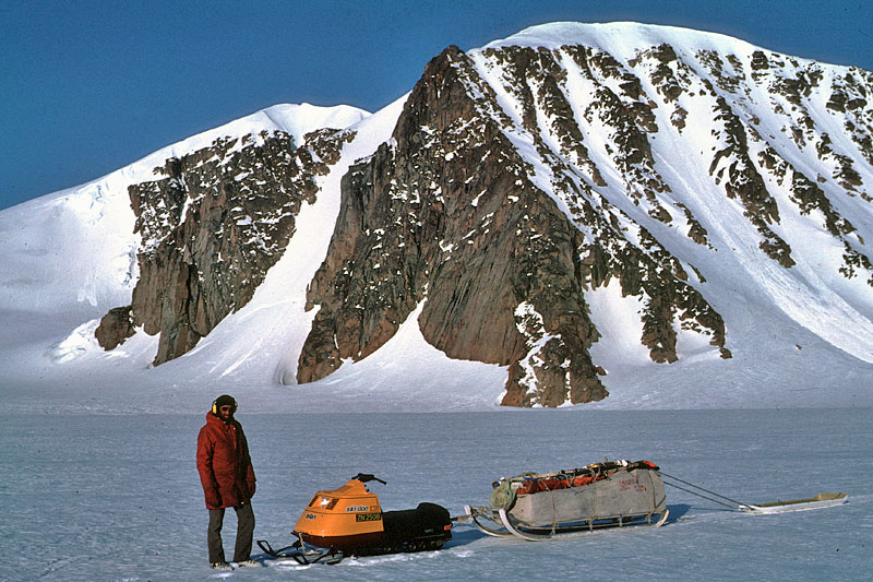 In some areas of the Arctic, the end of the Caledonian mountain-building period was marked by intrusion of granite bodies at depth within the crust. In this view, the granite peak of Newtontoppen (1717m), the highest in Svalbard, forms a resistant massif that projects above the surrounding icefield. | 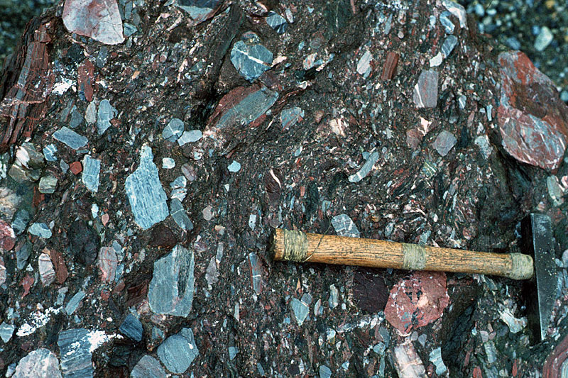 During the Devonian Period the Caledonian mountain chain throughout the Arctic was worn down under a hot desert regime. Coarse material was transported to the foot of the slopes to form alluvial fans (Fjortende Julibreen in NW Spitsbergen). | 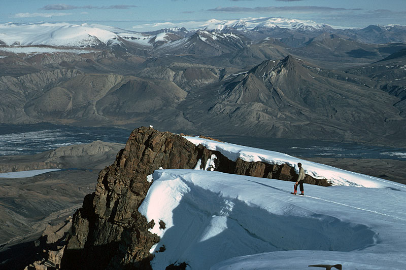 The summit of Wolf Mountain, Axel Heiberg Island (foreground) and the mountains beyond, are formed largely of Mesozoic strata of the Sverdrup Basin, and are gently folded. | 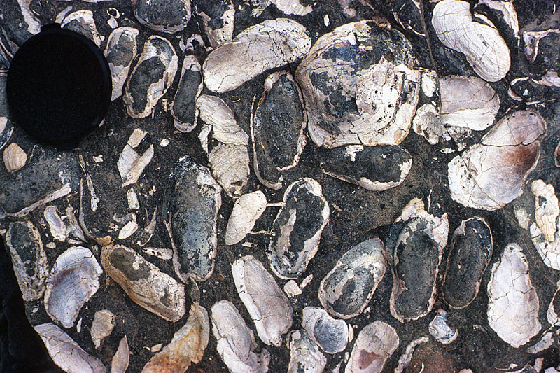 Fossil bivalves (Maletia sp.) found in Jurassic strata indicate that warm shallow seas prevailed in Th. Thomsen Land, East Greenland about 160 million years ago. |
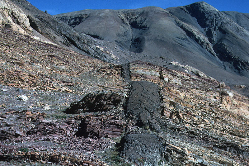 The opening of the North Atlantic Ocean in Palaeogene time (60 million years ago), was preceded by widespread volcanic activity. Basalt dyke cutting through late Precambrian sedimentary rocks in Brogetdal, Strindberg Land, East Greenland. | 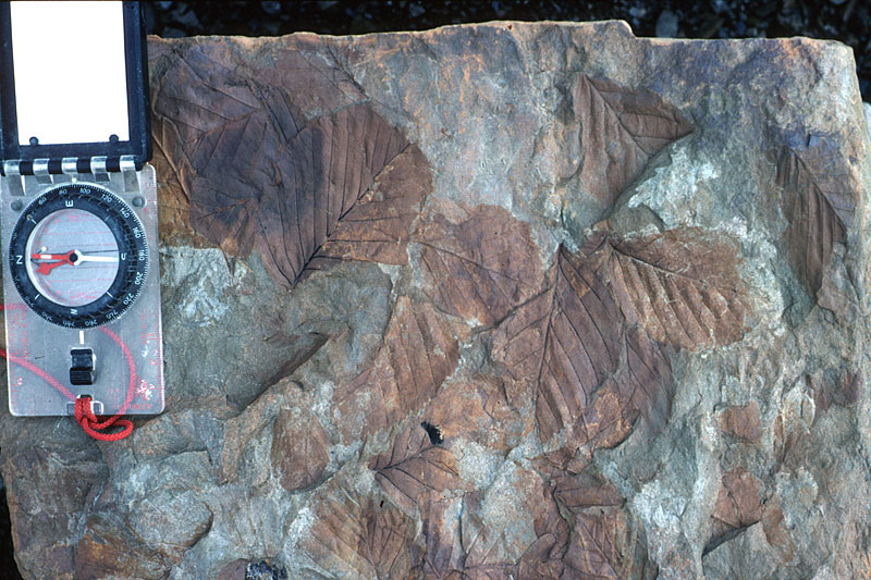 These fossil broad-leaved plant remains in sandstone indicate that Svalbard had a temperate climate around 50 million years ago. | 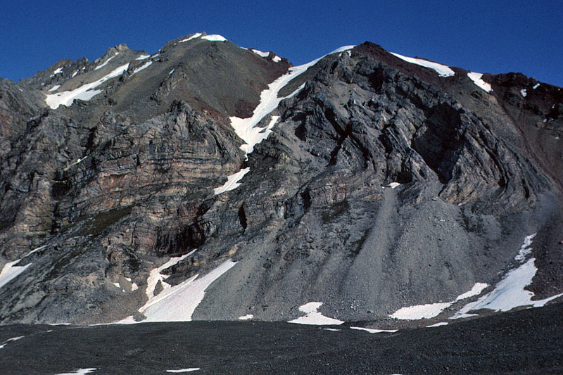 A localised phase of folding and faulting took place in West Spitsbergen in Palaeogene time (around 50-60 million years ago). Here is an overturned fold affecting Carboniferous rocks in the cliffs of Zeppelinfjellet. | 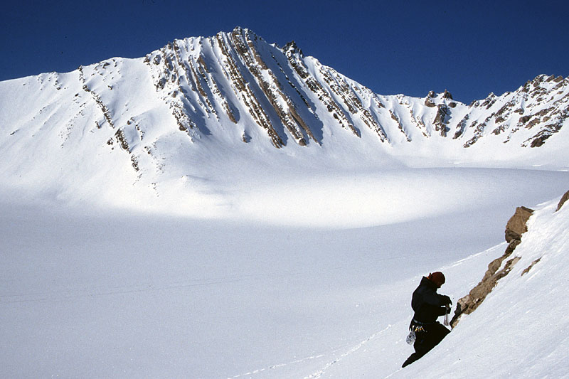 A geologist samples rocks adjacent to the snow-covered glacier Austre Brøggerbreen in West Spitsbergen. In the background, the v-shaped notch depicts a syncline in the Carboniferous bedrock. |
| Photos: Michael Hambrey |