Exploration and Environmental ImpactsThe Arctic is commonly perceived as one of the last wildernesses on Earth. While this is true for large tracts of land, human impact has been considerable. The indigenous population of Greenland and the Canadian Arctic, the Inuit, has occupied the region for several thousand years, and to this day have a deep appreciation of the land and sea from which they gain a living. People from the industrialised South have, in contrast, explored, experienced many disasters, waged wars, and exploited the region to an unsustainable degree. Nowadays, a more enlightened attitude prevails, and much of the region is protected, and increasingly serves as an educational base, in order that people can appreciate the vulnerability of the Arctic, now under pressure from global environmental change. |
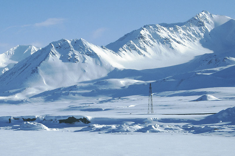 The mountains of Brøggerhalvøya form a backdrop for the airship mast at Ny-Ålesund, Spitsbergen, from whence Andrée, Nobile and Amundsen started their journeys to the North Pole in the early years of the 20th Century. | 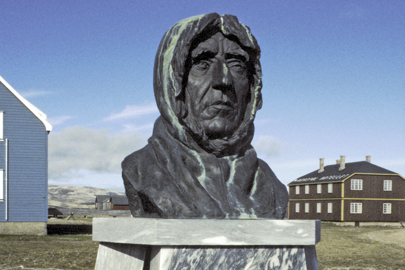 The severe features of Roald Amundsen are depicted in this bust of the famous Norwegian explorer, at Ny-Ålesund. | 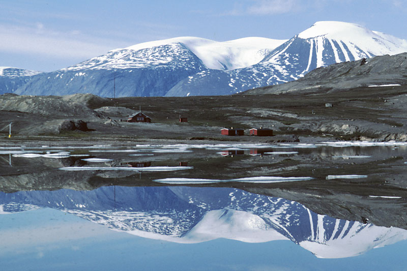 Danish geological expeditions, led by Lauge Koch, mapped large tracts of East and North Greenland in the 1950s. Their central base, named ‘Eagle’s Nest’, occupies an idyllic position on Ella Ø, a beautiful island in Kong Oscar Fjord. | 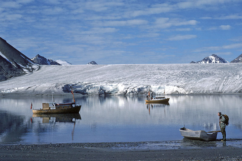 Small motor boats are useful for investigations along the indented coastline of Spitsbergen in summer. Motor vessels ‘Salterella’ and ‘Collenia’ (named after fossils), operated by the Cambridge Spitsbergen Expeditions through the 1970s and 1980s anchored in Bellsund. |
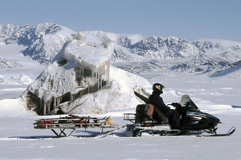 Skidoo transport in spring is fast and efficient, but extreme care is needed especially on sea ice, as depicted here around a debris-bearing iceberg in Kongsfjorden, northwestern Spitsbergen. | 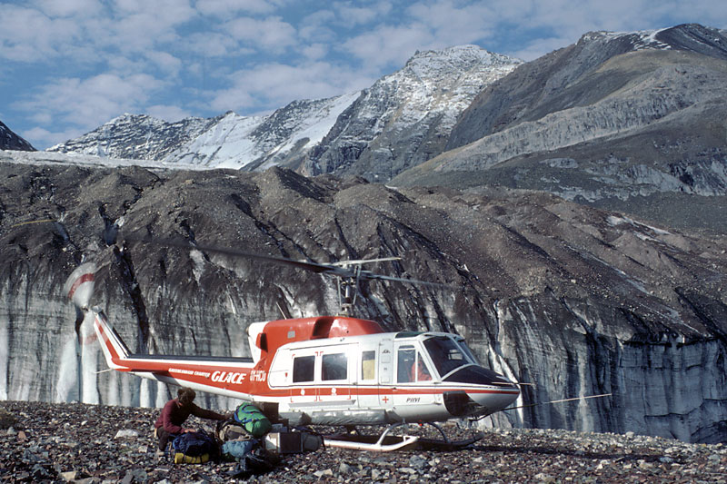 In good weather, helicopters are the most efficient means of transport to a field site. Here we see a Bell 212 helicopter off-loading a geological party near Sorteelv Gletscher in East Greenland. The geologist is lying on the equipment to prevent items blowing away under the draught from the rotor blades as the helicopter takes off. | 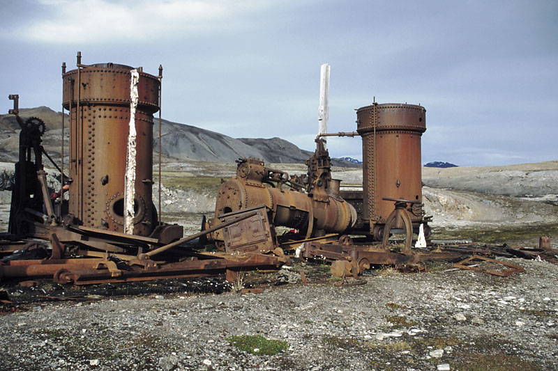 Remains of an ill-fated early 20th Century attempt at marble extraction by the Northern Exploration Company on Blomstrandøya, northwestern Spitsbergen. The settlement established was known as ‘London’, but was barely active for more than one season, as the marble disintegrated when the permafrost melted. | 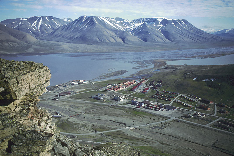 Longyearbyen, 'capital' of Svalbard. Most of the buildings have been built late in the 20th Century. Note how the flood plain in the foreground, of the river issuing from a small glacier at the head of the valley to the right, is kept clear of buildings. The small black 'crosses' apparently superimposed on the plain represent a flock of little auks. |
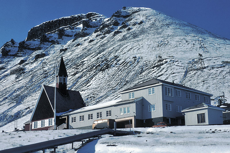 The Arctic is increasingly seen as a place where families live. In Svalbard, the community of Longyearbyen has been transformed from a mining settlement to a fully-integrated community over the past fifteen years or so. The church is one of the older community buildings, located near the cliffs which dominate the settlement. | 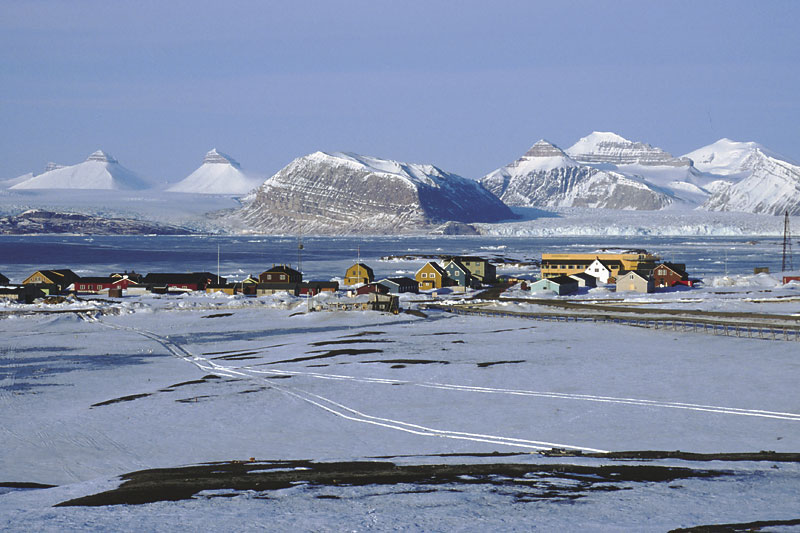 Ny-Ålesund is a former coal-mining village, but closed down following a major disaster in 1962. Recently, the settlement has found a new lease of life, with the establishment of scientific stations by several nations. Old buildings have been renovated, and new ones added. View across the fjord to the Tre Kroner, or Three Crowns, mountains. | 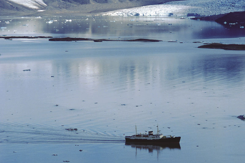 The historic Norwegian coastal steamer, ‘Nordstjernen’, plying the waters of Kongsfjorden in NW Spitsbergen, as seen from adjacent hills. | 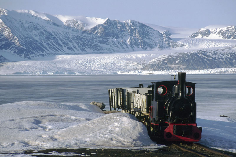 A cosmetically restored steam locomotive and coal wagons on a remnant of the world’s most northerly railway system, which once served the ill-fated coal mines at Ny-Ålesund, NW Spitsbergen. |
| Photos: Michael Hambrey |