ConwaybreenConwaybreen is named after the British explorer, Sir Martin Conway, who first mapped the glaciers in Kongsfjord (then Kings Bay) in the late 19th Century. Conwaybreen is a mostly self-contained valley glacier, although partly fed by the highland icefield of Holtedahlfonna to the west. It flows south for approximately 10 km, before turning sharply west to enter the sea on the north side of Kongsfjorden. The glacier was recently co-joined with the northern arm of Kongsbreen until at least 1990, but the termini of both these glaciers have receded rapidly since then (photos July 2009). |
 Wide-angle view of Conwaybreen (left) and Kongsbreen’s north arm from the Neoglacial moraine of the latter glacier (MH). |  Calving terminus of Conwaybreen from the northern tip of Ossian Sarsfjellet; Baronbreen and Conwaytoppen (1194 m) in the background (MH). |  Wide-angle view of Conwaybreen (left) and Kongsbreen’s north arm (right), seen from the ice-strewn beach near the true right margin of the former glacier (JA). |  Telephoto shot of the terminus of Conwaybreen from the northern end of Ossian Sarsfjellet (MH). |
 Supraglacial melt-stream on the surface of lower Conwaybreen, northern margin. Note the heavy load of suspended sediment, derived from reworking of adjacent morainic debris (MH). |  Cliff of stagnant ice at Conwaybreen’s northern margin, illustrating the soft basal till beneath and fractures (interpreted as thrusts) propagating to the ice surface (MH). |  Thrusts of varying angle, propagating from the bed of Conwaybreen, carrying poorly sorted sediment to the surface. Context of these features can be seen in previous photo (MH). |  The same debris layer as in the previous picture exposed on the glacier surface. Many metres of ablation of the debris-bearing ice are needed to produce a prominent ridge such as this (MH). |
 A dirt cone and scattering of large boulders on the surface of Conwaybreen’s northern margin, with Brřggerhalvřya in the background (MH). |  Northern margin of Conwaybeen with a thrust seen end-on. The northern arm of Kongsbreen is in the background Conwaybreen (MH). |  The basal debris layer of Conwaybreen at the cliffs of the northern margin. Trekking pole for scale (MH). |  NW of the terminus of Conwaybreen is Feiringbreen, a small valley glacier with medial moraines and exceptionally large supraglacial boulders (MH). |
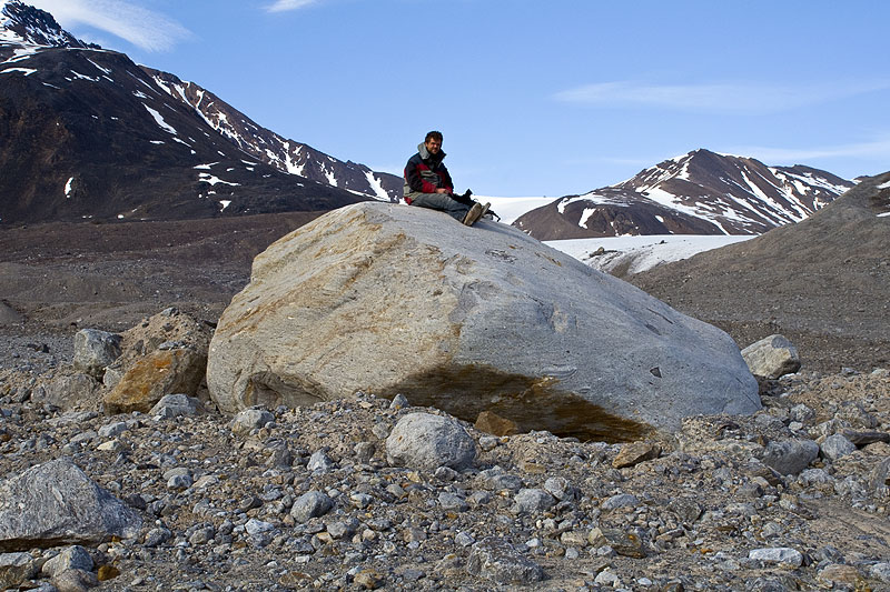
 A large subglacially transported, lodged and smoothed erratic of gneiss, close to the terminus of Conwaybreen (MH). |  Conwaybreen has a narrow zone of well developed fluted moraine, including this one in the foreground which extends down-flow of a large bouder embedded in basal till (MH). |  View along the axis of the Conwaybreen flutes, looking upglacier (MH). |  A scattering of erratics occurs along the shoreline near Conwaybreen. These have been washed out of the basal till by wave action (MH). |
 A narrow strip of land between the sea and the cliff of the stagnating part of Conwaybreen reveals a layer of soft wet till, deposited from the base of the glacier (JA). |  At its SE margin, Conwaybreen spills over a bedrock riegel of Proterozoic marble, which reveals a well-developed striated surface (JA). |  A telephoto shot of the contact between marble bedrock and the glacier, illustrating the thin basal debris layer and a sediment-rich waterfall (JA). |  An exceptionally deep blue iceberg, standing about 3 m above water level, with Conwaybreen in the background (JA). |
 The sandy shoreline near the northern margin of Conwaybreen with stranded bergy bits (small icebergs) at low tide. Conwaybreen (left) and Kongsbreen’s north arm (right) are in the background (MH). |  Cluster of bergy bits on a gravel shore near Conwaybreen with Kongsbreen\'s north arm (right) in the background (MH). |  Close-up view of decaying bergy bits on the Conwaybreen shoreline (MH). |  Small rivulets of glacial meltwater running over coastal sand and drying up (JA). |
|