Glacier recession in the Swiss AlpsSummary of repeat photos from glaciers in the Swiss Alps. Many more photos can be found on pages dedicated to each of these glaciers. |
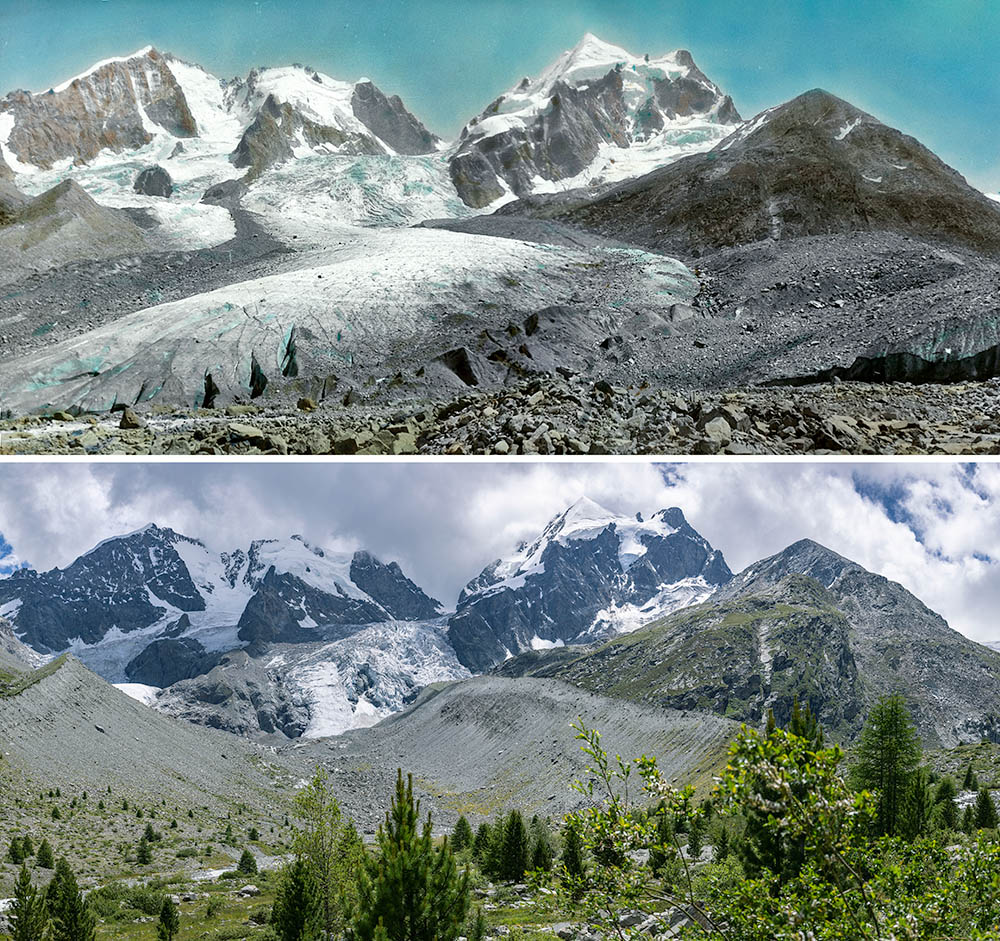 Vadret da Tschierva 1945 and 2023. In the older photo, the debris-covered end of the tongue of Vadret da Roseg can be seen on the right, which then abutted laterally against the tongue of Vadret da Tschierva (Photo 1945: ETH-Bibliothek Zürich, Bildarchiv, Fotograf: Leo Wehrli, Dia_247-14488 and 14489, CC BY-SA 4.0, photo 2023: J. Alean). | 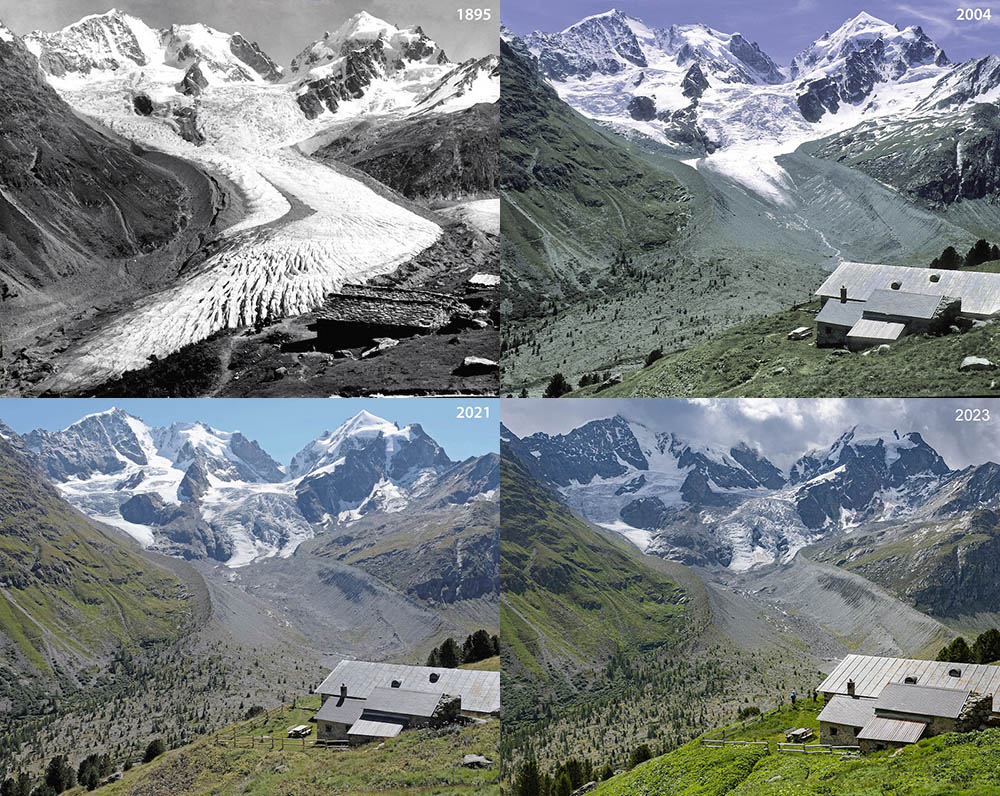 Vadret da Tschierva from Alp Ota approximately in 1895 (Swiss Alpine Museum; date reconstructed based on glacier level, note far right the terminus of Vadret da Roseg), 2004 (photo Alean), 2021 (photo Melaine le Roy)and 2023 (photo Alean). | 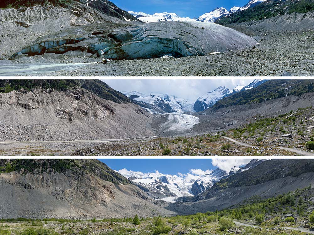 Vadret da Morteratsch in 1985, 2006 and 2021. In 1985, the tongue is bulging, but subsequently it is becoming flatter during recession. In the glacier forefield, first willow species are growing, later larches and finally the first pines (pinus silvestris, photos Alean). | 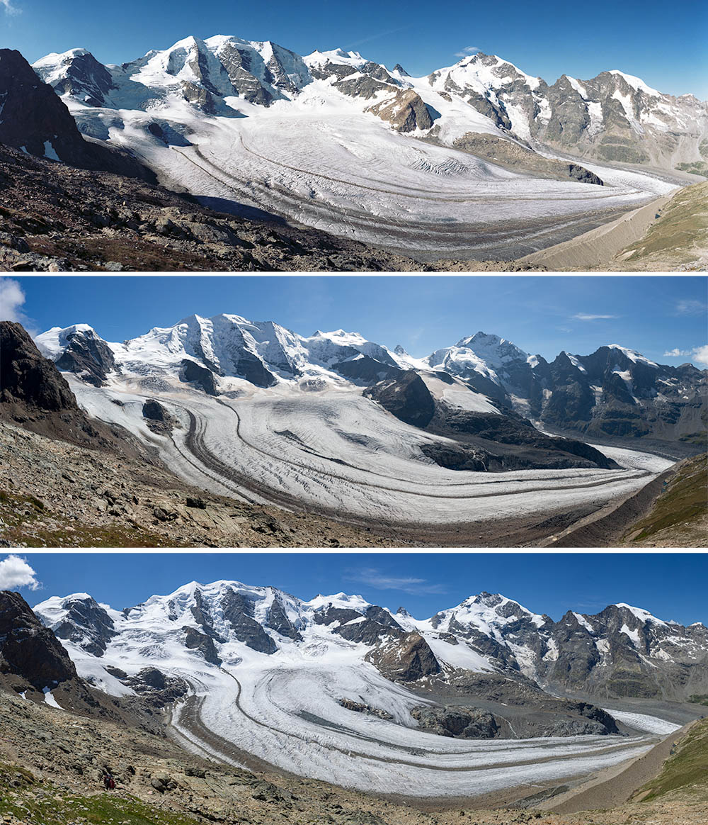 Panoramic views of Vadret Pers from Diavolezza in 1996, 2015 and 2023. Recession is particularly evident by the emergence of large rock outcrops in the middle right and far left. The medial moraines become more pronounced, and from 2015 to 2023 larger debris-covered areas have migrated downglacier. On the far right, Vadret da Morteratsch can be seen to be thinning (photo Alean). |
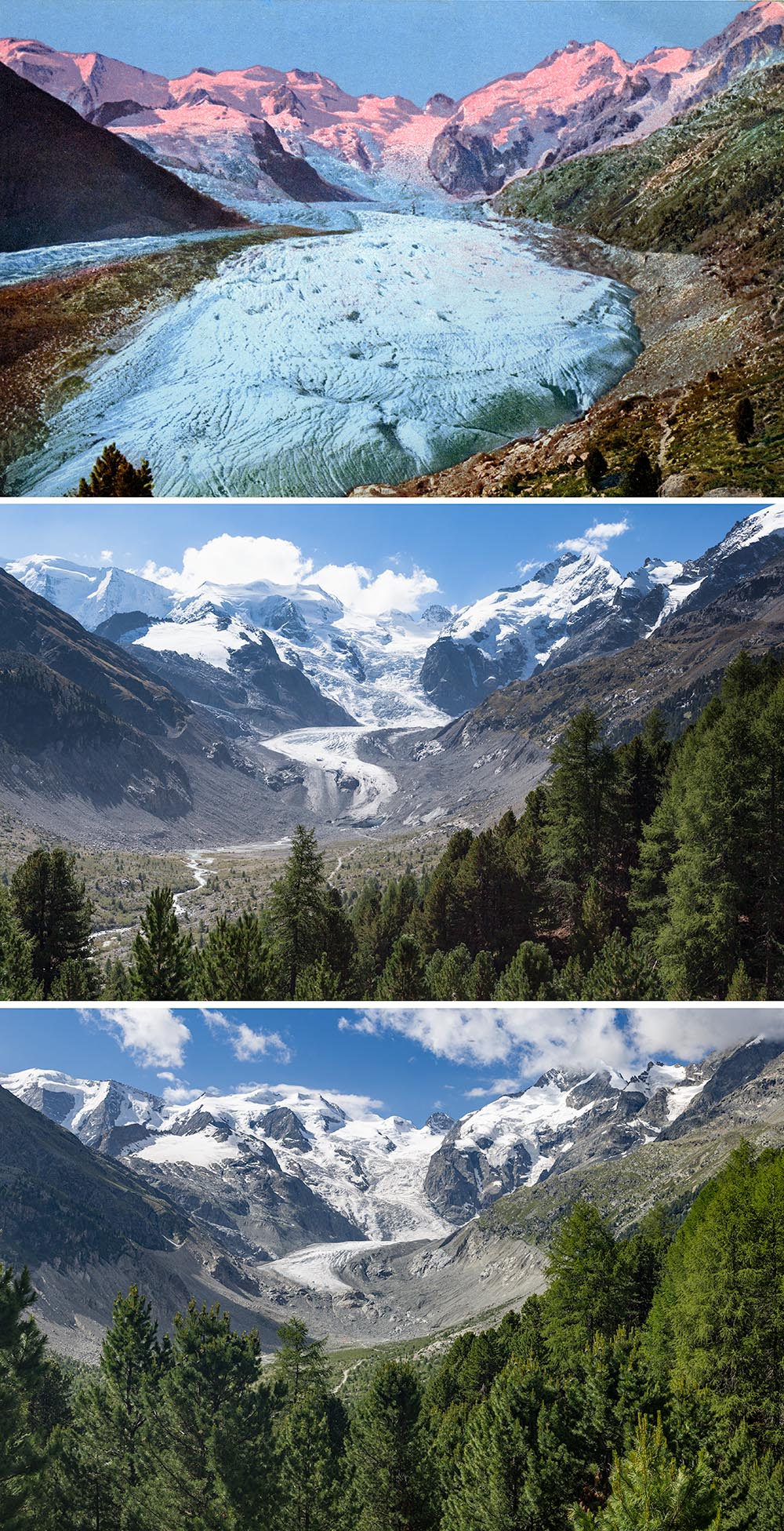 Vadret da Morteratsch from Chünetta around 1900, 2012 and 2023. The cumulative length change from 1900 to 2023 is nearly 2700 metres. Continued growth of the larch-pine-forest will eventually hide the remnant glacier tongue from this location, which is just above the moraine from the Little Ice Age (photo 1900: postcard, 2012 and 2023: Alean). | 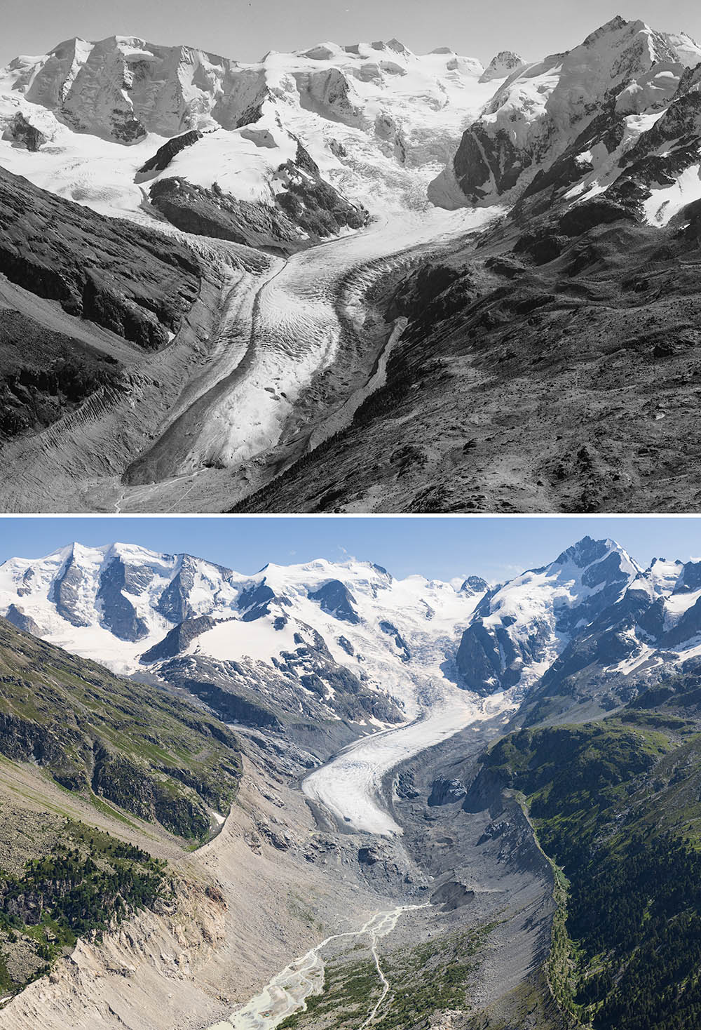 Aerial photos of Vadret da Morteratsch from similar positions in 1969 and 2021. In the older image, Vadret Pers flows from the left (true right) into Vadret da Morteratsch and forms a medial moraine with it. Since about 2015, the two glacier tongues are separated (image 1969: ETH-Bibliothek ZH, Bildarchiv, Comet Photo AG (Zurich), Com_F69-16375, CC BY-SA 4.0, image 2021: Alean). | 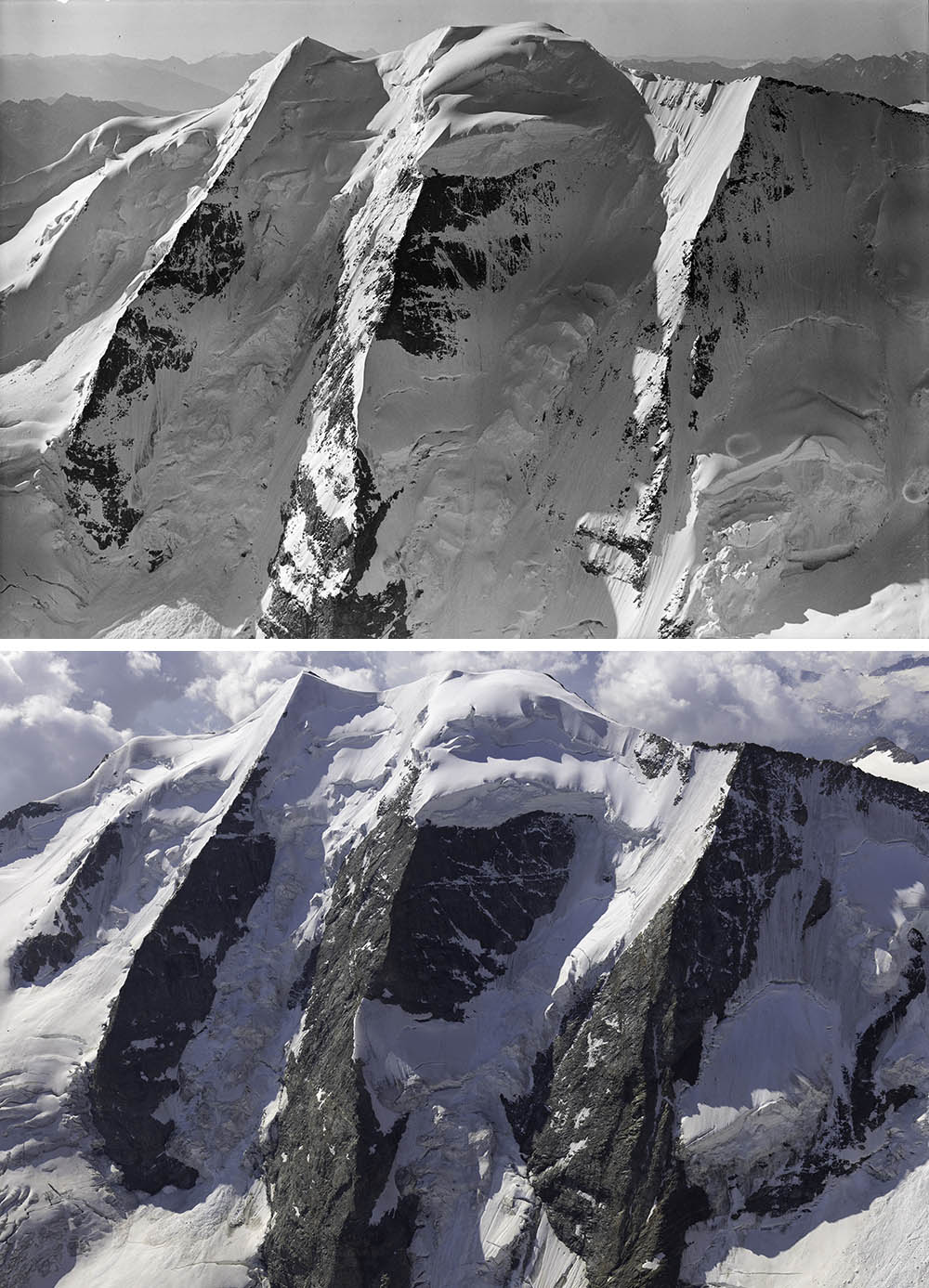 Aerial photos of Piz Palü (3899m) from similar positions in 1934 and 2021. Glacier recession is somewhat less on the high, north-facing flank of Piz Palü than at lower elevations. However, snowcover on the rock outcrops is considerably reduced (1934: ETH-Bibliothek ZH, Bildarchiv/Stiftung Luftbild Schweiz, Mittelholzer, LBS_MH01-007844, PD, 2021: Alean). | 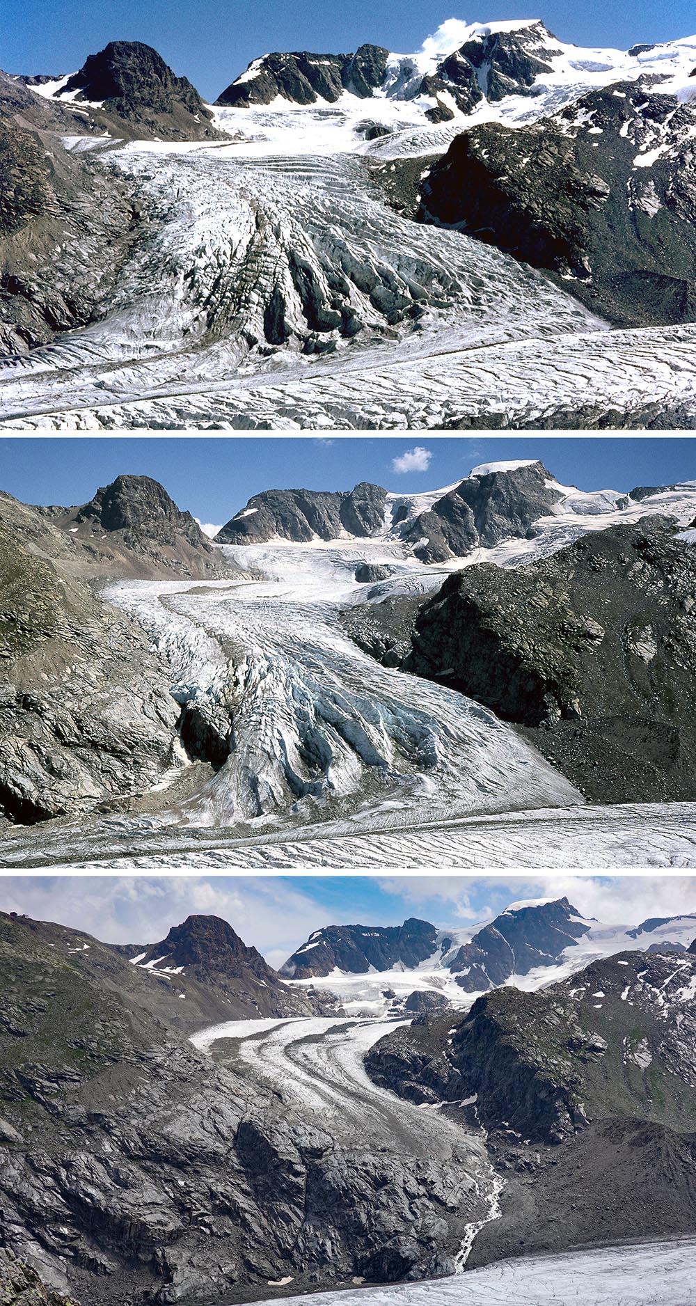 Vadret Pers from the Boval Hut in 1973, 2003 and 2021 with Piz Trovat (top left) and Piz Cambrenas (top right) in the background. Since about 2015, the connection to Vadret da Morteratsch has been severed (photos 1973 and 2003 J. Wolff, 2021 A. Jung-Hüttl). |
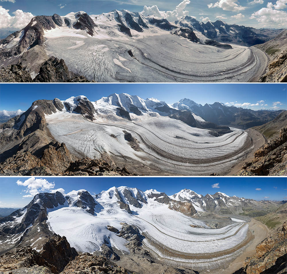 Panoramic photos of Vadret Pers from Piz Trovat (3146m, photo location about 70m SSE of the summit) from 1998, 2005 and 2023. Although the photo from 2023 was taken quite early in the season, the ongoing glacier recession is clearly visible. The rock outcrop in the centre of the image has become much larger, the medial moraines wider and the glacier much thinner, especially on the right (photos Alean). | 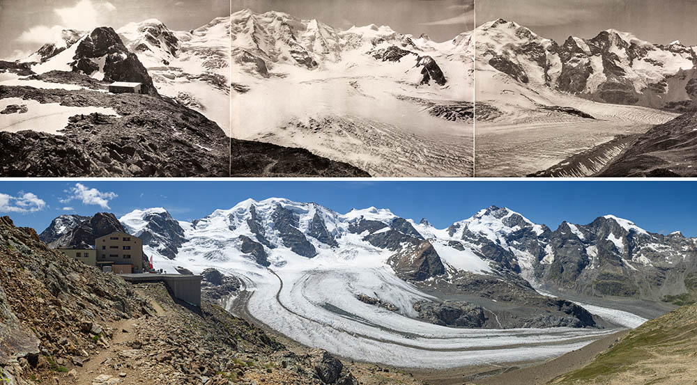 Panoramic views of Vadret Pers from Diavolezza circa 1895 and 2023. The old photo location could not be reached precisely because it is now occupied by a building. In 1895 there were hardly any medial moraines on Vadret Pers because most of of this part of the glacier was within the accumulation area. Isla Persa is only a tiny rock outcrop between Vadret Pers and Vadret da Morteratsch (Photo 1895: ETH-Bibliothek Zurich, Bildarchiv, photographer unknown, Ans_06493-1-3, PD; 2023: Alean). | 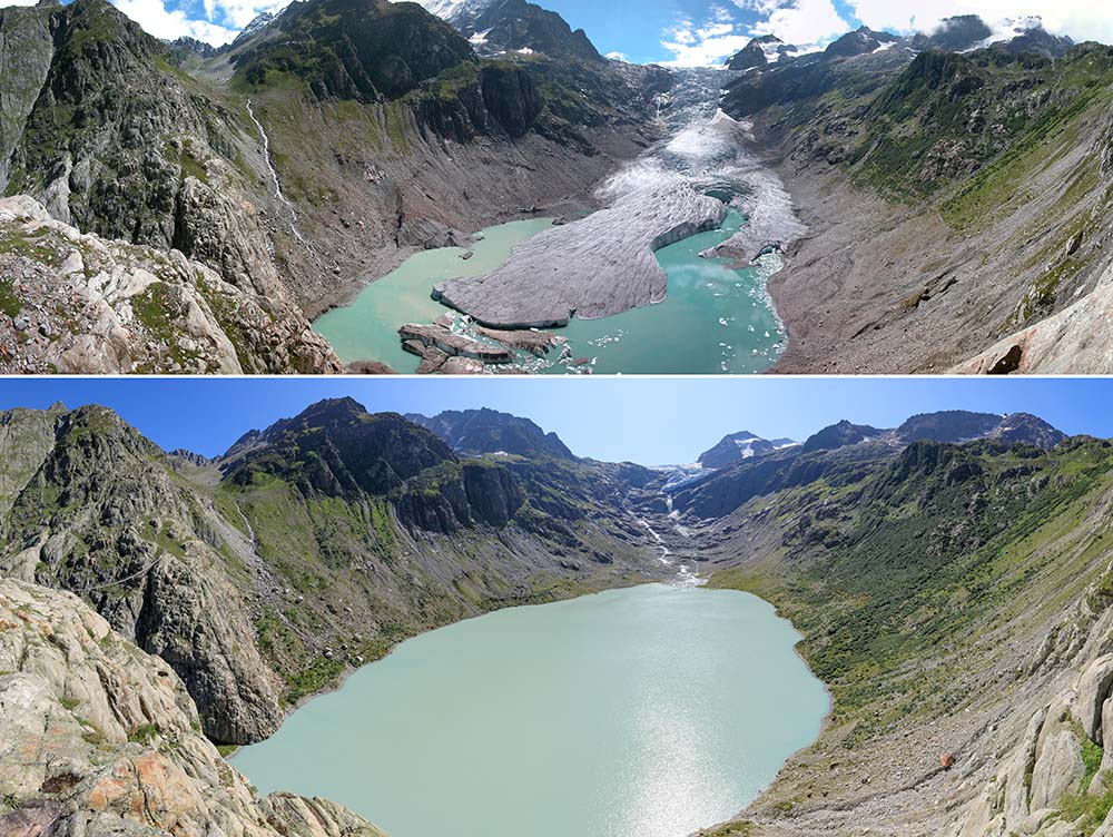 Panoramic view of Triftgletscher (Gadmen, BE) 2002 and 2019. Due to the recession of the glacier tongue, a large rock basin with a proglacial lake has formed (photos Alean). | 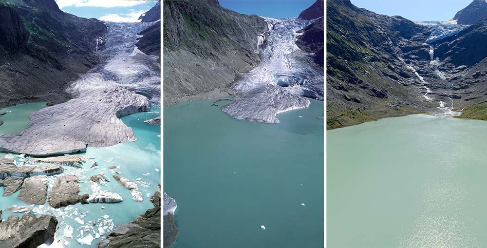 Triftgletscher (Gadmen, BE) in 2002, 2003, 2007 and 2019 (photos Alean). |
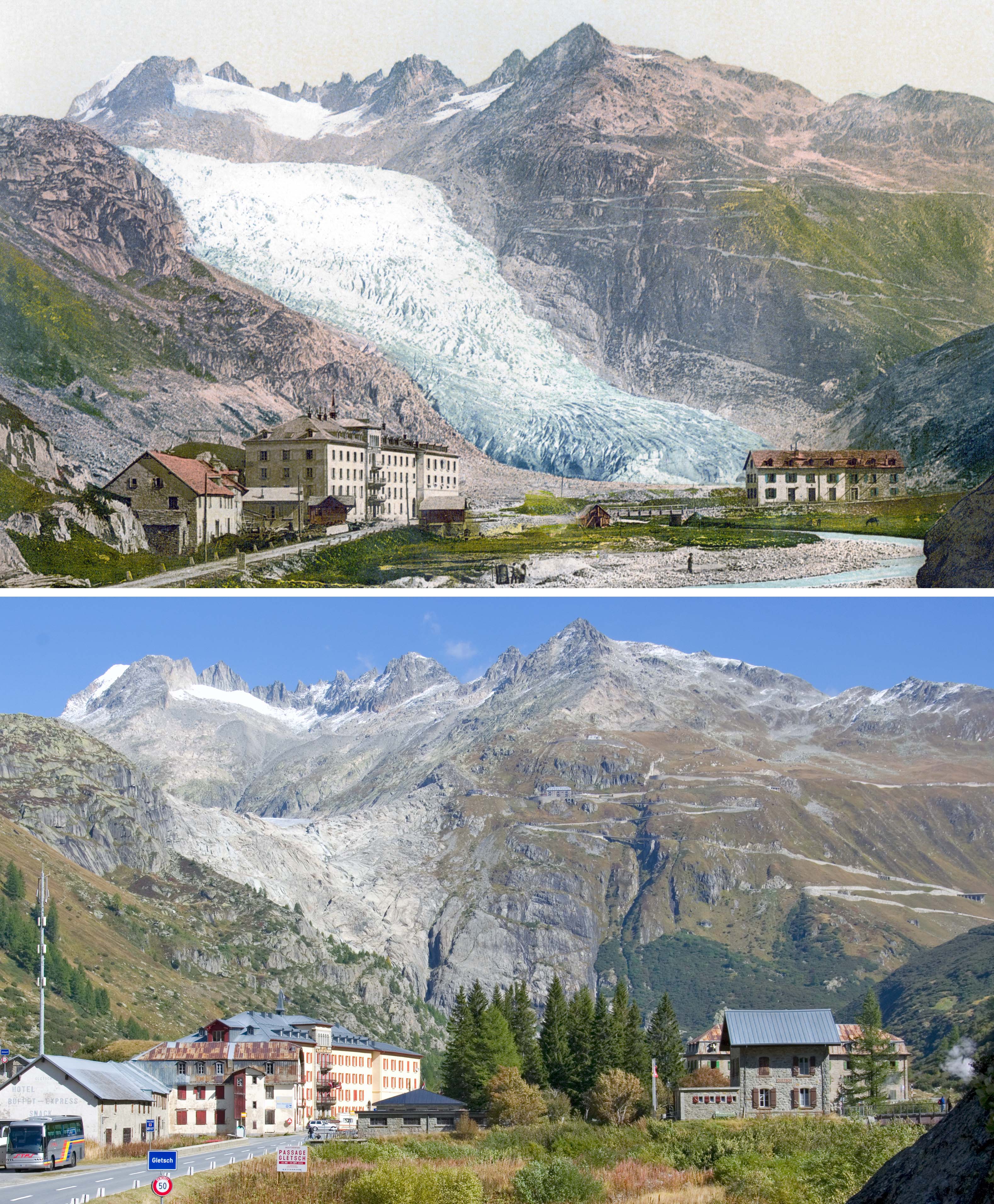 Recession of the tongue of the Rhonegletscher: The glacier terminus, which had reached the valley floor behind the village of Gletsch in 1900, receded so much receded so much that by 2008 hardly any ice was visible from this location (1900: hand-coloured postcard, 2008 photo: Alean. | 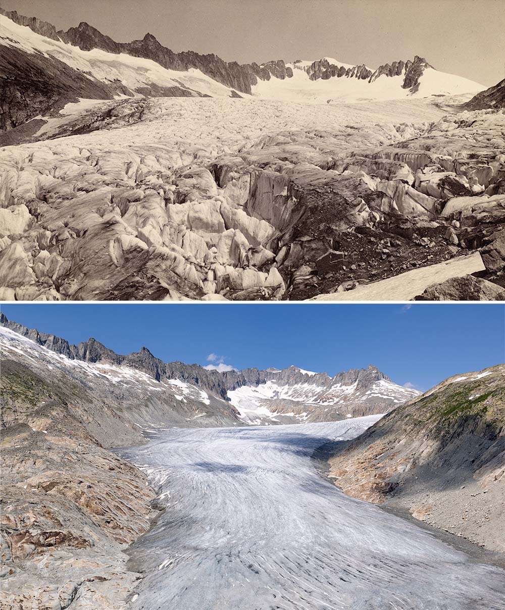 Lower part of Rhonegletscher, looking upglacier about 1880 and 2023. In the older picture, the glacier surface is still close to its maximum from the Little Ice Age (ETH-Bibliothek Zurich, Bildarchiv, photographer: Charnaux, Frères, Hs_1458-GK-B001-1880-0001, PD; 2023: Alean). | 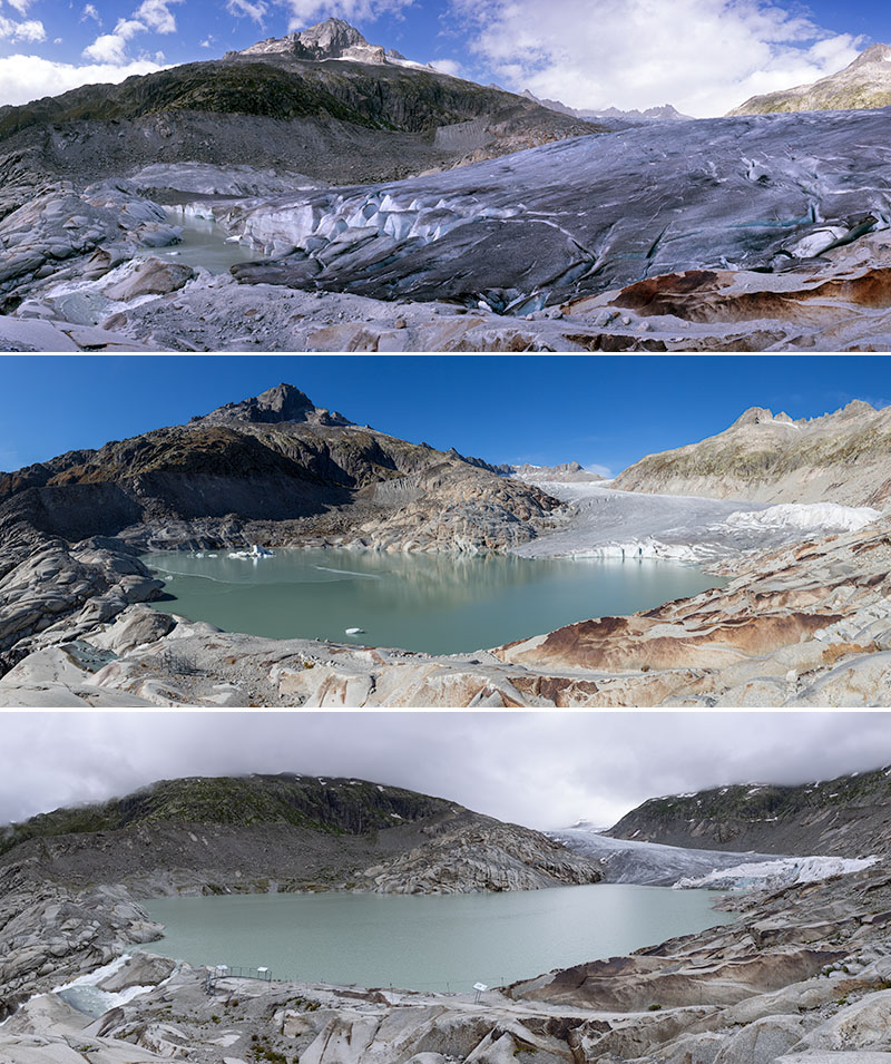 Formation and growth of the proglacial lake at Rhonegletscher in 2007, 2016 and 2021 (photos Alean). | 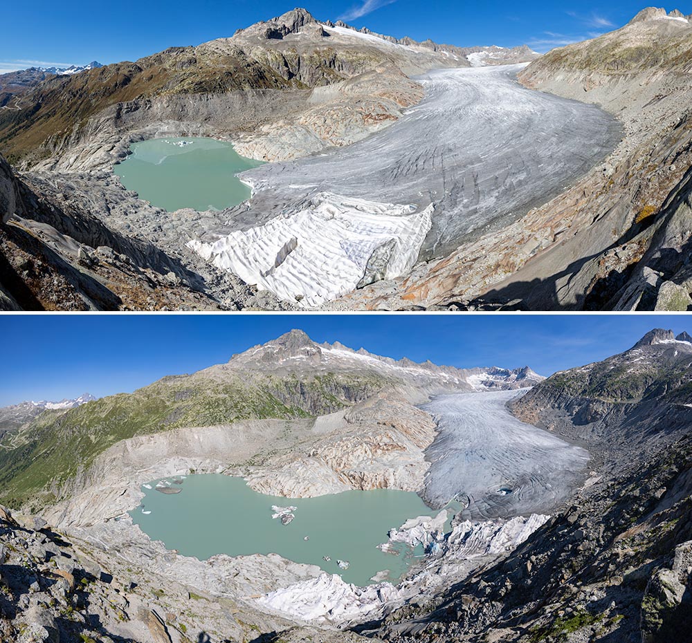 Panoramic view of the new proglacial at Rhonegletscher in 2016 and 2023. In the foreground is the protective cover to reduce ablation in the area of the artificial ice cave. For some years now, increasing amounts of the cover have ended up in the lake. Now, it is being removed again (photos Alean). |
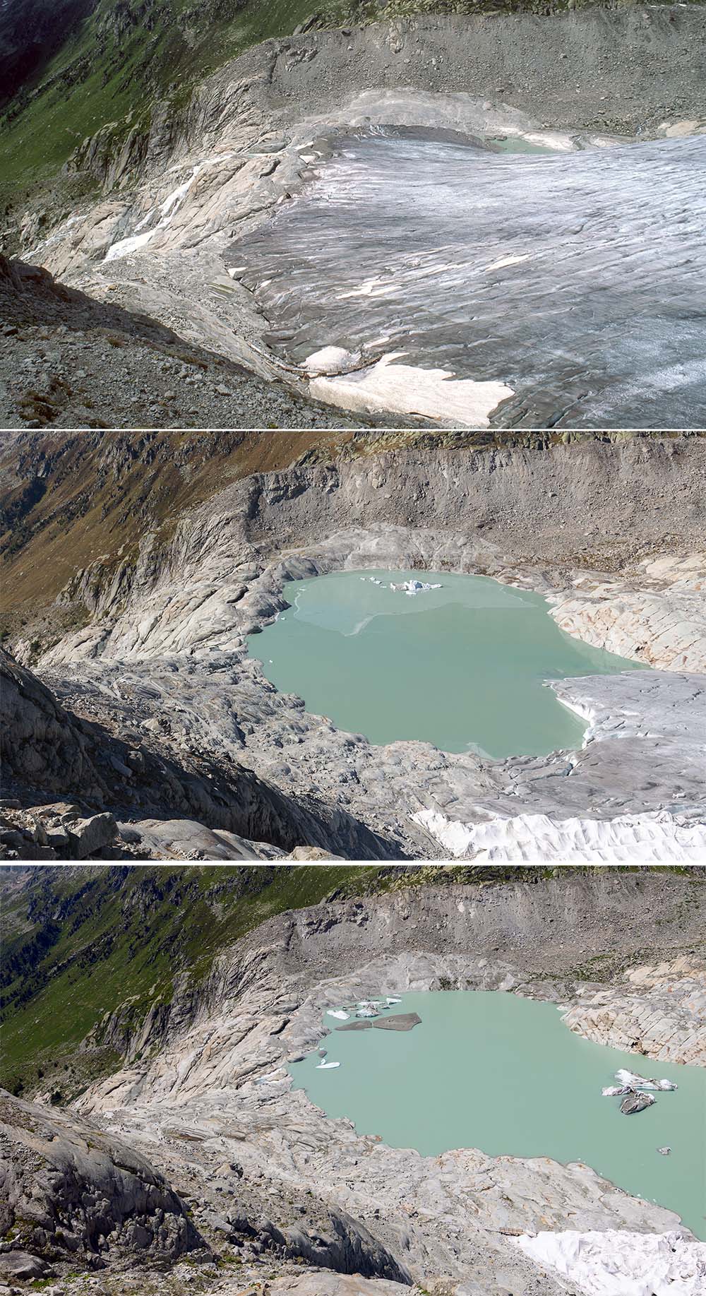 Formation and growth of the proglacial lake in front of the Rhonegletscher in 2007, 2016 and 2021 (photos Alean). | 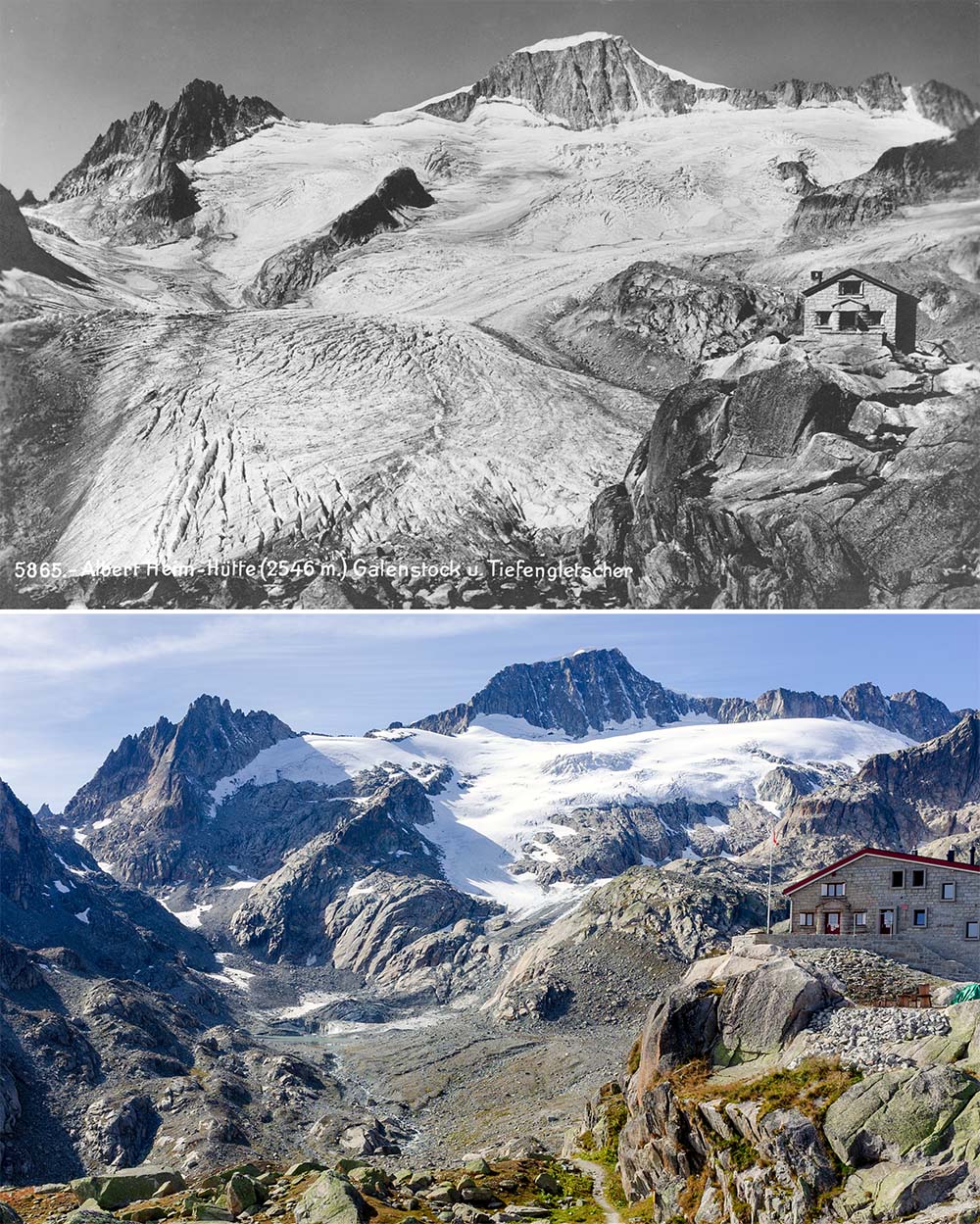 Tiefengletscher and Albert Heim Hut viewed from the same location on a rocky ridge about 150 metres east of the hut. The upper photo was taken some time after 1918 (when the hut was inaugurated), and the lower photo in 2021 after its extension. A new proglacial lake is just visible below left-centre in the new picture. (Old photo: author unknown, 2021: Alean). | 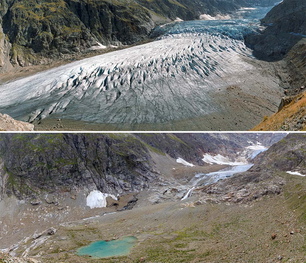 Recession of Steigletscher at Sustenpass from 1994 to 2019 (photos Alean). | 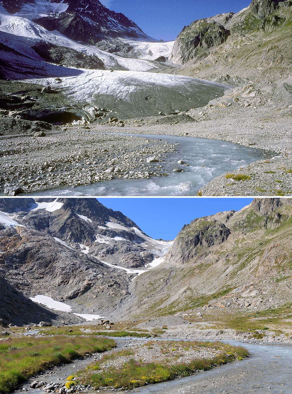 Recession of Steilimmigletscher, the eastern neighbour of Steigletscher, at Sustenpass from 1994 to 2019. Note spreading and growth of vegetation in the foreground (photos Alean). |
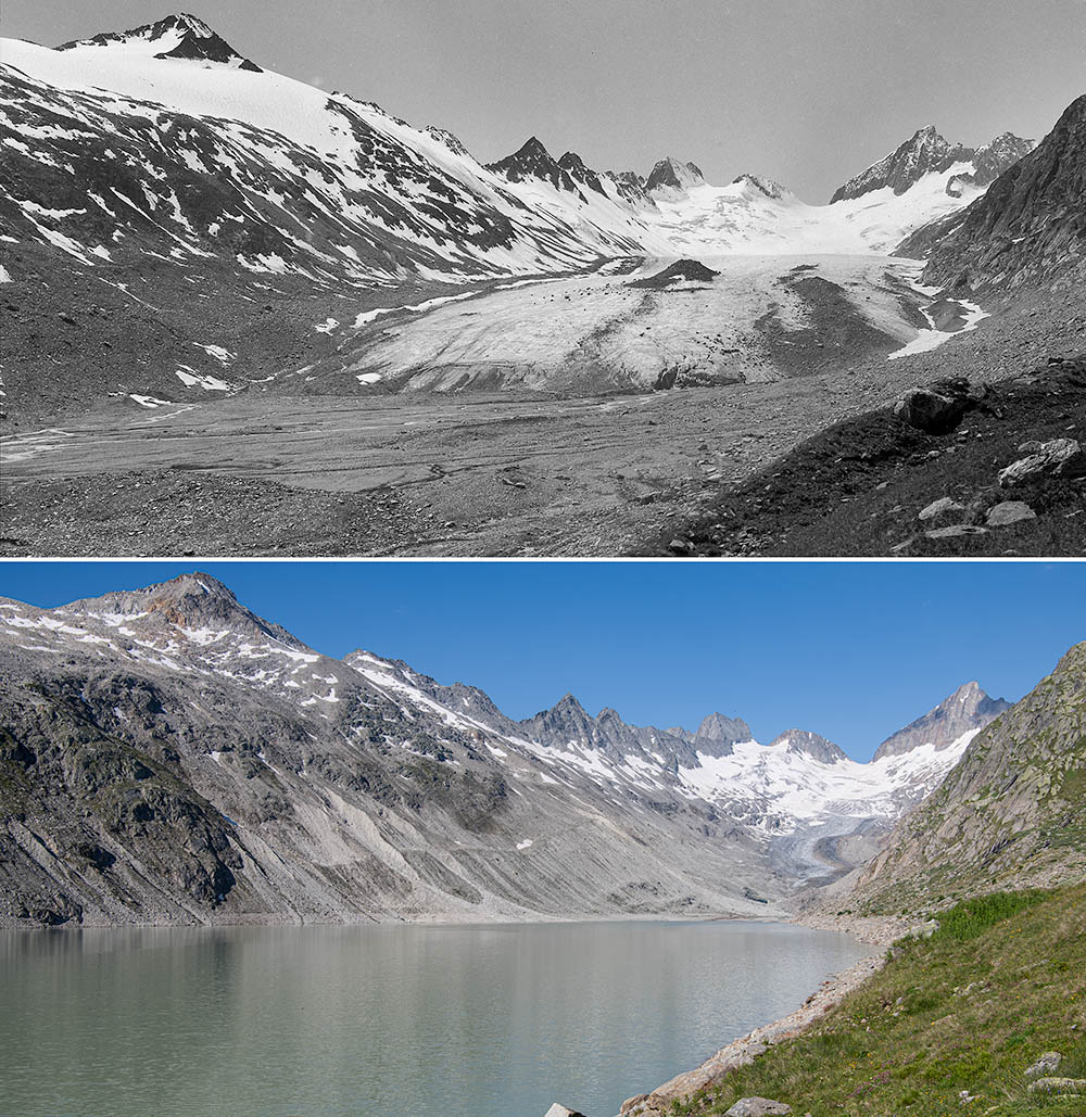 Oberaargletscher 1922 and 2023 with the small but well developped moraine from the Little Ice Age at bottom right. The old location could not be reached because it is now flooded by the lake (1922 image: ETH-Bibliothek Zurich, Bildarchiv, photographer: Paul-Louis Mercanton, Hs_1458-GK-B050-1922-0001-F, CC BY-SA 4.0; 2023: Alean). | 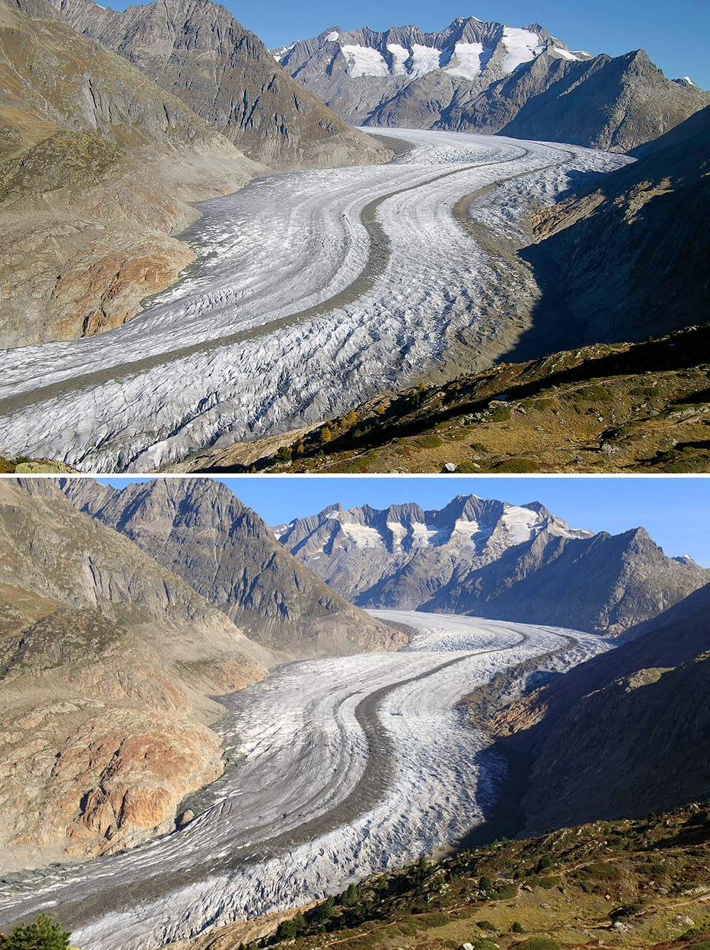 View over Grosser Aletschgletscher from Moosfluh in 2006 and 2019. During this 13 year interval, the glacier surface has lowered considerably. In addition, the small mountain glaciers on the south-western flank of the Grosses and Kleines Wannenhorn (top) have become much smaller (photos Alean). | 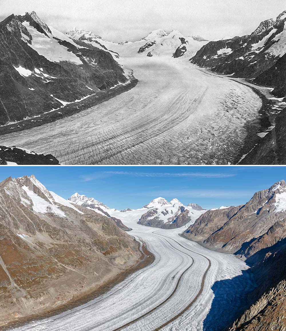 Grosser Aletschgletscher, looking towards Jungfrau and Mönch in 1880 (upper photo) and 2015 (lower). In the old photo, the glacier surface was close to its maximum level of the Little Ice Age (1880: ETH-Bibliothek Zurich, Bildarchiv, photographer: Francis Frith, Hs_1458-GK-B005-1880-0001, PD, 2015: Alean). | 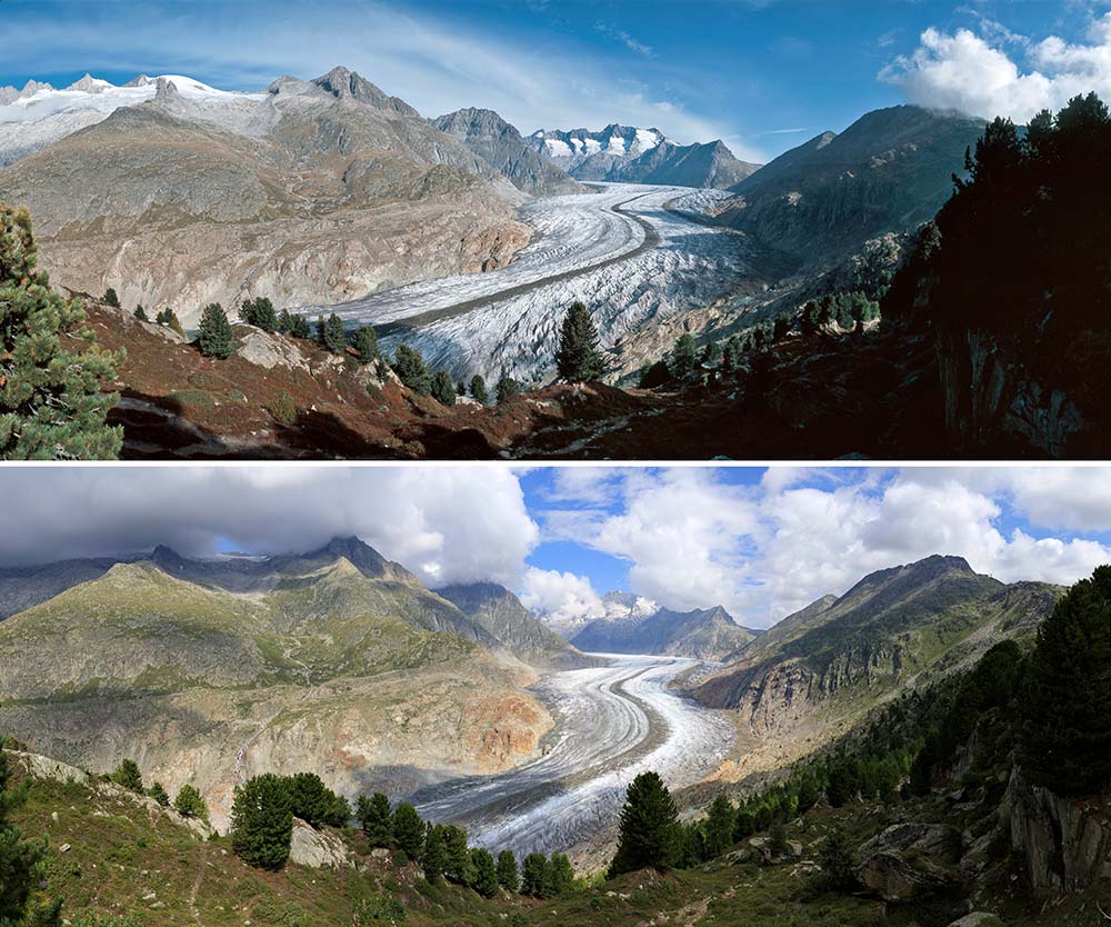 View from the Aletsch forest onto the tongue of Grosser Aletschgletscher in 2005 and 2019 (photos Alean). |
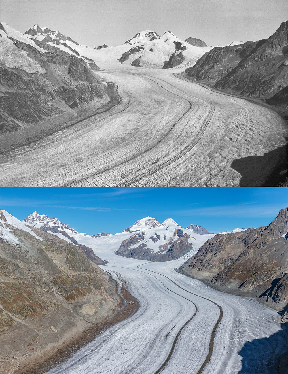 Grosser Aletschgletscher from Eggishorn 1921 and 2015. Note the reduction in elevation of the glacier surface over this period (1922: ETH-Bibliothek Zürich, Bildarchiv, Fotograf: Werner Lüdi, Dia_282-1603,CC BY-SA 4.0, 2015: Alean). | 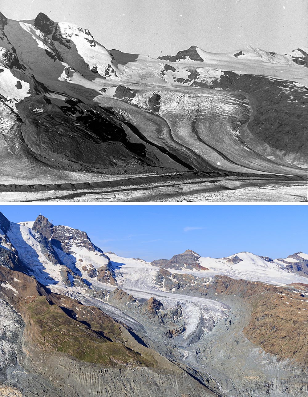 Unterer Theodulgletscher from Gornergrat 1941 and 2021, Kleines Matterhorn top left (1941: ETH-Bibliothek Zürich, Bildarchiv, Fotograf: Leo Wehrli, Dia_247-12952,CC BY-SA 4.0, 2021: Alean). | 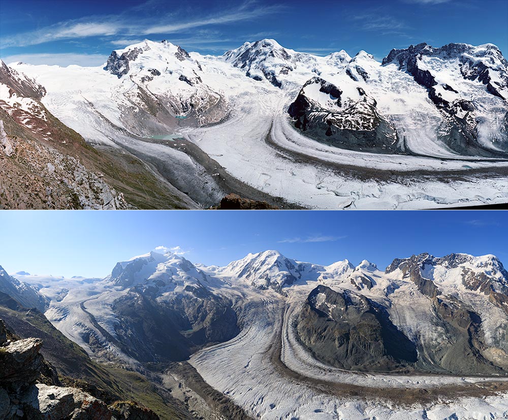 Panoramic views of Gornergletscher 2004 and 2018 from Gornergrat. The northern flow unit of Gornergletscher (between Stockhorn and Monte Rosa, far left), Schwärzegletscher (right) and Breithorngletscher (at the right edge of the photo) no longer reached the main part of the glacier in 2018. The surface has sunk so much that the ice-dammed Gornersee at the foot of Monte Rosa no longer forms (photos Alean). | 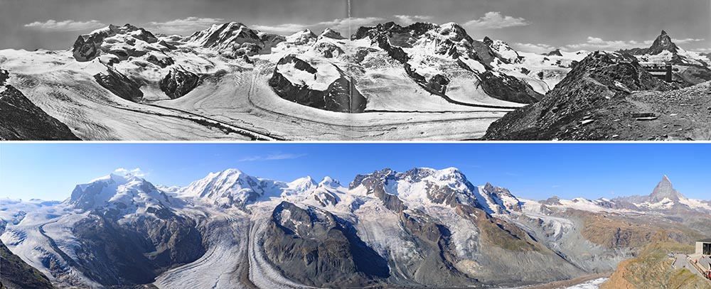 Panoramic views of Gornergletscher around 1900 and 2018 from Gornergrat. The ice surface has sunk so much that most of the glacier tongue lies below the lower edge of the picture. The small mountain glacier at Schwärze (left of centre) has almost completely disappeared (old panorama: ETH-Bibliothek Zürich, Bildarchiv, Fotograf: Unbekannt, Hs_1458-GK-B014-0000-0008, CC BY-SA 4.0, 2018: Alean). |
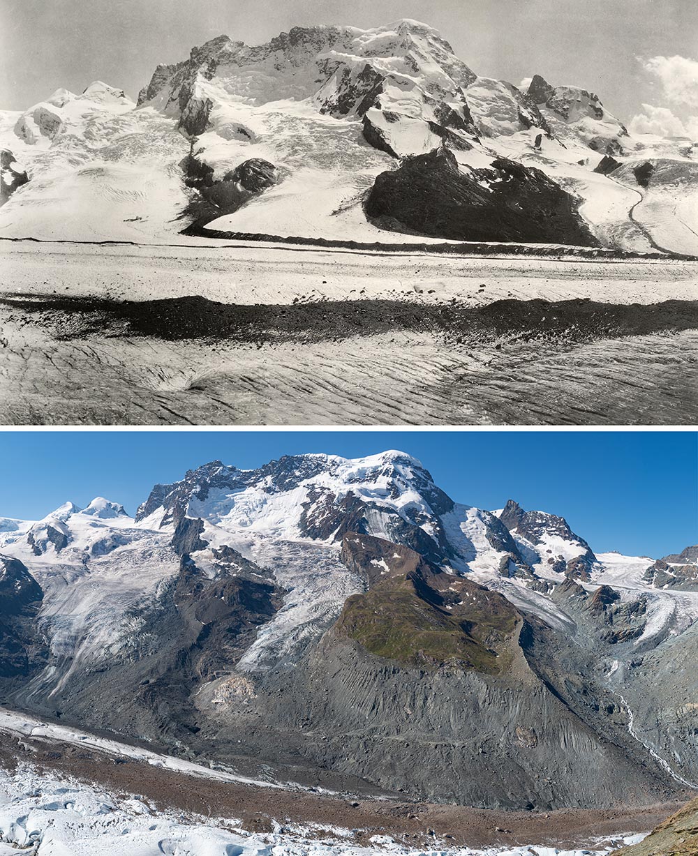 Panoramic views of Gornergletscher (bottom), Schwärzegletscher, Breithorngletscher, Triftjigletscher and Unterer Theodulgletscher (f.l.t.r.) around 1930-1940 and 2018 from a location south of Rotenboden. The surface of Gornergletscher is about 200 metres lower in the newer photo (older panorama renered from: ETH-Bibliothek Zürich, Bildarchiv, Fotograf: Chaix, Emile, Hs_1458-
GK-B014-1930-0024 bis 0026, CC BY-SA 4.0, 2018 panorama: Michael Hambrey). | | | |
|