2021 and 2023: aerial and repeat photos of Vadret da Tschierva |
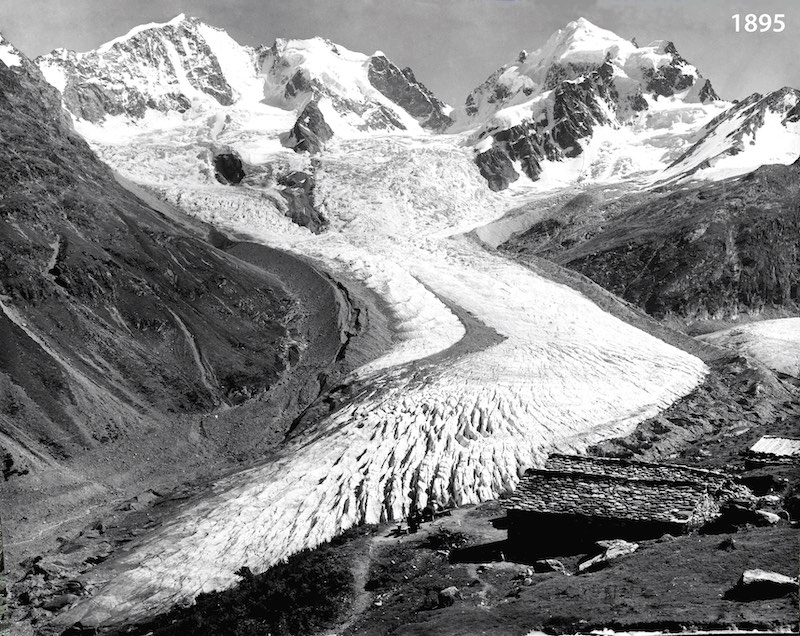 Repeat photo 1: Vadret da Tschierva as seen from Alp Ota in approximately 1895 (Schweizerisches Alpines Museum; date reconstructed from glacier extent). | 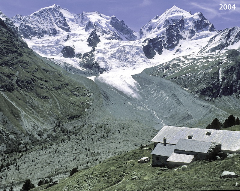 Repeat photo 2: Vadret da Tschierva as seen from Alp Ota in 2004; note massive recession of the glacier tongue (photo Jürg Alean). | 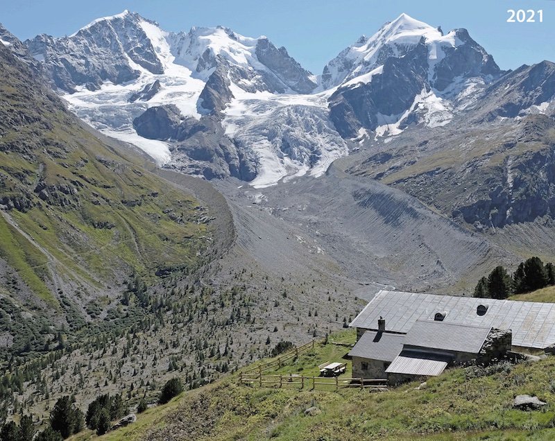 Repeat photo 3: Vadret da Tschierva as seen from Alp Ota in 2021; note continued glacier recession and growth of trees in glacier forefield and just beyond the huts (photo Melaine Le Roy). | 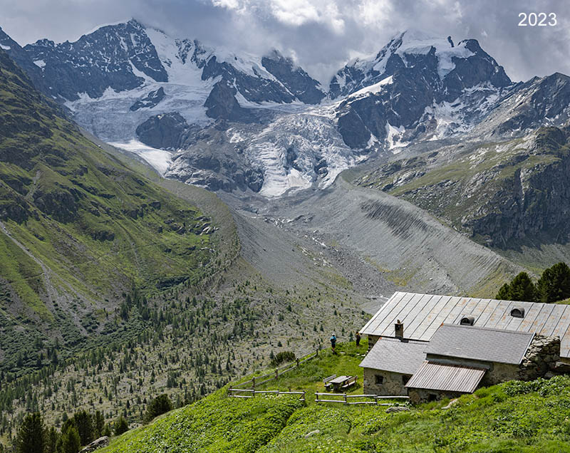 Repeat photo 4: Vadret da Tschierva as seen from Alp Ota in 2023; recession of the glacier tongue continues. In the icefall rock outcrops have enlarged (photo Jürg Alean). |
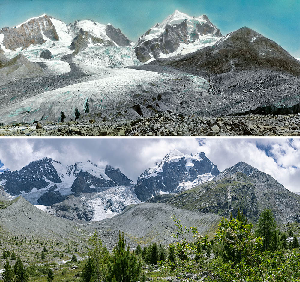 Repeat photo: Vadret da Tschierva from the path towards Lej da Vadret. In 1945 Vadret da Roseg is pushing agains the true left side of Vadret da Tschierva. By 2023 willows, larches and pines have colonized the glacier forefield (Photos 1945: ETH-Bibliothek Zürich, Bildarchiv / Fotograf: Wehrli, Leo / Dia_247-14488 and Dia_247-14489/ CC BY-SA 4.0, 2023: J. Alean). | 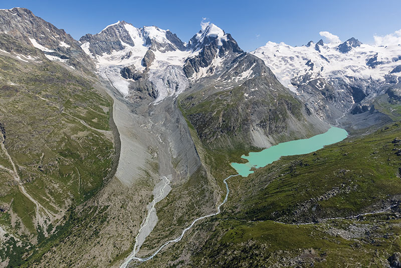 Vadret da Tschierva, Lej da Vadret, Vadret da la Sella and Vadret da Roseg (aerial photo July 23rd, 2021, Jürg Alean). | 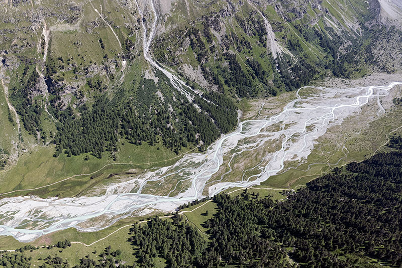 Impressive system of braided meltwater streams below the proglacial area of Vadret da Tschierva (aerial photo July 23rd, 2021, Jürg Alean). | 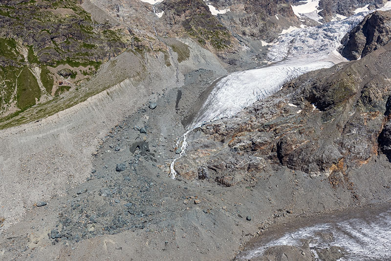 A large landslide occurred in 1988 on the northern tributary to Vadret da Tschierva. Most of it has now been deposited beyond the present snout of the glacier. The landslide can be recognized by the dark, greenish tint of the debris (diorite rock with little weathering; aerial photo July 23rd, 2021, Jürg Alean). |
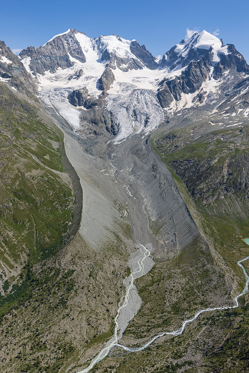 Vadret da Tschierva and its proglacial area with Piz Bernina (left), Piz Scerscen (middle) and Piz Roseg (right) in the background (aerial photo July 23rd, 2021, Jürg Alean). | 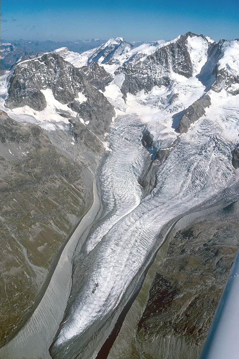 Vadret da Tschierva in 1985. Note convex shape of the glacier snout during a period of temporary advance. Vadret da Tschierva advanced 228 meters between 1963 and 1987, but subsequently receded 1147 meters between 1987 and 2020 (aerial photo Jürg Alean). | 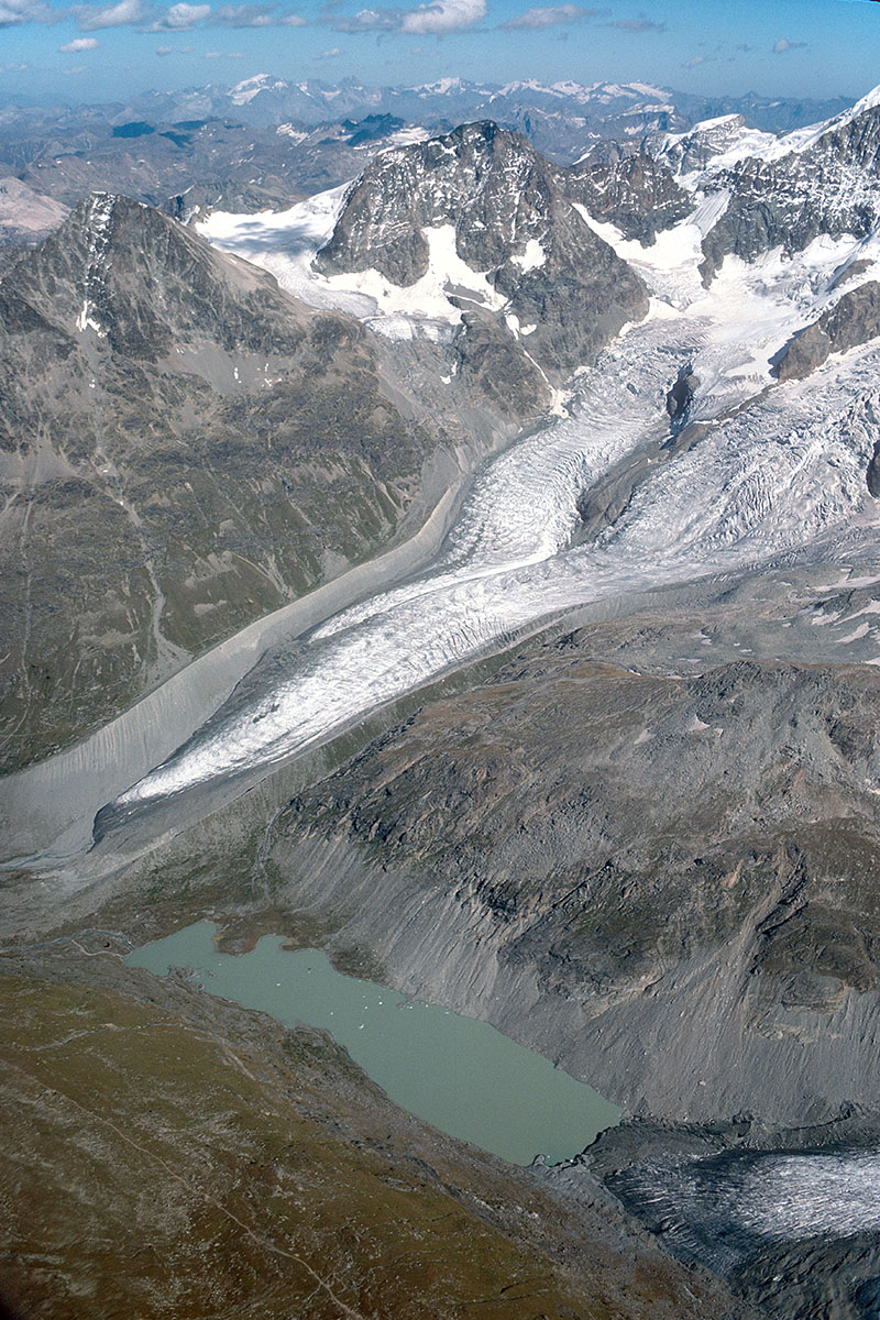 Vadret da Tschierva, Lej da Vadret and tongue of Vadret da Roseg (lower right) in 1985. Since then Vadret da Roseg has receded considerably and no longer reaches the proglacial lake Ley da Roseg (aerial photo Jürg Alean). | 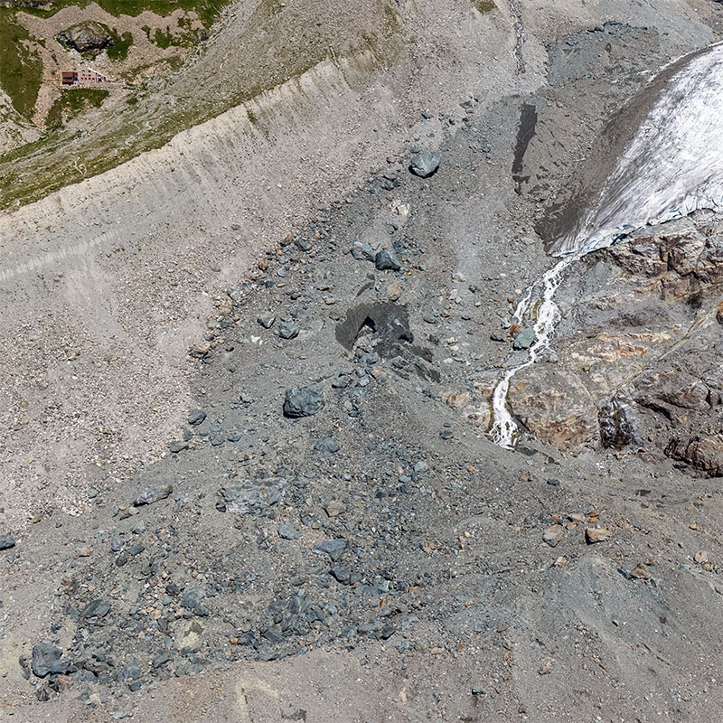 Landslide deposit from 1988, close-up. A dark patch and tunnel entrance indicates the presence of dead ice, which remains protected from ablation beneath the thick debris cover (aerial photo July 23rd, 2021, Jürg Alean). |
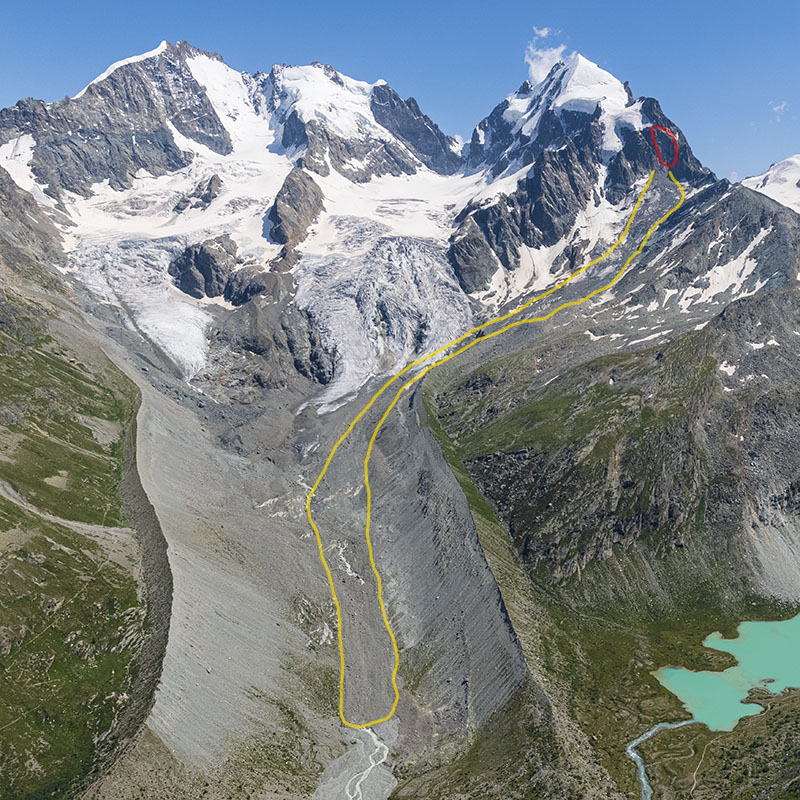 In late January 2021 85,000 to 90,000 m3 of rock became from Piz Roseg at an altitude of approximately 3350 m.a.s.l. (red). The landslide deposit extends beyond the glacier tongue and is partly covering the meltwater stream from the glacier (yellow; aerial photo July 23rd, 2021, Jürg Alean). | 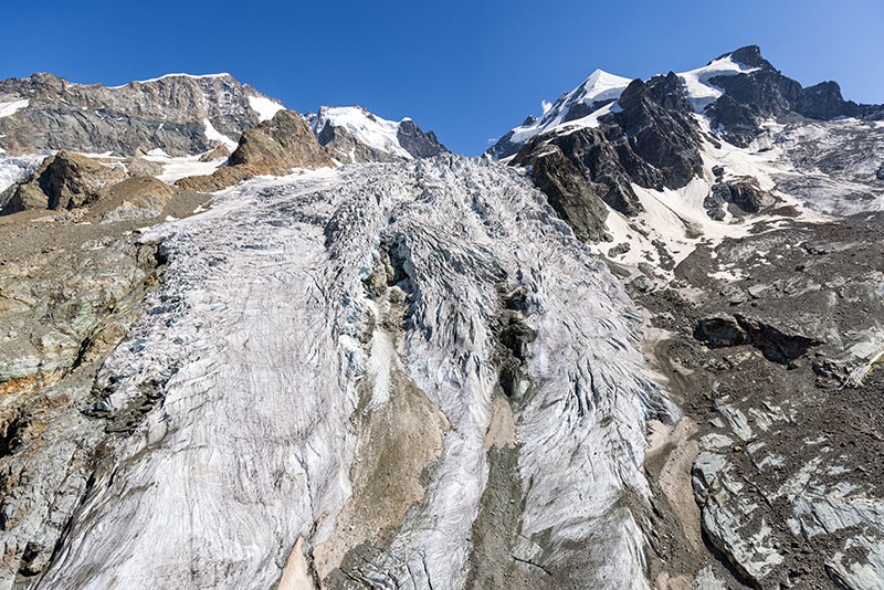 Lower part of the landslide of Vadret da Tschierva, Piz Bernina top left, Piz Roseg top right. Debris from the rockfall from Piz Roseg in late January 2021 can be seen on the right (aerial photo July 23rd, 2021, Jürg Alean). | 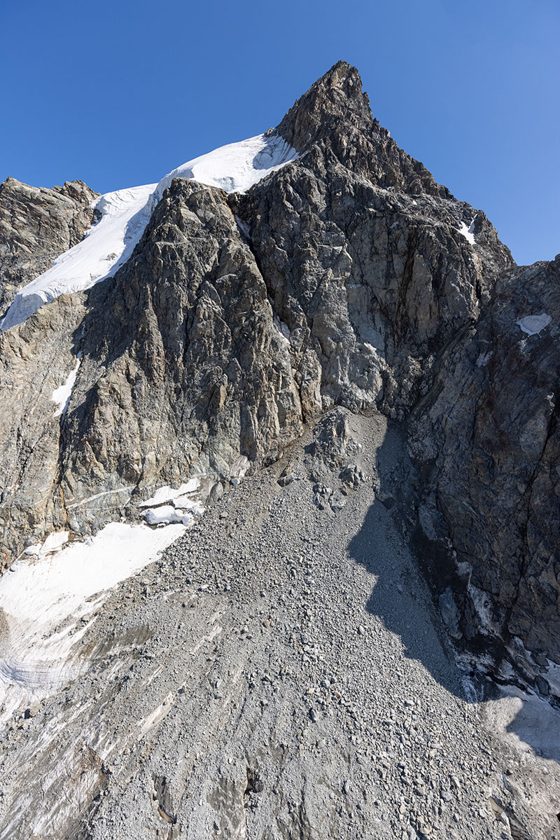 Detatchment area of the landslide from Piz Roseg in late January 2021 (center) and debris deposit (below; aerial photo July 23rd, 2021, Jürg Alean). | 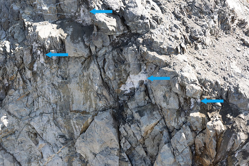 In the detachment area of the landslide some ice can still be seen, which must have been filling joints in the rock. The north-facing wall is clearly within the permafrost zone (aerial photo July 23rd, 2021, Jürg Alean). |
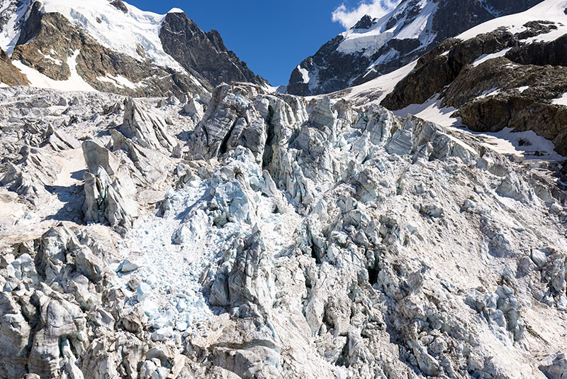 Upper part of the icefall of Vadret da Tschierva, Fuorcla da la Sella is in the background (aerial photo July 23rd, 2021, Jürg Alean). | 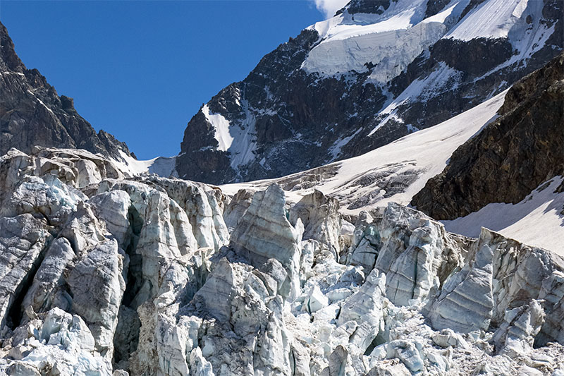 Detail from the previous photo, note firn stratigraphy in the seracs (foreground) and in the frontal cliff of the hanging glacier (background; aerial photo July 23rd, 2021, Jürg Alean). | | |
|