Cenozoic Volcanism

Late Cenozoic explosive volcanic activity is associated with plate collision in the Antarctic Peninsula region. The most active areas today are to the north of the Peninsula, but to the east of the Peninsula, centred on James Ross Island, there is a huge basaltic province. With rocks dating back to 8 m.y. ago. Elsewhere, the West Antarctic Rift System has remained active sporadically throughout the last 50 million years, with uplift along the western flanks producing the Transantarctic Mountains anda number of volcanoes, including the famous Mount Erebus. |
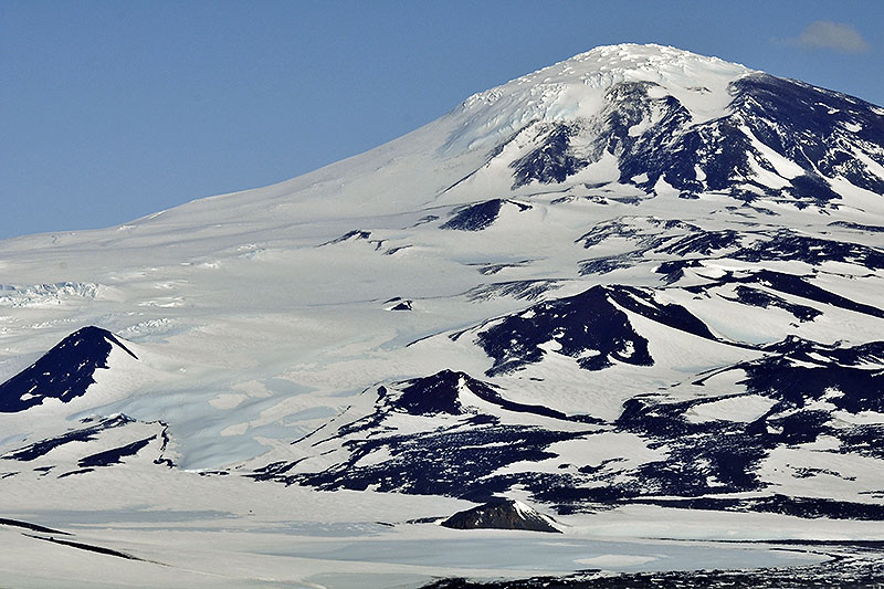
 Cenozoic volcanic activity is evident from small cones of basaltic (black) material on the flanks of Ferrar Glacier, Victoria Land. |  Crater Hill is a partially ice-filled volcanic crater of Cenozoic age near Scott Base (New Zealand) and McMurdo Station (USA) on Ross Island. |  The ice-covered volcano of Mount Erebus (3394 m) dominates the landscape of Ross Island, and formed an iconic backdrop to the early 20th century expeditions of Scott and Shackleton, as well as New Zealand’s Scott Base (from where this view was taken) and America’s McMurdo Station. This volcano is the southernmost in the world, and the fact that it is active is evident from the plume of steam at the summit. |  Mount Discovery (2681 m) is an older inactive Cenozoic volcano, clearly visible from the old “Discovery” hut of Scott’s 1902-3 expedition. |
 Mt. Discovery, a Quaternary basaltic volcano, with parasitic cones on its ice-mantled flanks. |  Cenozoic (Neogene-Quaternary) volcanic activity was widespread in the Antarctic Peninsula region. James Ross Island is a basalt shield volcano and represents the largest volcanic centre in the region; the low profile of ice-capped Mt Haddington (c. 1600 m) is clearly outlined at sunset in this image. |  Waterfalls from a small ice cap plunge over the volcanic breccia (“hyaloclastite”) Förster Cliffs, northern James Ross Island. |  Volcanic breccia on NE James Ross Island, illustrating a detached basalt pillow and other fragments formed from the source lavas as they entered a lake. |
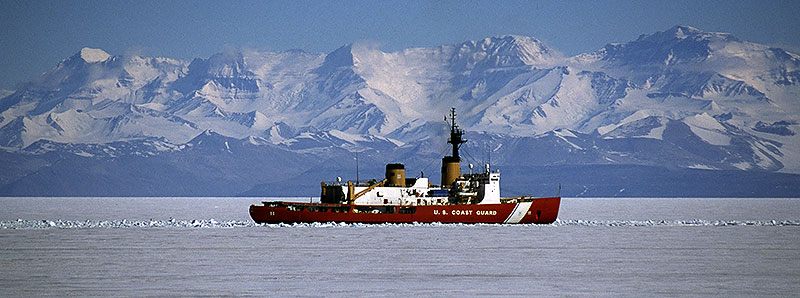
 Tuff at the base of the James Ross Island Volcanic Group illustrating cross-lamination from currents and overturned folds resulting from slumping, both processes occurring in a lake. |  Cone of layered volcanic ash ( a “tuff cone”, several hundred thousand years old (Early Quaternary) forming Terrapin Hill (546 m) on northern James Ross Island. |  Cenozoic rifting has led to the opening of the Ross Sea/Ross Ice Shelf region. The 4000 m high mountains of the Royal Society Range are part of the Transantarctic Mountains which form the “curled up” margins of the rift. The US coastguard vessel in the middle distance is breaking up sea ice at the start of the season. | |
| Photos Michael Hambrey |